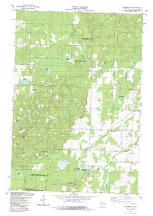
Bloomville Topo Map Wisconsin
To zoom in, hover over the map of Bloomville
USGS Topo Quad 45089c5 - 1:24,000 scale
| Topo Map Name: | Bloomville |
| USGS Topo Quad ID: | 45089c5 |
| Print Size: | ca. 21 1/4" wide x 27" high |
| Southeast Coordinates: | 45.25° N latitude / 89.5° W longitude |
| Map Center Coordinates: | 45.3125° N latitude / 89.5625° W longitude |
| U.S. State: | WI |
| Filename: | o45089c5.jpg |
| Download Map JPG Image: | Bloomville topo map 1:24,000 scale |
| Map Type: | Topographic |
| Topo Series: | 7.5´ |
| Map Scale: | 1:24,000 |
| Source of Map Images: | United States Geological Survey (USGS) |
| Alternate Map Versions: |
Bloomville WI 1982, updated 1983 Download PDF Buy paper map Bloomville WI 2010 Download PDF Buy paper map Bloomville WI 2013 Download PDF Buy paper map Bloomville WI 2015 Download PDF Buy paper map |
1:24,000 Topo Quads surrounding Bloomville
> Back to 45089a1 at 1:100,000 scale
> Back to 45088a1 at 1:250,000 scale
> Back to U.S. Topo Maps home
Bloomville topo map: Gazetteer
Bloomville: Dams
Doering E12.129 Dam elevation 486m 1594′Prairie Dell Dam elevation 423m 1387′
Prairie Dells Dam (historical) elevation 420m 1377′
Bloomville: Lakes
Allen Lake elevation 452m 1482′Anderson Lake elevation 438m 1437′
Anient Lake elevation 470m 1541′
Copper Lake elevation 458m 1502′
Fox Lake elevation 456m 1496′
Hart Lake elevation 452m 1482′
Henson Lake elevation 471m 1545′
Lokemoen Lake elevation 460m 1509′
Luecks Lake elevation 453m 1486′
Oak Lake elevation 445m 1459′
Spring Lake elevation 412m 1351′
Swiss Lake elevation 436m 1430′
Bloomville: Parks
Hay Meadow County Park elevation 427m 1400′Kings Springs State Public Fishery Area elevation 441m 1446′
Pays Springs State Public Fishery Area elevation 445m 1459′
Prairie Dell County Park elevation 425m 1394′
Spring Lake State Public Hunting and Fishing Area elevation 412m 1351′
Bloomville: Populated Places
Bloomville elevation 437m 1433′Bloomville: Reservoirs
0.9 Reservoir elevation 486m 1594′Prairie Dell Pond elevation 420m 1377′
Prairie Dells Pond 179 elevation 431m 1414′
Wedlers Pond elevation 451m 1479′
Bloomville: Streams
Big Hay Meadow Creek elevation 426m 1397′Kippenberg Creek elevation 454m 1489′
Manacke Creek elevation 429m 1407′
North Branch Prairie River elevation 435m 1427′
Bloomville digital topo map on disk
Buy this Bloomville topo map showing relief, roads, GPS coordinates and other geographical features, as a high-resolution digital map file on DVD:


