Tripoli Topo Map Wisconsin
To zoom in, hover over the map of Tripoli
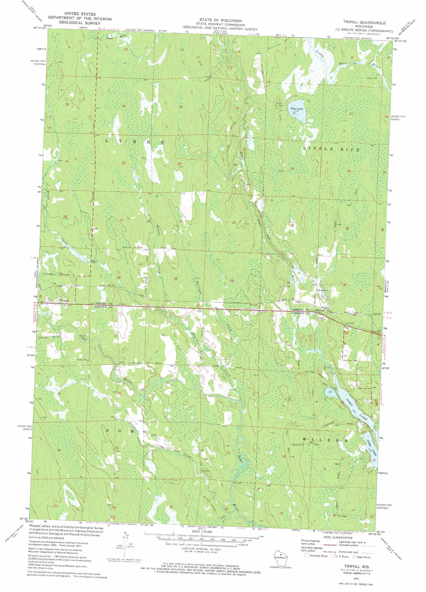
USGS Topo Quad 45089e8 - 1:24,000 scale
| Topo Map Name: | Tripoli |
| USGS Topo Quad ID: | 45089e8 |
| Print Size: | ca. 21 1/4" wide x 27" high |
| Southeast Coordinates: | 45.5° N latitude / 89.875° W longitude |
| Map Center Coordinates: | 45.5625° N latitude / 89.9375° W longitude |
| U.S. State: | WI |
| Filename: | o45089e8.jpg |
| Download Map JPG Image: | Tripoli topo map 1:24,000 scale |
| Map Type: | Topographic |
| Topo Series: | 7.5´ |
| Map Scale: | 1:24,000 |
| Source of Map Images: | United States Geological Survey (USGS) |
| Alternate Map Versions: |
Tripoli WI 1971, updated 1973 Download PDF Buy paper map Tripoli WI 2010 Download PDF Buy paper map Tripoli WI 2013 Download PDF Buy paper map Tripoli WI 2015 Download PDF Buy paper map |
1:24,000 Topo Quads surrounding Tripoli
Pike Lake Sw |
Pike Lake Se |
Lac Du Flambeau Sw |
Mercer Lake |
Hazelhurst |
Dover |
Thunder Creek |
Pier Lake |
Burrows Lake |
Harshaw |
Big Briens Lake |
Brantwood |
Tripoli |
Bradley |
Heafford Junction |
Timms Hill |
Spirit |
Spirit Falls |
Coffee Creek |
Tomahawk |
Rib Lake |
Wood Lake |
Natzke Camp |
Grandfather Falls |
Irma |
> Back to 45089e1 at 1:100,000 scale
> Back to 45088a1 at 1:250,000 scale
> Back to U.S. Topo Maps home
Tripoli topo map: Gazetteer
Tripoli: Dams
Shot and Hook Club E3870 Dam elevation 451m 1479′Tripoli: Lakes
Bass Lake elevation 466m 1528′Tripoli: Populated Places
McCord elevation 448m 1469′Tripoli elevation 469m 1538′
Tripoli: Reservoirs
Lake 31-3 3 elevation 451m 1479′Tripoli: Streams
Brant Creek elevation 448m 1469′Hauser Creek elevation 455m 1492′
Johnson Creek elevation 442m 1450′
Landwehr Creek elevation 445m 1459′
Rennhak Creek elevation 449m 1473′
Scott Creek elevation 463m 1519′
Tripoli digital topo map on disk
Buy this Tripoli topo map showing relief, roads, GPS coordinates and other geographical features, as a high-resolution digital map file on DVD: