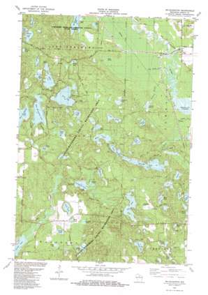
Mcnaughton Topo Map Wisconsin
To zoom in, hover over the map of Mcnaughton
USGS Topo Quad 45089f5 - 1:24,000 scale
| Topo Map Name: | Mcnaughton |
| USGS Topo Quad ID: | 45089f5 |
| Print Size: | ca. 21 1/4" wide x 27" high |
| Southeast Coordinates: | 45.625° N latitude / 89.5° W longitude |
| Map Center Coordinates: | 45.6875° N latitude / 89.5625° W longitude |
| U.S. State: | WI |
| Filename: | o45089f5.jpg |
| Download Map JPG Image: | Mcnaughton topo map 1:24,000 scale |
| Map Type: | Topographic |
| Topo Series: | 7.5´ |
| Map Scale: | 1:24,000 |
| Source of Map Images: | United States Geological Survey (USGS) |
| Alternate Map Versions: |
Mc Naughton WI 1982, updated 1983 Download PDF Buy paper map McNaughton WI 2010 Download PDF Buy paper map McNaughton WI 2013 Download PDF Buy paper map McNaughton WI 2015 Download PDF Buy paper map |
1:24,000 Topo Quads surrounding Mcnaughton
> Back to 45089e1 at 1:100,000 scale
> Back to 45088a1 at 1:250,000 scale
> Back to U.S. Topo Maps home
Mcnaughton topo map: Gazetteer
Mcnaughton: Airports
Pine Grove Airport elevation 496m 1627′Mcnaughton: Dams
Spruce Lake E1176.2 Dam elevation 475m 1558′Mcnaughton: Lakes
Alva Lake elevation 484m 1587′Beaver Lake elevation 485m 1591′
Bobs Lake elevation 486m 1594′
Cherry Lake elevation 485m 1591′
Clear Lake elevation 484m 1587′
Coon Lake elevation 485m 1591′
Corner Lake elevation 482m 1581′
East Horsehead Lake elevation 478m 1568′
Elna Lake elevation 485m 1591′
Flag Lake elevation 482m 1581′
Garland Lake elevation 480m 1574′
Goodyear Lake elevation 474m 1555′
Hodag Lake elevation 477m 1564′
Hook Lake elevation 484m 1587′
Island Lake elevation 483m 1584′
John Lake elevation 482m 1581′
Josie Lake elevation 475m 1558′
Lake Samway elevation 484m 1587′
Liege Lake elevation 484m 1587′
Long Lake elevation 483m 1584′
Lorraine Lake elevation 485m 1591′
Lumen Lake elevation 483m 1584′
Lyle Lake elevation 470m 1541′
Maud Lake elevation 485m 1591′
McNaughton Lake elevation 481m 1578′
Mildred Lake elevation 484m 1587′
Newbold Lake elevation 489m 1604′
Ole Lake elevation 485m 1591′
Perch Lake elevation 482m 1581′
Perch Lake elevation 479m 1571′
Pritch Lake elevation 478m 1568′
Roby Lake elevation 475m 1558′
Rudy Lake elevation 477m 1564′
Shadow Lake elevation 483m 1584′
Soo Lake elevation 484m 1587′
Spruce Lake elevation 476m 1561′
Swamp Lake elevation 481m 1578′
Timber Lake elevation 479m 1571′
Tyler Lake elevation 483m 1584′
West Horsehead Lake elevation 475m 1558′
Whitey Lake elevation 486m 1594′
Mcnaughton: Parks
Cassian-Woodboro County Recreation Area elevation 508m 1666′Germain Hemlocks State Natural Area elevation 489m 1604′
Mcnaughton: Populated Places
McNaughton elevation 479m 1571′Newbold elevation 479m 1571′
Mcnaughton: Reservoirs
Spruce Lake elevation 475m 1558′Mcnaughton: Springs
Cedar Spring elevation 482m 1581′Goodyear Springs elevation 475m 1558′
Newbold Springs elevation 480m 1574′
Mcnaughton: Streams
Cedar Spring Creek elevation 475m 1558′Goodyear Creek elevation 467m 1532′
Newbold Spring Creek elevation 475m 1558′
Mcnaughton digital topo map on disk
Buy this Mcnaughton topo map showing relief, roads, GPS coordinates and other geographical features, as a high-resolution digital map file on DVD:


