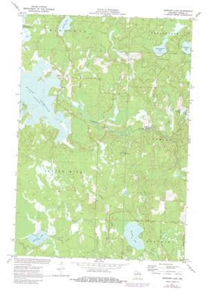
Burrows Lake Topo Map Wisconsin
To zoom in, hover over the map of Burrows Lake
USGS Topo Quad 45089f7 - 1:24,000 scale
| Topo Map Name: | Burrows Lake |
| USGS Topo Quad ID: | 45089f7 |
| Print Size: | ca. 21 1/4" wide x 27" high |
| Southeast Coordinates: | 45.625° N latitude / 89.75° W longitude |
| Map Center Coordinates: | 45.6875° N latitude / 89.8125° W longitude |
| U.S. State: | WI |
| Filename: | o45089f7.jpg |
| Download Map JPG Image: | Burrows Lake topo map 1:24,000 scale |
| Map Type: | Topographic |
| Topo Series: | 7.5´ |
| Map Scale: | 1:24,000 |
| Source of Map Images: | United States Geological Survey (USGS) |
| Alternate Map Versions: |
Burrows Lake WI 1971, updated 1973 Download PDF Buy paper map Burrows Lake WI 1971, updated 1982 Download PDF Buy paper map Burrows Lake WI 2010 Download PDF Buy paper map Burrows Lake WI 2013 Download PDF Buy paper map Burrows Lake WI 2015 Download PDF Buy paper map |
1:24,000 Topo Quads surrounding Burrows Lake
> Back to 45089e1 at 1:100,000 scale
> Back to 45088a1 at 1:250,000 scale
> Back to U.S. Topo Maps home
Burrows Lake topo map: Gazetteer
Burrows Lake: Dams
Willow River Reservoir 2WP50 Dam elevation 464m 1522′Burrows Lake: Lakes
Burrows Lake elevation 467m 1532′Hughitt Lake elevation 469m 1538′
McCormick Lake elevation 471m 1545′
Skunk Lake elevation 471m 1545′
Swamp Lake elevation 452m 1482′
Burrows Lake: Rapids
Halfbreed Rapids elevation 455m 1492′Burrows Lake: Reservoirs
Willow Reservoir elevation 464m 1522′Willow Reservoir 327 elevation 467m 1532′
Burrows Lake: Streams
Bear Creek elevation 457m 1499′Oelhafen Creek elevation 459m 1505′
Rocky Run elevation 455m 1492′
Swan Creek elevation 454m 1489′
Burrows Lake: Summits
Jack Pine Lookout Tower elevation 479m 1571′Burrows Lake digital topo map on disk
Buy this Burrows Lake topo map showing relief, roads, GPS coordinates and other geographical features, as a high-resolution digital map file on DVD:


