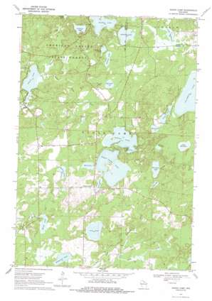
Sugar Camp Topo Map Wisconsin
To zoom in, hover over the map of Sugar Camp
USGS Topo Quad 45089g3 - 1:24,000 scale
| Topo Map Name: | Sugar Camp |
| USGS Topo Quad ID: | 45089g3 |
| Print Size: | ca. 21 1/4" wide x 27" high |
| Southeast Coordinates: | 45.75° N latitude / 89.25° W longitude |
| Map Center Coordinates: | 45.8125° N latitude / 89.3125° W longitude |
| U.S. State: | WI |
| Filename: | o45089g3.jpg |
| Download Map JPG Image: | Sugar Camp topo map 1:24,000 scale |
| Map Type: | Topographic |
| Topo Series: | 7.5´ |
| Map Scale: | 1:24,000 |
| Source of Map Images: | United States Geological Survey (USGS) |
| Alternate Map Versions: |
Sugar Camp WI 1970, updated 1972 Download PDF Buy paper map Sugar Camp WI 1970, updated 1986 Download PDF Buy paper map Sugar Camp WI 2010 Download PDF Buy paper map Sugar Camp WI 2013 Download PDF Buy paper map Sugar Camp WI 2015 Download PDF Buy paper map |
1:24,000 Topo Quads surrounding Sugar Camp
> Back to 45089e1 at 1:100,000 scale
> Back to 45088a1 at 1:250,000 scale
> Back to U.S. Topo Maps home
Sugar Camp topo map: Gazetteer
Sugar Camp: Lakes
Aldridge Lake elevation 501m 1643′Arbutus Lake elevation 498m 1633′
Baggs Lake elevation 498m 1633′
Bass Lake elevation 505m 1656′
Bog Lake elevation 501m 1643′
Burnham Lake elevation 503m 1650′
Chain Lake elevation 487m 1597′
Columbus Lake elevation 496m 1627′
Cranberry Lake elevation 504m 1653′
Deer Lake elevation 497m 1630′
Denton Lake elevation 504m 1653′
Haven Lake elevation 489m 1604′
Indian Lake elevation 505m 1656′
Kathan Lake elevation 498m 1633′
Lake Seventeen elevation 504m 1653′
Lily Lake elevation 504m 1653′
Little Rice Lake elevation 495m 1624′
Long Lake elevation 496m 1627′
Lost Lake elevation 490m 1607′
Mill Lake elevation 508m 1666′
Minnow Lake elevation 501m 1643′
Sugar Camp Lake elevation 506m 1660′
Tamarack Lake elevation 491m 1610′
Walters Lake elevation 503m 1650′
Sugar Camp: Populated Places
Sugar Camp elevation 506m 1660′Sugar Camp: Streams
Brown Creek elevation 491m 1610′Burnham Creek elevation 500m 1640′
Indian Chain Creek elevation 487m 1597′
Jones Creek elevation 491m 1610′
Kathan Creek elevation 487m 1597′
Sugar Camp digital topo map on disk
Buy this Sugar Camp topo map showing relief, roads, GPS coordinates and other geographical features, as a high-resolution digital map file on DVD:


