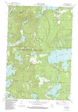
Sayner Topo Map Wisconsin
To zoom in, hover over the map of Sayner
USGS Topo Quad 45089h5 - 1:24,000 scale
| Topo Map Name: | Sayner |
| USGS Topo Quad ID: | 45089h5 |
| Print Size: | ca. 21 1/4" wide x 27" high |
| Southeast Coordinates: | 45.875° N latitude / 89.5° W longitude |
| Map Center Coordinates: | 45.9375° N latitude / 89.5625° W longitude |
| U.S. State: | WI |
| Filename: | o45089h5.jpg |
| Download Map JPG Image: | Sayner topo map 1:24,000 scale |
| Map Type: | Topographic |
| Topo Series: | 7.5´ |
| Map Scale: | 1:24,000 |
| Source of Map Images: | United States Geological Survey (USGS) |
| Alternate Map Versions: |
Sayner WI 1982, updated 1983 Download PDF Buy paper map Sayner WI 1982, updated 1983 Download PDF Buy paper map Sayner WI 2010 Download PDF Buy paper map Sayner WI 2013 Download PDF Buy paper map Sayner WI 2015 Download PDF Buy paper map |
1:24,000 Topo Quads surrounding Sayner
> Back to 45089e1 at 1:100,000 scale
> Back to 45088a1 at 1:250,000 scale
> Back to U.S. Topo Maps home
Sayner topo map: Gazetteer
Sayner: Dams
Big Saint Germain 1909C361 Dam elevation 489m 1604′Sayner: Forests
Northern Highland-American Legion State Forest elevation 506m 1660′Sayner: Lakes
Big Saint Germain Lake elevation 485m 1591′Bittersweet Lake elevation 491m 1610′
Buffalo Lake elevation 485m 1591′
Butterfly Lake elevation 490m 1607′
Fawn Lake elevation 486m 1594′
Hobo Lake elevation 500m 1640′
Kasomo Lake elevation 485m 1591′
Lake Content elevation 485m 1591′
Little Arbor Vitae Lake elevation 488m 1601′
Little Cloud Lake elevation 503m 1650′
Oberlin Lake elevation 501m 1643′
Pickerel Lake elevation 482m 1581′
Prong Lake elevation 491m 1610′
Roach Lake elevation 511m 1676′
Ross Lake elevation 498m 1633′
Smith Lake elevation 499m 1637′
West Plum Lake elevation 497m 1630′
Witches Lake elevation 501m 1643′
Sayner: Parks
Bittersweet Lakes State Natural Area elevation 497m 1630′Sayner: Populated Places
Sayner elevation 508m 1666′Sayner: Post Offices
Sayner Post Office elevation 510m 1673′Sayner: Reservoirs
Fawn Lake elevation 489m 1604′Sayner: Springs
Hermanson Springs elevation 490m 1607′Sayner: Streams
Border Creek elevation 486m 1594′Lost Creek elevation 487m 1597′
Mud Creek elevation 487m 1597′
Plum Creek elevation 486m 1594′
Saint Germain River elevation 482m 1581′
West Branch Plum Creek elevation 493m 1617′
Sayner digital topo map on disk
Buy this Sayner topo map showing relief, roads, GPS coordinates and other geographical features, as a high-resolution digital map file on DVD:


