Sheldon Topo Map Wisconsin
To zoom in, hover over the map of Sheldon
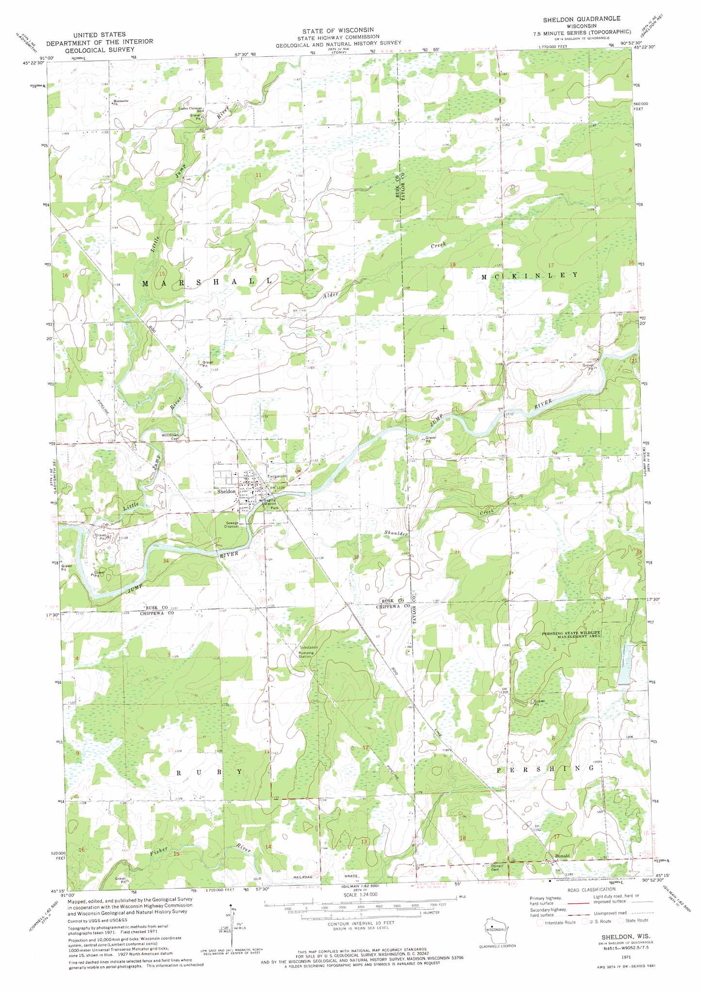
USGS Topo Quad 45090c8 - 1:24,000 scale
| Topo Map Name: | Sheldon |
| USGS Topo Quad ID: | 45090c8 |
| Print Size: | ca. 21 1/4" wide x 27" high |
| Southeast Coordinates: | 45.25° N latitude / 90.875° W longitude |
| Map Center Coordinates: | 45.3125° N latitude / 90.9375° W longitude |
| U.S. State: | WI |
| Filename: | o45090c8.jpg |
| Download Map JPG Image: | Sheldon topo map 1:24,000 scale |
| Map Type: | Topographic |
| Topo Series: | 7.5´ |
| Map Scale: | 1:24,000 |
| Source of Map Images: | United States Geological Survey (USGS) |
| Alternate Map Versions: |
Sheldon WI 1971, updated 1974 Download PDF Buy paper map Sheldon WI 2010 Download PDF Buy paper map Sheldon WI 2013 Download PDF Buy paper map Sheldon WI 2015 Download PDF Buy paper map |
1:24,000 Topo Quads surrounding Sheldon
Crane |
Exeland Se |
Big Falls Dam |
Ingram |
Hawkins |
Thornapple |
Ladysmith |
Tony |
Sheldon Ne |
Jump River Fire Tower Nw |
Flambeau Ridge |
Ladysmith Se |
Sheldon |
Jump River |
Jump River Fire Tower Sw |
Cornell |
Holcombe |
Ruby |
Gilman |
Lublin Nw |
Crescent |
Colburn |
Huron |
Bellinger |
Lublin |
> Back to 45090a1 at 1:100,000 scale
> Back to 45090a1 at 1:250,000 scale
> Back to U.S. Topo Maps home
Sheldon topo map: Gazetteer
Sheldon: Populated Places
Donald elevation 366m 1200′Sheldon elevation 342m 1122′
Sheldon Estates elevation 344m 1128′
Sheldon: Streams
Alder Creek elevation 341m 1118′Little Jump River elevation 328m 1076′
Shoulder Creek elevation 336m 1102′
Sheldon digital topo map on disk
Buy this Sheldon topo map showing relief, roads, GPS coordinates and other geographical features, as a high-resolution digital map file on DVD: