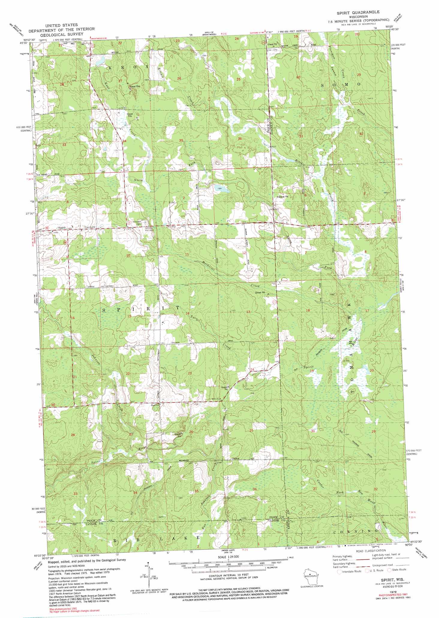
Spirit Topo Map Wisconsin
To zoom in, hover over the map of Spirit
USGS Topo Quad 45090d1 - 1:24,000 scale
| Topo Map Name: | Spirit |
| USGS Topo Quad ID: | 45090d1 |
| Print Size: | ca. 21 1/4" wide x 27" high |
| Southeast Coordinates: | 45.375° N latitude / 90° W longitude |
| Map Center Coordinates: | 45.4375° N latitude / 90.0625° W longitude |
| U.S. State: | WI |
| Filename: | o45090d1.jpg |
| Download Map JPG Image: | Spirit topo map 1:24,000 scale |
| Map Type: | Topographic |
| Topo Series: | 7.5´ |
| Map Scale: | 1:24,000 |
| Source of Map Images: | United States Geological Survey (USGS) |
| Alternate Map Versions: |
Spirit WI 1979, updated 1980 Download PDF Buy paper map Spirit WI 1979, updated 1991 Download PDF Buy paper map Spirit WI 2010 Download PDF Buy paper map Spirit WI 2013 Download PDF Buy paper map Spirit WI 2015 Download PDF Buy paper map |
1:24,000 Topo Quads surrounding Spirit
Cranberry Lake |
Dover |
Thunder Creek |
Pier Lake |
Burrows Lake |
Prentice |
Big Briens Lake |
Brantwood |
Tripoli |
Bradley |
Ogema |
Timms Hill |
Spirit |
Spirit Falls |
Coffee Creek |
Westboro |
Rib Lake |
Wood Lake |
Natzke Camp |
Grandfather Falls |
Medford |
Rib River Lookout Tower |
Goodrich |
Fromm Lookout Tower |
Alexander Lake |
> Back to 45090a1 at 1:100,000 scale
> Back to 45090a1 at 1:250,000 scale
> Back to U.S. Topo Maps home
Spirit topo map: Gazetteer
Spirit: Dams
Severson E5388 Dam elevation 488m 1601′Thomas Breakey and Ray Bush G5995 Dam elevation 478m 1568′
Spirit: Populated Places
Spirit elevation 513m 1683′Spirit: Reservoirs
0.39 Reservoir elevation 488m 1601′1 Reservoir elevation 478m 1568′
Spirit: Streams
Flanigan Creek elevation 456m 1496′Gus Johnson Creek elevation 460m 1509′
Johnson Creek elevation 470m 1541′
Knox Creek elevation 478m 1568′
Marheime Creek elevation 451m 1479′
North Fork Spirit River elevation 449m 1473′
Ritchie Creek elevation 451m 1479′
Twin Creek elevation 455m 1492′
Spirit digital topo map on disk
Buy this Spirit topo map showing relief, roads, GPS coordinates and other geographical features, as a high-resolution digital map file on DVD: