Big Briens Lake Topo Map Wisconsin
To zoom in, hover over the map of Big Briens Lake
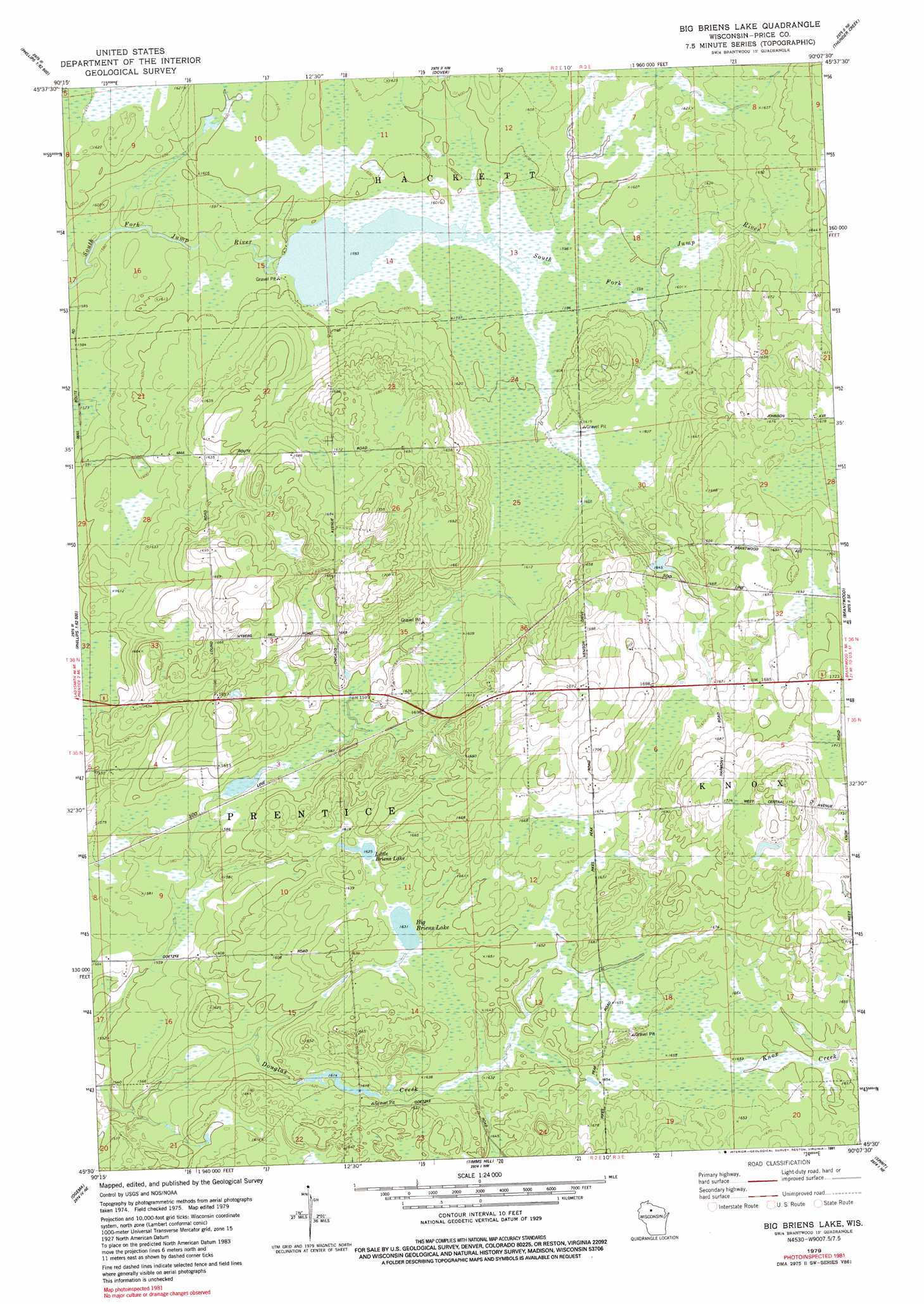
USGS Topo Quad 45090e2 - 1:24,000 scale
| Topo Map Name: | Big Briens Lake |
| USGS Topo Quad ID: | 45090e2 |
| Print Size: | ca. 21 1/4" wide x 27" high |
| Southeast Coordinates: | 45.5° N latitude / 90.125° W longitude |
| Map Center Coordinates: | 45.5625° N latitude / 90.1875° W longitude |
| U.S. State: | WI |
| Filename: | o45090e2.jpg |
| Download Map JPG Image: | Big Briens Lake topo map 1:24,000 scale |
| Map Type: | Topographic |
| Topo Series: | 7.5´ |
| Map Scale: | 1:24,000 |
| Source of Map Images: | United States Geological Survey (USGS) |
| Alternate Map Versions: |
Big Briens Lake WI 1979, updated 1980 Download PDF Buy paper map Big Briens Lake WI 1979, updated 1991 Download PDF Buy paper map Big Briens Lake WI 2010 Download PDF Buy paper map Big Briens Lake WI 2013 Download PDF Buy paper map Big Briens Lake WI 2015 Download PDF Buy paper map |
1:24,000 Topo Quads surrounding Big Briens Lake
Priest Lake |
Gates Lake |
Pike Lake Sw |
Pike Lake Se |
Lac Du Flambeau Sw |
Phillips |
Cranberry Lake |
Dover |
Thunder Creek |
Pier Lake |
Pennington |
Prentice |
Big Briens Lake |
Brantwood |
Tripoli |
Ogema Nw |
Ogema |
Timms Hill |
Spirit |
Spirit Falls |
Mondeaux Dam |
Westboro |
Rib Lake |
Wood Lake |
Natzke Camp |
> Back to 45090e1 at 1:100,000 scale
> Back to 45090a1 at 1:250,000 scale
> Back to U.S. Topo Maps home
Big Briens Lake topo map: Gazetteer
Big Briens Lake: Dams
Moyle 2WP978 Dam elevation 484m 1587′Big Briens Lake: Lakes
Big Briens Lake elevation 497m 1630′Little Briens Lake elevation 495m 1624′
Big Briens Lake: Reservoirs
Moyle Lake 35 elevation 484m 1587′Big Briens Lake digital topo map on disk
Buy this Big Briens Lake topo map showing relief, roads, GPS coordinates and other geographical features, as a high-resolution digital map file on DVD: