Kennan Topo Map Wisconsin
To zoom in, hover over the map of Kennan
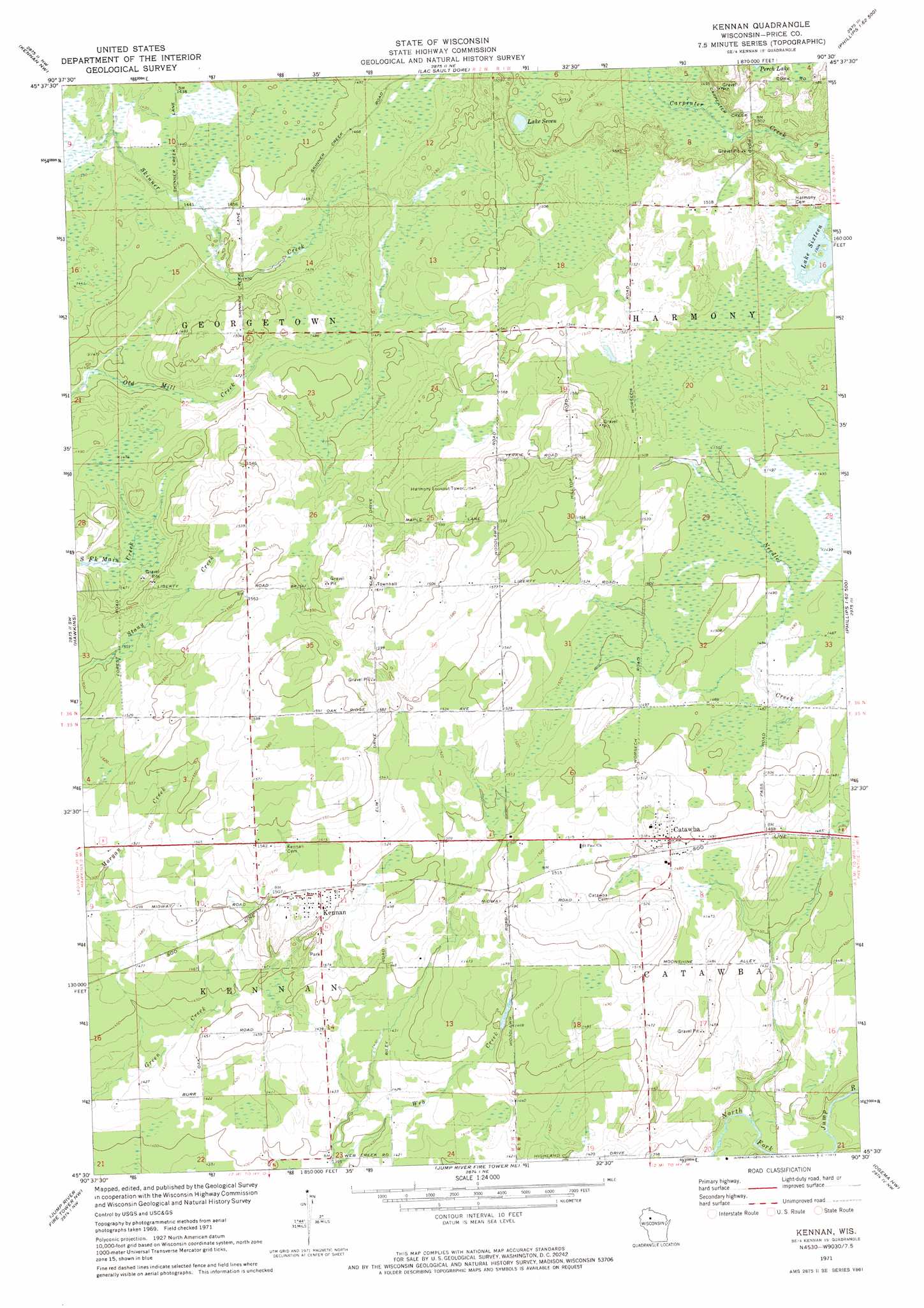
USGS Topo Quad 45090e5 - 1:24,000 scale
| Topo Map Name: | Kennan |
| USGS Topo Quad ID: | 45090e5 |
| Print Size: | ca. 21 1/4" wide x 27" high |
| Southeast Coordinates: | 45.5° N latitude / 90.5° W longitude |
| Map Center Coordinates: | 45.5625° N latitude / 90.5625° W longitude |
| U.S. State: | WI |
| Filename: | o45090e5.jpg |
| Download Map JPG Image: | Kennan topo map 1:24,000 scale |
| Map Type: | Topographic |
| Topo Series: | 7.5´ |
| Map Scale: | 1:24,000 |
| Source of Map Images: | United States Geological Survey (USGS) |
| Alternate Map Versions: |
Kennan WI 1971, updated 1973 Download PDF Buy paper map Kennan WI 2010 Download PDF Buy paper map Kennan WI 2013 Download PDF Buy paper map Kennan WI 2015 Download PDF Buy paper map |
1:24,000 Topo Quads surrounding Kennan
Babbs Island |
Oxbo |
Lugerville |
Priest Lake |
Gates Lake |
Ingram Ne |
Kennan Nw |
Lac Sault Dore |
Phillips |
Cranberry Lake |
Ingram |
Hawkins |
Kennan |
Pennington |
Prentice |
Sheldon Ne |
Jump River Fire Tower Nw |
Jump River Fire Tower Ne |
Ogema Nw |
Ogema |
Jump River |
Jump River Fire Tower Sw |
Jump River Fire Tower |
Mondeaux Dam |
Westboro |
> Back to 45090e1 at 1:100,000 scale
> Back to 45090a1 at 1:250,000 scale
> Back to U.S. Topo Maps home
Kennan topo map: Gazetteer
Kennan: Dams
Bolger 2WP266 Dam elevation 462m 1515′Kennan: Lakes
Lake Seven elevation 454m 1489′Lake Sixteen elevation 459m 1505′
Kennan: Populated Places
Catawba elevation 458m 1502′Kennan elevation 460m 1509′
Kennan digital topo map on disk
Buy this Kennan topo map showing relief, roads, GPS coordinates and other geographical features, as a high-resolution digital map file on DVD: