Colburn Topo Map Wisconsin
To zoom in, hover over the map of Colburn
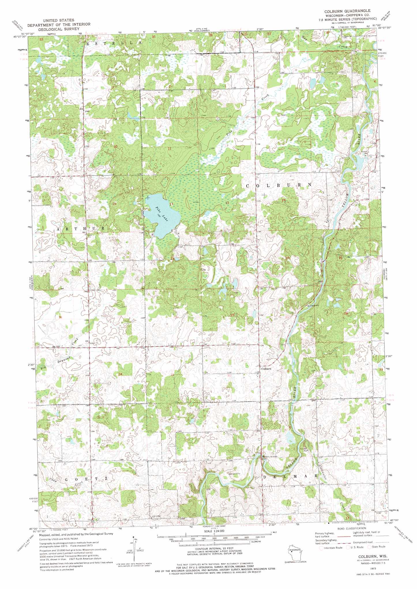
USGS Topo Quad 45091a1 - 1:24,000 scale
| Topo Map Name: | Colburn |
| USGS Topo Quad ID: | 45091a1 |
| Print Size: | ca. 21 1/4" wide x 27" high |
| Southeast Coordinates: | 45° N latitude / 91° W longitude |
| Map Center Coordinates: | 45.0625° N latitude / 91.0625° W longitude |
| U.S. State: | WI |
| Filename: | o45091a1.jpg |
| Download Map JPG Image: | Colburn topo map 1:24,000 scale |
| Map Type: | Topographic |
| Topo Series: | 7.5´ |
| Map Scale: | 1:24,000 |
| Source of Map Images: | United States Geological Survey (USGS) |
| Alternate Map Versions: |
Colburn WI 1973, updated 1976 Download PDF Buy paper map Colburn WI 2010 Download PDF Buy paper map Colburn WI 2013 Download PDF Buy paper map Colburn WI 2015 Download PDF Buy paper map |
1:24,000 Topo Quads surrounding Colburn
Fireside Lakes |
Flambeau Ridge |
Ladysmith Se |
Sheldon |
Jump River |
Bob Lake |
Cornell |
Holcombe |
Ruby |
Gilman |
Jim Falls |
Crescent |
Colburn |
Huron |
Bellinger |
Lake Wissota |
Cadott |
Boyd |
Stanley |
Thorp |
Fall Creek |
Lake Eau Claire West |
Lake Eau Claire East |
Simes Creek |
Mead Lake West |
> Back to 45091a1 at 1:100,000 scale
> Back to 45090a1 at 1:250,000 scale
> Back to U.S. Topo Maps home
Colburn topo map: Gazetteer
Colburn: Lakes
Pike Lake elevation 334m 1095′Colburn: Populated Places
Colburn elevation 341m 1118′Colburn: Streams
Coldwater Creek elevation 323m 1059′Hay Creek elevation 329m 1079′
Otter Creek elevation 328m 1076′
Pike Creek elevation 331m 1085′
Colburn digital topo map on disk
Buy this Colburn topo map showing relief, roads, GPS coordinates and other geographical features, as a high-resolution digital map file on DVD: