Norton Topo Map Wisconsin
To zoom in, hover over the map of Norton
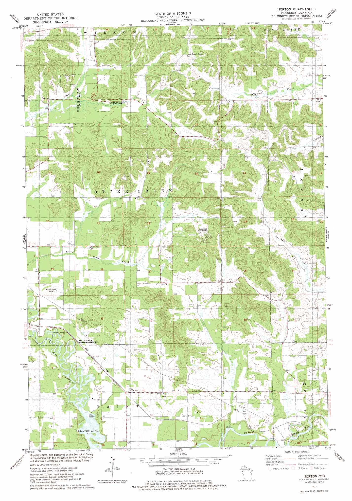
USGS Topo Quad 45091a7 - 1:24,000 scale
| Topo Map Name: | Norton |
| USGS Topo Quad ID: | 45091a7 |
| Print Size: | ca. 21 1/4" wide x 27" high |
| Southeast Coordinates: | 45° N latitude / 91.75° W longitude |
| Map Center Coordinates: | 45.0625° N latitude / 91.8125° W longitude |
| U.S. State: | WI |
| Filename: | o45091a7.jpg |
| Download Map JPG Image: | Norton topo map 1:24,000 scale |
| Map Type: | Topographic |
| Topo Series: | 7.5´ |
| Map Scale: | 1:24,000 |
| Source of Map Images: | United States Geological Survey (USGS) |
| Alternate Map Versions: |
Norton WI 1975, updated 1978 Download PDF Buy paper map Norton WI 2010 Download PDF Buy paper map Norton WI 2013 Download PDF Buy paper map Norton WI 2015 Download PDF Buy paper map |
1:24,000 Topo Quads surrounding Norton
Arland |
Dority Creek |
Dallas |
Chetek |
Moose Ear Lake |
Connorsville |
Ridgeland |
Ridgeland Ne |
Sand Creek |
New Auburn |
Boyceville |
Wheeler |
Norton |
Colfax North |
Como Creek |
Knapp |
Menomonie North |
Rusk |
Colfax South |
Albertville |
Weston |
Menomonie South |
Falls City |
Elk Creek Lake |
Eau Claire West |
> Back to 45091a1 at 1:100,000 scale
> Back to 45090a1 at 1:250,000 scale
> Back to U.S. Topo Maps home
Norton topo map: Gazetteer
Norton: Parks
Otter Creek Oak Barrens State Natural Area elevation 340m 1115′Otter Creek State Fishery Area elevation 298m 977′
Norton: Populated Places
Norton elevation 284m 931′Norton: Streams
Hay River elevation 264m 866′Norton digital topo map on disk
Buy this Norton topo map showing relief, roads, GPS coordinates and other geographical features, as a high-resolution digital map file on DVD: