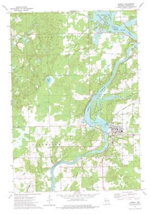
Cornell Topo Map Wisconsin
To zoom in, hover over the map of Cornell
USGS Topo Quad 45091b2 - 1:24,000 scale
| Topo Map Name: | Cornell |
| USGS Topo Quad ID: | 45091b2 |
| Print Size: | ca. 21 1/4" wide x 27" high |
| Southeast Coordinates: | 45.125° N latitude / 91.125° W longitude |
| Map Center Coordinates: | 45.1875° N latitude / 91.1875° W longitude |
| U.S. State: | WI |
| Filename: | o45091b2.jpg |
| Download Map JPG Image: | Cornell topo map 1:24,000 scale |
| Map Type: | Topographic |
| Topo Series: | 7.5´ |
| Map Scale: | 1:24,000 |
| Source of Map Images: | United States Geological Survey (USGS) |
| Alternate Map Versions: |
Cornell WI 1973, updated 1977 Download PDF Buy paper map Cornell WI 2010 Download PDF Buy paper map Cornell WI 2013 Download PDF Buy paper map Cornell WI 2015 Download PDF Buy paper map |
1:24,000 Topo Quads surrounding Cornell
> Back to 45091a1 at 1:100,000 scale
> Back to 45090a1 at 1:250,000 scale
> Back to U.S. Topo Maps home
Cornell topo map: Gazetteer
Cornell: Dams
Cornell 2WP7 Dam elevation 305m 1000′County Forest Crop Land 3 D-12.210 Dam elevation 346m 1135′
Holcombe 2WP723 Dam elevation 319m 1046′
Holcombe Dam elevation 309m 1013′
Cornell: Islands
Brunet Island elevation 312m 1023′Cornell: Lakes
Firth Lake elevation 326m 1069′Jerome Lake elevation 371m 1217′
Cornell: Parks
Brunet Island State Park elevation 322m 1056′Pine Point County Park elevation 320m 1049′
Cornell: Populated Places
Cornell elevation 330m 1082′Cornell: Reservoirs
Cornell Flowage elevation 305m 1000′Cornell Flowage 4797 elevation 292m 958′
Holcombe Flowage elevation 309m 1013′
Holcombe Flowage 4700 elevation 319m 1046′
Horseshoe Flowage 0.75 elevation 346m 1135′
Cornell: Streams
Birch Creek elevation 319m 1046′Bob Creek elevation 290m 951′
Clark Creek elevation 295m 967′
Cranberry Creek elevation 321m 1053′
Fisher River elevation 305m 1000′
French Creek elevation 292m 958′
North Fork Bob Creek elevation 293m 961′
South Fork Bob Creek elevation 293m 961′
Cornell: Trails
Firth Lake Trail elevation 329m 1079′Moonridge Trail elevation 364m 1194′
Cornell digital topo map on disk
Buy this Cornell topo map showing relief, roads, GPS coordinates and other geographical features, as a high-resolution digital map file on DVD:


