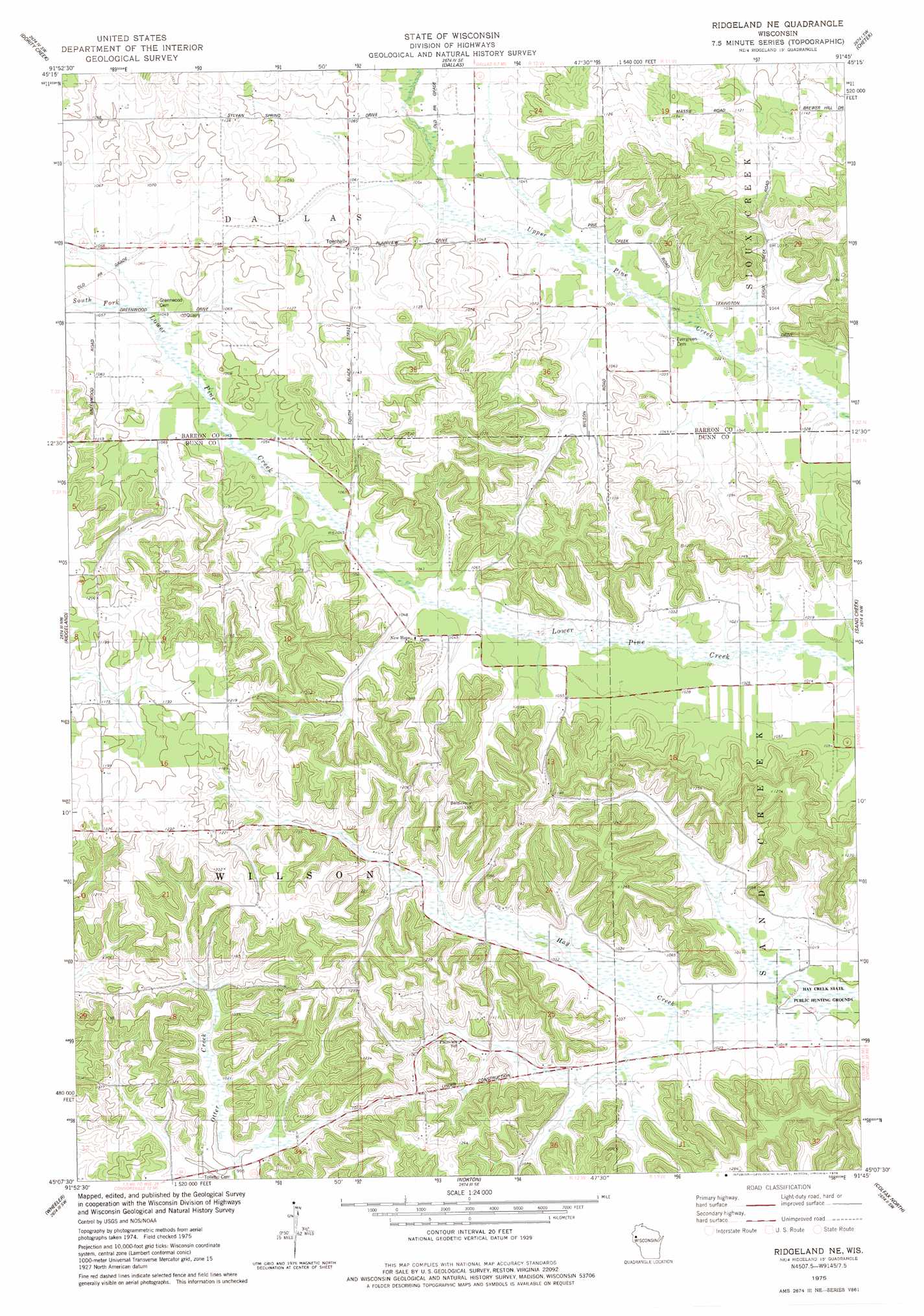
Ridgeland Ne Topo Map Wisconsin
To zoom in, hover over the map of Ridgeland Ne
USGS Topo Quad 45091b7 - 1:24,000 scale
| Topo Map Name: | Ridgeland Ne |
| USGS Topo Quad ID: | 45091b7 |
| Print Size: | ca. 21 1/4" wide x 27" high |
| Southeast Coordinates: | 45.125° N latitude / 91.75° W longitude |
| Map Center Coordinates: | 45.1875° N latitude / 91.8125° W longitude |
| U.S. State: | WI |
| Filename: | o45091b7.jpg |
| Download Map JPG Image: | Ridgeland Ne topo map 1:24,000 scale |
| Map Type: | Topographic |
| Topo Series: | 7.5´ |
| Map Scale: | 1:24,000 |
| Source of Map Images: | United States Geological Survey (USGS) |
| Alternate Map Versions: |
Ridgeland NE WI 1975, updated 1978 Download PDF Buy paper map Ridgeland NE WI 2010 Download PDF Buy paper map Ridgeland NE WI 2013 Download PDF Buy paper map Ridgeland NE WI 2015 Download PDF Buy paper map |
1:24,000 Topo Quads surrounding Ridgeland Ne
Almenia |
Poskin |
Barron |
Rice Lake South |
Strickland |
Arland |
Dority Creek |
Dallas |
Chetek |
Moose Ear Lake |
Connorsville |
Ridgeland |
Ridgeland Ne |
Sand Creek |
New Auburn |
Boyceville |
Wheeler |
Norton |
Colfax North |
Como Creek |
Knapp |
Menomonie North |
Rusk |
Colfax South |
Albertville |
> Back to 45091a1 at 1:100,000 scale
> Back to 45090a1 at 1:250,000 scale
> Back to U.S. Topo Maps home
Ridgeland Ne topo map: Gazetteer
Ridgeland Ne: Streams
South Fork Lower Pine Creek elevation 322m 1056′Ridgeland Ne digital topo map on disk
Buy this Ridgeland Ne topo map showing relief, roads, GPS coordinates and other geographical features, as a high-resolution digital map file on DVD: