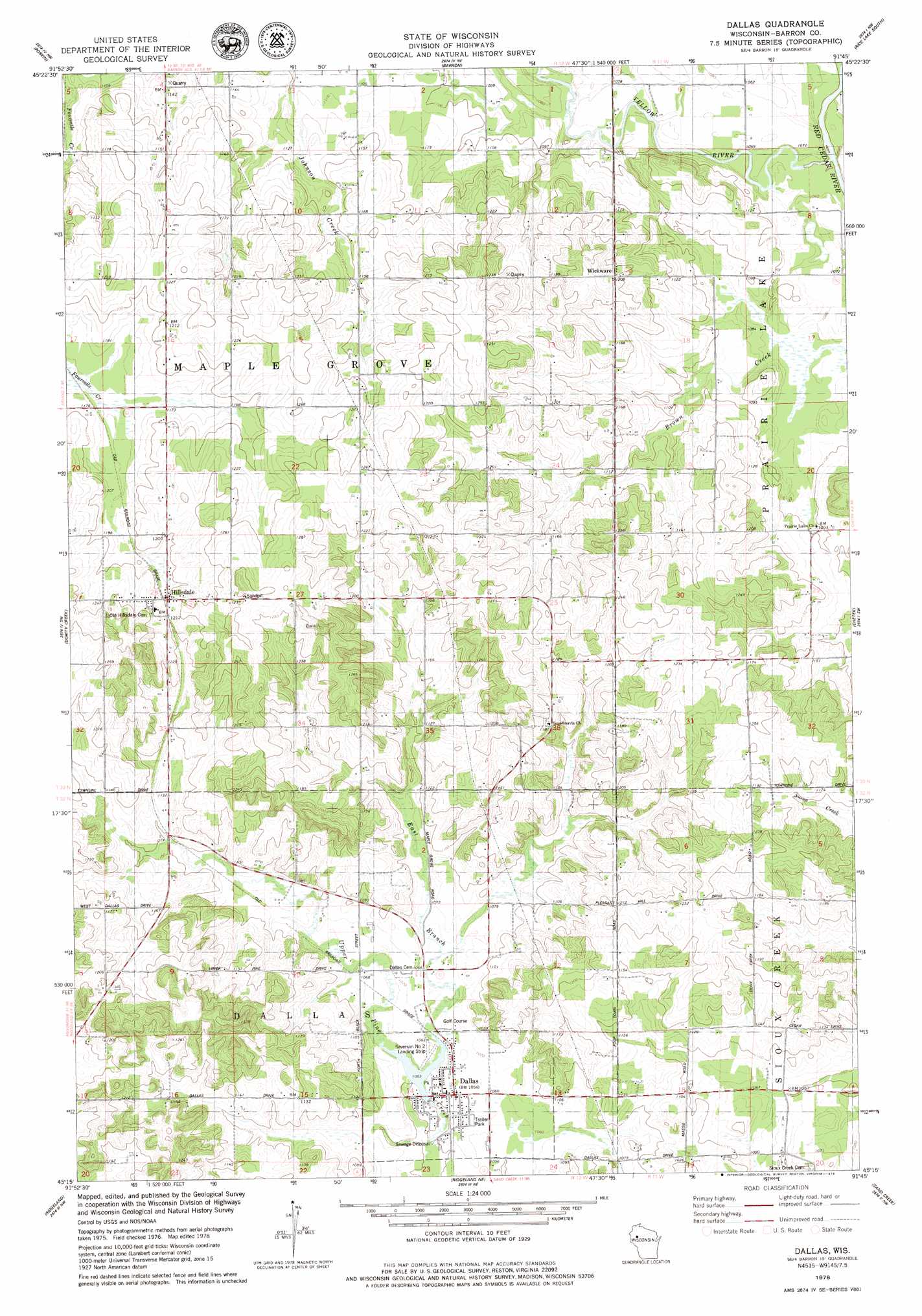
Dallas Topo Map Wisconsin
To zoom in, hover over the map of Dallas
USGS Topo Quad 45091c7 - 1:24,000 scale
| Topo Map Name: | Dallas |
| USGS Topo Quad ID: | 45091c7 |
| Print Size: | ca. 21 1/4" wide x 27" high |
| Southeast Coordinates: | 45.25° N latitude / 91.75° W longitude |
| Map Center Coordinates: | 45.3125° N latitude / 91.8125° W longitude |
| U.S. State: | WI |
| Filename: | o45091c7.jpg |
| Download Map JPG Image: | Dallas topo map 1:24,000 scale |
| Map Type: | Topographic |
| Topo Series: | 7.5´ |
| Map Scale: | 1:24,000 |
| Source of Map Images: | United States Geological Survey (USGS) |
| Alternate Map Versions: |
Dallas WI 1978, updated 1979 Download PDF Buy paper map Dallas WI 2010 Download PDF Buy paper map Dallas WI 2013 Download PDF Buy paper map Dallas WI 2015 Download PDF Buy paper map |
1:24,000 Topo Quads surrounding Dallas
Cumberland |
Lower Vermillion Lake |
Haugen |
Rice Lake North |
Mikana |
Almenia |
Poskin |
Barron |
Rice Lake South |
Strickland |
Arland |
Dority Creek |
Dallas |
Chetek |
Moose Ear Lake |
Connorsville |
Ridgeland |
Ridgeland Ne |
Sand Creek |
New Auburn |
Boyceville |
Wheeler |
Norton |
Colfax North |
Como Creek |
> Back to 45091a1 at 1:100,000 scale
> Back to 45090a1 at 1:250,000 scale
> Back to U.S. Topo Maps home
Dallas topo map: Gazetteer
Dallas: Airports
Severson Number 2 Landing Strip elevation 323m 1059′Dallas: Dams
Anderson Dam elevation 321m 1053′Dallas: Populated Places
Dallas elevation 323m 1059′Hillsdale elevation 365m 1197′
Wickware elevation 366m 1200′
Dallas: Reservoirs
Dallas Flowage 14 elevation 321m 1053′Dallas: Streams
East Branch Upper Pine Creek elevation 321m 1053′North Branch Upper Pine Creek elevation 323m 1059′
Yellow River elevation 317m 1040′
Dallas digital topo map on disk
Buy this Dallas topo map showing relief, roads, GPS coordinates and other geographical features, as a high-resolution digital map file on DVD: