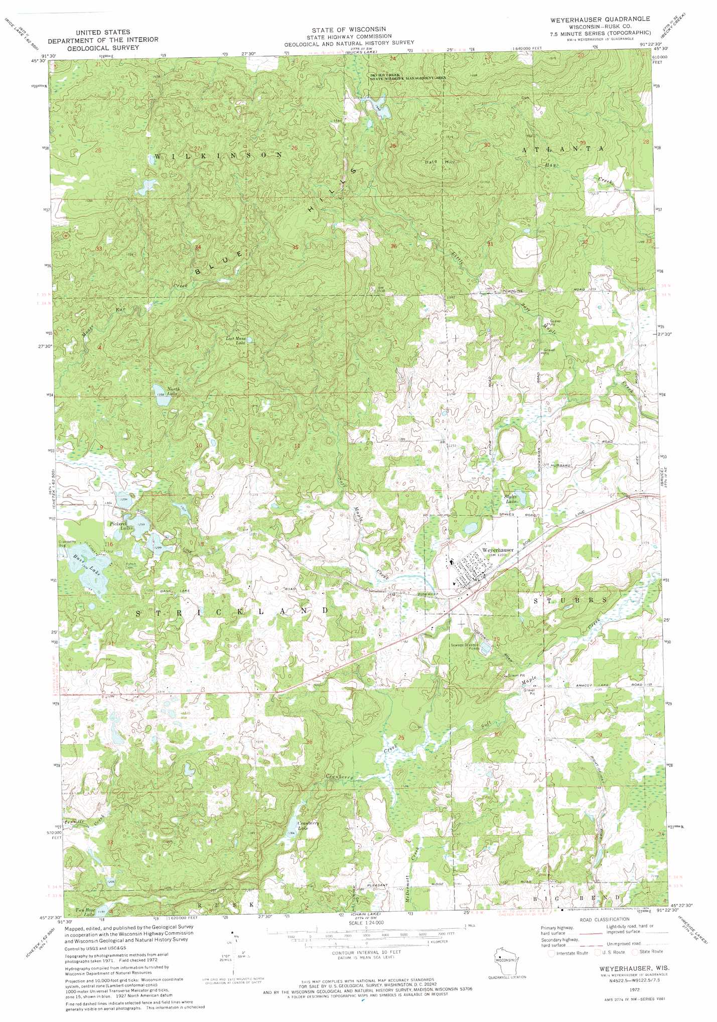
Weyerhauser Topo Map Wisconsin
To zoom in, hover over the map of Weyerhauser
USGS Topo Quad 45091d4 - 1:24,000 scale
| Topo Map Name: | Weyerhauser |
| USGS Topo Quad ID: | 45091d4 |
| Print Size: | ca. 21 1/4" wide x 27" high |
| Southeast Coordinates: | 45.375° N latitude / 91.375° W longitude |
| Map Center Coordinates: | 45.4375° N latitude / 91.4375° W longitude |
| U.S. State: | WI |
| Filename: | o45091d4.jpg |
| Download Map JPG Image: | Weyerhauser topo map 1:24,000 scale |
| Map Type: | Topographic |
| Topo Series: | 7.5´ |
| Map Scale: | 1:24,000 |
| Source of Map Images: | United States Geological Survey (USGS) |
| Alternate Map Versions: |
Weyerhauser WI 1972, updated 1974 Download PDF Buy paper map Weyerhaeuser WI 2010 Download PDF Buy paper map Weyerhaeuser WI 2013 Download PDF Buy paper map Weyerhaeuser WI 2015 Download PDF Buy paper map |
1:24,000 Topo Quads surrounding Weyerhauser
Nobleton |
Birchwood |
Edgewater |
Weirgor |
Exeland |
Rice Lake North |
Mikana |
Bucks Lake |
Becky Creek |
Crane |
Rice Lake South |
Strickland |
Weyerhauser |
Bruce |
Thornapple |
Chetek |
Moose Ear Lake |
Chain Lake |
Fireside Lakes |
Flambeau Ridge |
Sand Creek |
New Auburn |
Marsh-Miller Lake |
Bob Lake |
Cornell |
> Back to 45091a1 at 1:100,000 scale
> Back to 45090a1 at 1:250,000 scale
> Back to U.S. Topo Maps home
Weyerhauser topo map: Gazetteer
Weyerhauser: Dams
Sieja E-7435 Dam elevation 362m 1187′Weyerhauser: Lakes
Bass Lake elevation 398m 1305′Cranberry Lake elevation 355m 1164′
Lost Mans Lake elevation 450m 1476′
North Lake elevation 414m 1358′
Pickerel Lakes elevation 396m 1299′
Styles Lake elevation 365m 1197′
Weyerhauser: Parks
Devils Creek State Wildlife Management Area elevation 438m 1437′Weyerhauser: Populated Places
Weyerhaeuser elevation 362m 1187′Weyerhauser: Ranges
Blue Hills elevation 485m 1591′Weyerhauser: Reservoirs
0.2 Reservoir elevation 362m 1187′Weyerhauser: Streams
Cranberry Creek elevation 340m 1115′Weyerhauser: Summits
Bald Hill elevation 516m 1692′Weyerhauser digital topo map on disk
Buy this Weyerhauser topo map showing relief, roads, GPS coordinates and other geographical features, as a high-resolution digital map file on DVD: