Becky Creek Topo Map Wisconsin
To zoom in, hover over the map of Becky Creek
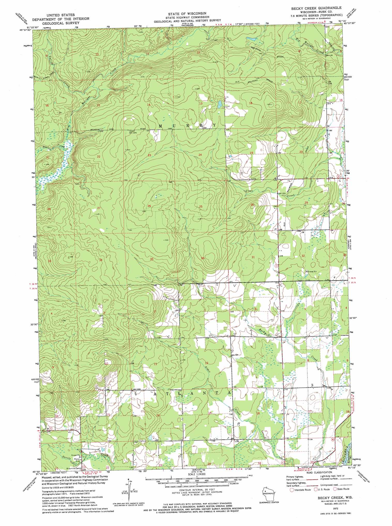
USGS Topo Quad 45091e3 - 1:24,000 scale
| Topo Map Name: | Becky Creek |
| USGS Topo Quad ID: | 45091e3 |
| Print Size: | ca. 21 1/4" wide x 27" high |
| Southeast Coordinates: | 45.5° N latitude / 91.25° W longitude |
| Map Center Coordinates: | 45.5625° N latitude / 91.3125° W longitude |
| U.S. State: | WI |
| Filename: | o45091e3.jpg |
| Download Map JPG Image: | Becky Creek topo map 1:24,000 scale |
| Map Type: | Topographic |
| Topo Series: | 7.5´ |
| Map Scale: | 1:24,000 |
| Source of Map Images: | United States Geological Survey (USGS) |
| Alternate Map Versions: |
Becky Creek WI 1972, updated 1975 Download PDF Buy paper map Becky Creek WI 1972, updated 1975 Download PDF Buy paper map Becky Creek WI 2010 Download PDF Buy paper map Becky Creek WI 2013 Download PDF Buy paper map Becky Creek WI 2015 Download PDF Buy paper map |
1:24,000 Topo Quads surrounding Becky Creek
Stone Lake |
Hauer |
Couderay |
Radisson |
Winter |
Birchwood |
Edgewater |
Weirgor |
Exeland |
Hogsback Creek |
Mikana |
Bucks Lake |
Becky Creek |
Crane |
Exeland Se |
Strickland |
Weyerhauser |
Bruce |
Thornapple |
Ladysmith |
Moose Ear Lake |
Chain Lake |
Fireside Lakes |
Flambeau Ridge |
Ladysmith Se |
> Back to 45091e1 at 1:100,000 scale
> Back to 45090a1 at 1:250,000 scale
> Back to U.S. Topo Maps home
Becky Creek topo map: Gazetteer
Becky Creek: Streams
Deer Creek elevation 399m 1309′Spring Creek elevation 393m 1289′
Becky Creek: Trails
Serley Camp Trail elevation 443m 1453′Becky Creek digital topo map on disk
Buy this Becky Creek topo map showing relief, roads, GPS coordinates and other geographical features, as a high-resolution digital map file on DVD: