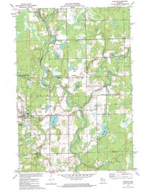
Exeland Topo Map Wisconsin
To zoom in, hover over the map of Exeland
USGS Topo Quad 45091f2 - 1:24,000 scale
| Topo Map Name: | Exeland |
| USGS Topo Quad ID: | 45091f2 |
| Print Size: | ca. 21 1/4" wide x 27" high |
| Southeast Coordinates: | 45.625° N latitude / 91.125° W longitude |
| Map Center Coordinates: | 45.6875° N latitude / 91.1875° W longitude |
| U.S. State: | WI |
| Filename: | o45091f2.jpg |
| Download Map JPG Image: | Exeland topo map 1:24,000 scale |
| Map Type: | Topographic |
| Topo Series: | 7.5´ |
| Map Scale: | 1:24,000 |
| Source of Map Images: | United States Geological Survey (USGS) |
| Alternate Map Versions: |
Exeland WI 1972, updated 1975 Download PDF Buy paper map Exeland WI 2010 Download PDF Buy paper map Exeland WI 2013 Download PDF Buy paper map Exeland WI 2015 Download PDF Buy paper map |
1:24,000 Topo Quads surrounding Exeland
> Back to 45091e1 at 1:100,000 scale
> Back to 45090a1 at 1:250,000 scale
> Back to U.S. Topo Maps home
Exeland topo map: Gazetteer
Exeland: Lakes
Balsam Lake elevation 361m 1184′Bass Lake elevation 362m 1187′
Boribo Lake elevation 364m 1194′
Hess Lake elevation 363m 1190′
Jacques Lake elevation 365m 1197′
Miller Lake elevation 371m 1217′
Murphy Lake elevation 358m 1174′
South Lakes elevation 361m 1184′
Villard Lake elevation 367m 1204′
White Birch Lake elevation 357m 1171′
Windfall Lake elevation 357m 1171′
Exeland: Parks
Swan Creek Park elevation 358m 1174′Weirgor Springs State Public Hunting Grounds elevation 366m 1200′
Exeland: Populated Places
Exeland elevation 365m 1197′Exeland: Streams
Brunet River elevation 353m 1158′Couderay River elevation 363m 1190′
Kenyon Creek elevation 360m 1181′
Maple Creek elevation 361m 1184′
Nail Creek elevation 347m 1138′
Swan Creek elevation 357m 1171′
White Birch Creek elevation 347m 1138′
Exeland digital topo map on disk
Buy this Exeland topo map showing relief, roads, GPS coordinates and other geographical features, as a high-resolution digital map file on DVD:


