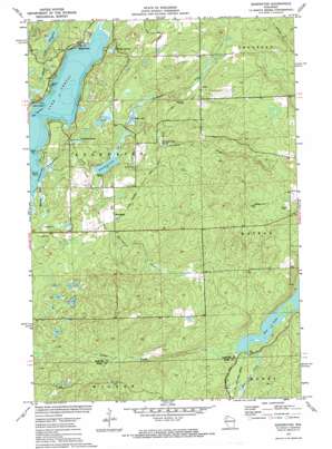
Edgewater Topo Map Wisconsin
To zoom in, hover over the map of Edgewater
USGS Topo Quad 45091f4 - 1:24,000 scale
| Topo Map Name: | Edgewater |
| USGS Topo Quad ID: | 45091f4 |
| Print Size: | ca. 21 1/4" wide x 27" high |
| Southeast Coordinates: | 45.625° N latitude / 91.375° W longitude |
| Map Center Coordinates: | 45.6875° N latitude / 91.4375° W longitude |
| U.S. State: | WI |
| Filename: | o45091f4.jpg |
| Download Map JPG Image: | Edgewater topo map 1:24,000 scale |
| Map Type: | Topographic |
| Topo Series: | 7.5´ |
| Map Scale: | 1:24,000 |
| Source of Map Images: | United States Geological Survey (USGS) |
| Alternate Map Versions: |
Edgewater WI 1972, updated 1975 Download PDF Buy paper map Edgewater WI 2010 Download PDF Buy paper map Edgewater WI 2013 Download PDF Buy paper map Edgewater WI 2015 Download PDF Buy paper map |
1:24,000 Topo Quads surrounding Edgewater
> Back to 45091e1 at 1:100,000 scale
> Back to 45090a1 at 1:250,000 scale
> Back to U.S. Topo Maps home
Edgewater topo map: Gazetteer
Edgewater: Bays
Badger Bay elevation 375m 1230′Squaw Bay elevation 375m 1230′
The Bullpen Bay elevation 375m 1230′
Edgewater: Capes
Indian Point elevation 378m 1240′Pikes Point elevation 378m 1240′
Edgewater: Channels
The Narrows elevation 375m 1230′Edgewater: Dams
Deer Creek 2WP1328 Dam elevation 468m 1535′Pigeon Creek Flowage G129 Dam elevation 426m 1397′
Edgewater: Lakes
Deer Lake elevation 464m 1522′Heron Lake elevation 377m 1236′
Knuteson Lake elevation 388m 1272′
Lake Chetac elevation 375m 1230′
Wise Lake elevation 390m 1279′
Edgewater: Populated Places
Edgewater elevation 387m 1269′Wooddale elevation 407m 1335′
Yarnell elevation 440m 1443′
Edgewater: Post Offices
Edgewater Post Office elevation 389m 1276′Edgewater: Reservoirs
Deer Lake 10 elevation 468m 1535′Pigeon Creek Flowage elevation 426m 1397′
Edgewater: Springs
Fortyone Creek Spring elevation 420m 1377′Knuteson Spring elevation 383m 1256′
Red Cedar Springs elevation 378m 1240′
Edgewater: Streams
Benson Creek elevation 375m 1230′Fortyone Creek elevation 391m 1282′
Knuteson Creek elevation 375m 1230′
Malviney Creek elevation 377m 1236′
Squaw Creek elevation 379m 1243′
Thirty-three Creek elevation 391m 1282′
Yarnell Creek elevation 408m 1338′
Edgewater: Summits
Meteor Hill elevation 547m 1794′Edgewater digital topo map on disk
Buy this Edgewater topo map showing relief, roads, GPS coordinates and other geographical features, as a high-resolution digital map file on DVD:


