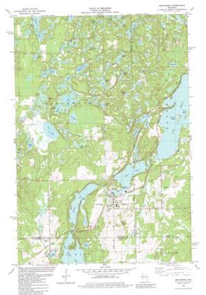
Birchwood Topo Map Wisconsin
To zoom in, hover over the map of Birchwood
USGS Topo Quad 45091f5 - 1:24,000 scale
| Topo Map Name: | Birchwood |
| USGS Topo Quad ID: | 45091f5 |
| Print Size: | ca. 21 1/4" wide x 27" high |
| Southeast Coordinates: | 45.625° N latitude / 91.5° W longitude |
| Map Center Coordinates: | 45.6875° N latitude / 91.5625° W longitude |
| U.S. State: | WI |
| Filename: | o45091f5.jpg |
| Download Map JPG Image: | Birchwood topo map 1:24,000 scale |
| Map Type: | Topographic |
| Topo Series: | 7.5´ |
| Map Scale: | 1:24,000 |
| Source of Map Images: | United States Geological Survey (USGS) |
| Alternate Map Versions: |
Birchwood WI 1982, updated 1982 Download PDF Buy paper map Birchwood WI 2010 Download PDF Buy paper map Birchwood WI 2013 Download PDF Buy paper map Birchwood WI 2015 Download PDF Buy paper map |
1:24,000 Topo Quads surrounding Birchwood
> Back to 45091e1 at 1:100,000 scale
> Back to 45090a1 at 1:250,000 scale
> Back to U.S. Topo Maps home
Birchwood topo map: Gazetteer
Birchwood: Capes
Stouts Point elevation 369m 1210′Birchwood: Dams
Birch Lake Dam elevation 375m 1230′Birchwood: Islands
Garbutt Island elevation 375m 1230′Grutt Island elevation 378m 1240′
Birchwood: Lakes
Balsam Lake elevation 361m 1184′Bass Lake elevation 364m 1194′
Bennett Lake elevation 376m 1233′
Birch Lake elevation 375m 1230′
Bodins Lake elevation 411m 1348′
Bridge Lake elevation 426m 1397′
County Line Lake elevation 419m 1374′
Elbow Lake elevation 405m 1328′
Garbutt Lake elevation 379m 1243′
Green Lake elevation 401m 1315′
Loon Lake elevation 407m 1335′
Lost Lake elevation 401m 1315′
Mallard Lake elevation 418m 1371′
Matson Lake elevation 409m 1341′
McDermott Lake elevation 407m 1335′
Nice Lake elevation 406m 1332′
Nick Lake elevation 404m 1325′
Peters Lake elevation 404m 1325′
Peufald Lakes elevation 399m 1309′
Pickerel Lake elevation 364m 1194′
Pickerel Lake elevation 380m 1246′
River Lake elevation 408m 1338′
Rock Lake elevation 399m 1309′
Sams Lake elevation 420m 1377′
Spider Lake elevation 397m 1302′
Spute Lake elevation 403m 1322′
Sugarbush Lake elevation 396m 1299′
Telstar Lake elevation 426m 1397′
Thomas Lake elevation 0m 0′
Vollmers Lake elevation 0m 0′
Birchwood: Parks
Doolittle County Park elevation 375m 1230′Birchwood: Populated Places
Angus elevation 384m 1259′Birchwood elevation 385m 1263′
Birchwood: Post Offices
Birchwood Post Office elevation 384m 1259′Birchwood: Reservoirs
Birch Lake elevation 375m 1230′Birchwood digital topo map on disk
Buy this Birchwood topo map showing relief, roads, GPS coordinates and other geographical features, as a high-resolution digital map file on DVD:


