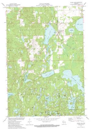
Stone Lake Topo Map Wisconsin
To zoom in, hover over the map of Stone Lake
USGS Topo Quad 45091g5 - 1:24,000 scale
| Topo Map Name: | Stone Lake |
| USGS Topo Quad ID: | 45091g5 |
| Print Size: | ca. 21 1/4" wide x 27" high |
| Southeast Coordinates: | 45.75° N latitude / 91.5° W longitude |
| Map Center Coordinates: | 45.8125° N latitude / 91.5625° W longitude |
| U.S. State: | WI |
| Filename: | o45091g5.jpg |
| Download Map JPG Image: | Stone Lake topo map 1:24,000 scale |
| Map Type: | Topographic |
| Topo Series: | 7.5´ |
| Map Scale: | 1:24,000 |
| Source of Map Images: | United States Geological Survey (USGS) |
| Alternate Map Versions: |
Stone Lake WI 1971, updated 1974 Download PDF Buy paper map Stone Lake WI 2010 Download PDF Buy paper map Stone Lake WI 2013 Download PDF Buy paper map Stone Lake WI 2015 Download PDF Buy paper map |
1:24,000 Topo Quads surrounding Stone Lake
> Back to 45091e1 at 1:100,000 scale
> Back to 45090a1 at 1:250,000 scale
> Back to U.S. Topo Maps home
Stone Lake topo map: Gazetteer
Stone Lake: Dams
Slim Creek 2WP220 Dam elevation 385m 1263′Slim Creek Dam elevation 382m 1253′
Stone Lake: Lakes
Beartrap Lake elevation 419m 1374′Camp Lake elevation 421m 1381′
Deep Lake elevation 419m 1374′
Fawn Lake elevation 425m 1394′
Horseshoe Lake elevation 382m 1253′
Little Dugan Lake elevation 382m 1253′
Little Sand Lake elevation 397m 1302′
Little Sissabagama Lake elevation 407m 1335′
Little Stone Lake elevation 397m 1302′
Loyhead Lake elevation 415m 1361′
MacRae Lake elevation 391m 1282′
Mud Lake elevation 404m 1325′
Ole Lake elevation 391m 1282′
Otter Lake elevation 415m 1361′
Pickerel Lake elevation 388m 1272′
Pine Island Lake elevation 415m 1361′
Saddle Lake elevation 409m 1341′
Sawmill Lake elevation 421m 1381′
Scoot Lake elevation 409m 1341′
Sissabagama Lake elevation 403m 1322′
Slim Creek Flowage elevation 382m 1253′
Slim Lake elevation 391m 1282′
Spring Lake elevation 400m 1312′
Stone Lake elevation 397m 1302′
Superior Lake elevation 406m 1332′
West Lake elevation 409m 1341′
Wolf Lake elevation 418m 1371′
Stone Lake: Populated Places
Stone Lake elevation 401m 1315′Stone Lake: Post Offices
Stone Lake Post Office elevation 403m 1322′Stone Lake: Reservoirs
Slim Creek Flowage 17 elevation 385m 1263′Stone Lake: Streams
Sissabagama Creek elevation 397m 1302′Slim Creek elevation 373m 1223′
Stone Lake digital topo map on disk
Buy this Stone Lake topo map showing relief, roads, GPS coordinates and other geographical features, as a high-resolution digital map file on DVD:


