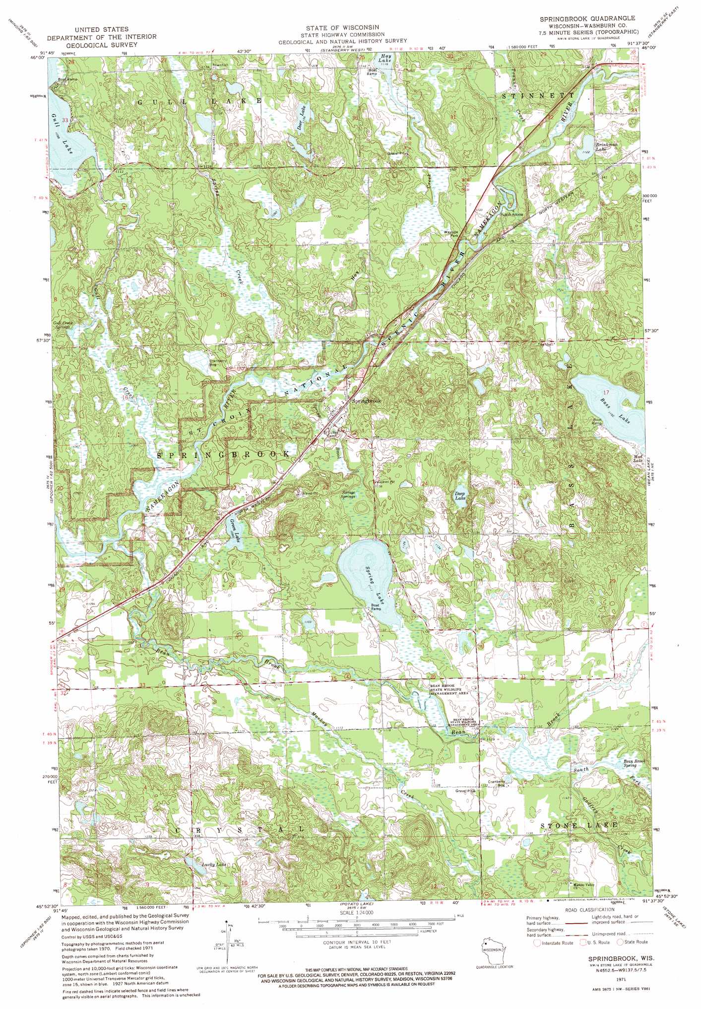
Springbrook Topo Map Wisconsin
To zoom in, hover over the map of Springbrook
USGS Topo Quad 45091h6 - 1:24,000 scale
| Topo Map Name: | Springbrook |
| USGS Topo Quad ID: | 45091h6 |
| Print Size: | ca. 21 1/4" wide x 27" high |
| Southeast Coordinates: | 45.875° N latitude / 91.625° W longitude |
| Map Center Coordinates: | 45.9375° N latitude / 91.6875° W longitude |
| U.S. State: | WI |
| Filename: | o45091h6.jpg |
| Download Map JPG Image: | Springbrook topo map 1:24,000 scale |
| Map Type: | Topographic |
| Topo Series: | 7.5´ |
| Map Scale: | 1:24,000 |
| Source of Map Images: | United States Geological Survey (USGS) |
| Alternate Map Versions: |
Springbrook WI 1971, updated 1974 Download PDF Buy paper map Springbrook WI 2010 Download PDF Buy paper map Springbrook WI 2013 Download PDF Buy paper map Springbrook WI 2015 Download PDF Buy paper map |
1:24,000 Topo Quads surrounding Springbrook
Minong Flowage |
Gordon |
Chittamo |
Chittamo Ne |
Totagatic Lake |
Horseshoe Lake |
Minong |
Stanberry West |
Stanberry East |
Hayward |
Dunn Lake |
Trego |
Springbrook |
Bean Lake |
Reserve |
Spooner |
Spooner Lake |
Potato Lake |
Stone Lake |
Hauer |
Shell Lake |
Sarona |
Nobleton |
Birchwood |
Edgewater |
> Back to 45091e1 at 1:100,000 scale
> Back to 45090a1 at 1:250,000 scale
> Back to U.S. Topo Maps home
Springbrook topo map: Gazetteer
Springbrook: Airports
Springbrook Airport elevation 342m 1122′Springbrook: Lakes
Bass Lake elevation 350m 1148′Brinkman Lake elevation 342m 1122′
Deep Lake elevation 344m 1128′
Deer Lake elevation 352m 1154′
Green Lake elevation 332m 1089′
Gull Creek Springs elevation 325m 1066′
Lucky Lake elevation 369m 1210′
Spring Lake elevation 338m 1108′
Springbrook: Populated Places
Springbrook elevation 334m 1095′Springbrook: Springs
Bean Brook Spring elevation 340m 1115′Savage Springs elevation 336m 1102′
Springbrook: Streams
Bean Brook elevation 322m 1056′Chippanazie Creek elevation 340m 1115′
Godfrey Creek elevation 340m 1115′
Gull Creek elevation 322m 1056′
Hay Creek elevation 326m 1069′
Mackay Creek elevation 332m 1089′
South Fork Bean Brook elevation 342m 1122′
Spring Brook elevation 321m 1053′
Spring Creek elevation 325m 1066′
Tranus Creek elevation 337m 1105′
Springbrook digital topo map on disk
Buy this Springbrook topo map showing relief, roads, GPS coordinates and other geographical features, as a high-resolution digital map file on DVD: