Emerald Topo Map Wisconsin
To zoom in, hover over the map of Emerald
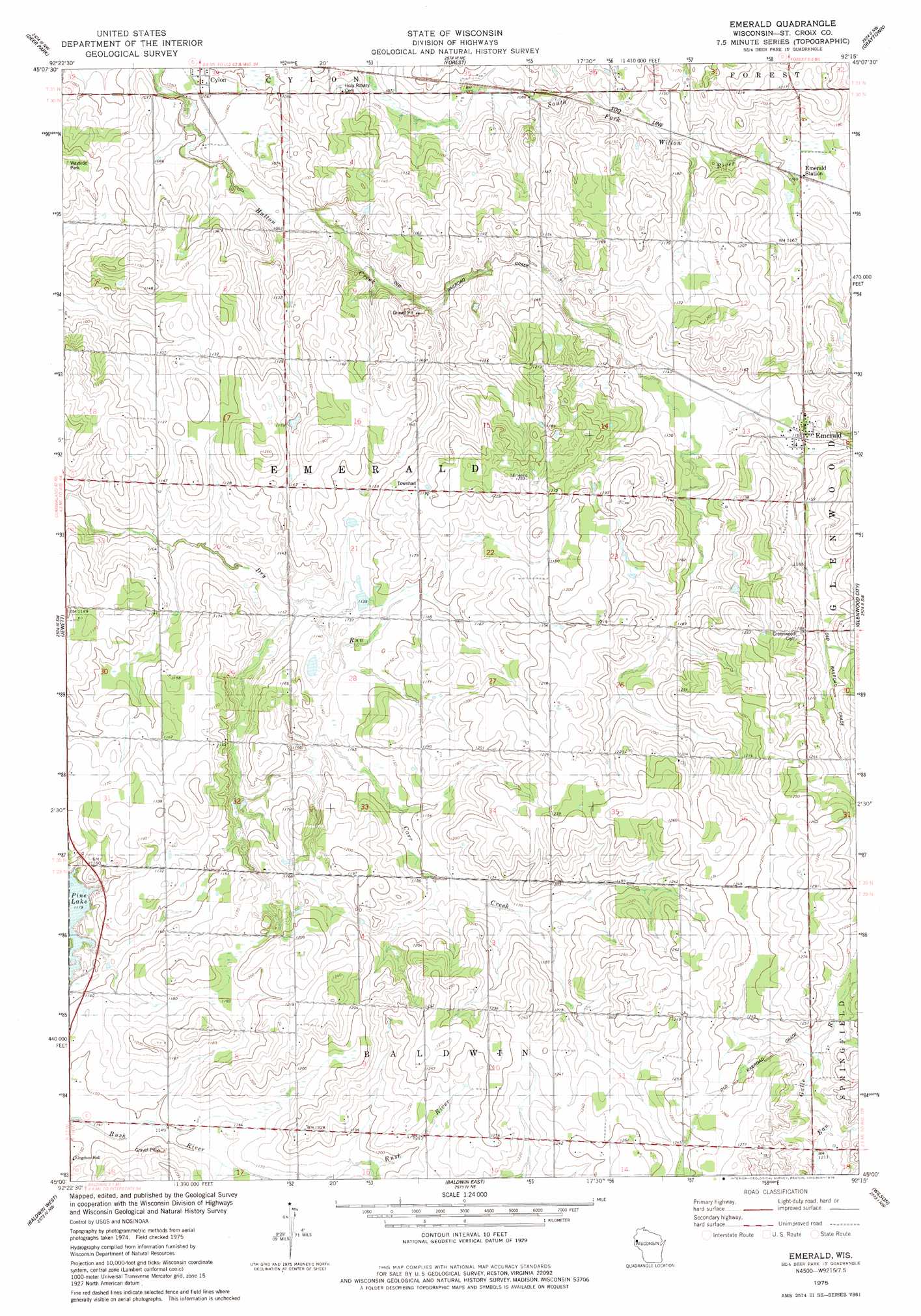
USGS Topo Quad 45092a3 - 1:24,000 scale
| Topo Map Name: | Emerald |
| USGS Topo Quad ID: | 45092a3 |
| Print Size: | ca. 21 1/4" wide x 27" high |
| Southeast Coordinates: | 45° N latitude / 92.25° W longitude |
| Map Center Coordinates: | 45.0625° N latitude / 92.3125° W longitude |
| U.S. State: | WI |
| Filename: | o45092a3.jpg |
| Download Map JPG Image: | Emerald topo map 1:24,000 scale |
| Map Type: | Topographic |
| Topo Series: | 7.5´ |
| Map Scale: | 1:24,000 |
| Source of Map Images: | United States Geological Survey (USGS) |
| Alternate Map Versions: |
Emerald WI 1975, updated 1978 Download PDF Buy paper map Emerald WI 2010 Download PDF Buy paper map Emerald WI 2013 Download PDF Buy paper map Emerald WI 2015 Download PDF Buy paper map |
1:24,000 Topo Quads surrounding Emerald
Nye |
Wapogasset Lake |
Amery |
Clayton |
Arland |
New Richmond North |
Deer Park |
Forest |
Graytown |
Connorsville |
New Richmond South |
Jewett |
Emerald |
Glenwood City |
Boyceville |
Roberts |
Baldwin West |
Baldwin East |
Wilson |
Knapp |
River Falls East |
Martell |
El Paso |
Spring Valley |
Weston |
> Back to 45092a1 at 1:100,000 scale
> Back to 45092a1 at 1:250,000 scale
> Back to U.S. Topo Maps home
Emerald topo map: Gazetteer
Emerald: Airports
Flyplassen Airport elevation 386m 1266′Kanten Field elevation 350m 1148′
Emerald: Populated Places
Cylon elevation 323m 1059′Emerald elevation 351m 1151′
Emerald: Streams
Carr Creek elevation 337m 1105′Emerald digital topo map on disk
Buy this Emerald topo map showing relief, roads, GPS coordinates and other geographical features, as a high-resolution digital map file on DVD: