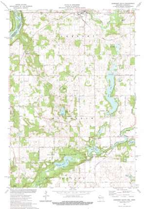
Somerset South Topo Map Wisconsin
To zoom in, hover over the map of Somerset South
USGS Topo Quad 45092a6 - 1:24,000 scale
| Topo Map Name: | Somerset South |
| USGS Topo Quad ID: | 45092a6 |
| Print Size: | ca. 21 1/4" wide x 27" high |
| Southeast Coordinates: | 45° N latitude / 92.625° W longitude |
| Map Center Coordinates: | 45.0625° N latitude / 92.6875° W longitude |
| U.S. States: | WI, MN |
| Filename: | o45092a6.jpg |
| Download Map JPG Image: | Somerset South topo map 1:24,000 scale |
| Map Type: | Topographic |
| Topo Series: | 7.5´ |
| Map Scale: | 1:24,000 |
| Source of Map Images: | United States Geological Survey (USGS) |
| Alternate Map Versions: |
Somerset South WI 1974, updated 1977 Download PDF Buy paper map Somerset South WI 2010 Download PDF Buy paper map Somerset South WI 2013 Download PDF Buy paper map Somerset South WI 2015 Download PDF Buy paper map |
1:24,000 Topo Quads surrounding Somerset South
> Back to 45092a1 at 1:100,000 scale
> Back to 45092a1 at 1:250,000 scale
> Back to U.S. Topo Maps home
Somerset South topo map: Gazetteer
Somerset South: Airports
Beer Airport elevation 282m 925′Irlbeck Airport elevation 302m 990′
Somerset South: Areas
Birch Park Ski Area elevation 244m 800′Snow Crest Ski Area elevation 280m 918′
Somerset South: Dams
Little Falls Dam elevation 226m 741′Mound Plant WP 224 Dam elevation 269m 882′
Willow Falls WP 195 Dam elevation 274m 898′
Somerset South: Lakes
Bass Lake elevation 275m 902′Bright Lake elevation 266m 872′
Dry Dam Lake elevation 272m 892′
North Bass Lake elevation 275m 902′
Perch Lake elevation 232m 761′
Shank Lake elevation 270m 885′
Somerset South: Parks
Floaters Haven Park elevation 255m 836′Willow River State Park elevation 242m 793′
Somerset South: Populated Places
Burkhardt elevation 275m 902′Burkhardt Station elevation 282m 925′
Somerset elevation 257m 843′
Somerset South: Reservoirs
Burkhardt Mill Pond 169.1 elevation 274m 898′Little Falls Lake elevation 226m 741′
Little Falls Lake 171 elevation 222m 728′
Mill Pond elevation 242m 793′
Mounds Pond elevation 269m 882′
Mounds Pond 168 elevation 269m 882′
Somerset South: Springs
Levesque Spring elevation 259m 849′Somerset South digital topo map on disk
Buy this Somerset South topo map showing relief, roads, GPS coordinates and other geographical features, as a high-resolution digital map file on DVD:


