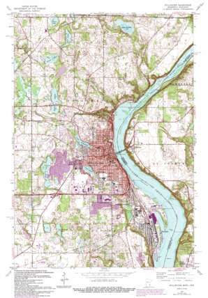
Stillwater Topo Map Minnesota
To zoom in, hover over the map of Stillwater
USGS Topo Quad 45092a7 - 1:24,000 scale
| Topo Map Name: | Stillwater |
| USGS Topo Quad ID: | 45092a7 |
| Print Size: | ca. 21 1/4" wide x 27" high |
| Southeast Coordinates: | 45° N latitude / 92.75° W longitude |
| Map Center Coordinates: | 45.0625° N latitude / 92.8125° W longitude |
| U.S. States: | MN, WI |
| Filename: | o45092a7.jpg |
| Download Map JPG Image: | Stillwater topo map 1:24,000 scale |
| Map Type: | Topographic |
| Topo Series: | 7.5´ |
| Map Scale: | 1:24,000 |
| Source of Map Images: | United States Geological Survey (USGS) |
| Alternate Map Versions: |
Stillwater MN 1951, updated 1952 Download PDF Buy paper map Stillwater MN 1951, updated 1959 Download PDF Buy paper map Stillwater MN 1951, updated 1966 Download PDF Buy paper map Stillwater MN 1967, updated 1969 Download PDF Buy paper map Stillwater MN 1967, updated 1975 Download PDF Buy paper map Stillwater MN 1967, updated 1981 Download PDF Buy paper map Stillwater MN 1967, updated 1987 Download PDF Buy paper map Stillwater MN 1967, updated 1993 Download PDF Buy paper map Stillwater MN 2010 Download PDF Buy paper map Stillwater MN 2013 Download PDF Buy paper map Stillwater MN 2016 Download PDF Buy paper map |
1:24,000 Topo Quads surrounding Stillwater
> Back to 45092a1 at 1:100,000 scale
> Back to 45092a1 at 1:250,000 scale
> Back to U.S. Topo Maps home
Stillwater topo map: Gazetteer
Stillwater: Bridges
Interstate Bridge elevation 204m 669′Oak Park Heights City Hall elevation 289m 948′
Stillwater: Capes
Lookout Point elevation 204m 669′Stillwater: Channels
Crosswinds Community Church elevation 274m 898′Stillwater: Islands
Liberty Newman Island elevation 274m 898′Stillwater: Lakes
Brewers Pond elevation 273m 895′Brick Pond elevation 261m 856′
Cloverdale Lake elevation 272m 892′
Lake McKusick elevation 256m 839′
Lily Lake elevation 256m 839′
Little Carnelian Lake elevation 253m 830′
Long Lake elevation 272m 892′
Loon Lake elevation 272m 892′
Louise Lake elevation 287m 941′
McDonald Lake elevation 269m 882′
Perro Pond elevation 227m 744′
Silver Lake elevation 266m 872′
Twin Lakes elevation 269m 882′
Stillwater: Parks
Anez Ridge Park elevation 278m 912′Barkers Alps Park elevation 232m 761′
Bayport Wildlife Management Area elevation 269m 882′
Benson Park elevation 291m 954′
Brown's Creek Park elevation 265m 869′
Creekside Park elevation 269m 882′
Crocus Park elevation 208m 682′
Croixwood Open Square elevation 277m 908′
Ferry Landing Park elevation 208m 682′
Heritage Square Park elevation 288m 944′
Jackson Wildlife Management Area elevation 272m 892′
JC Ball Fields elevation 262m 859′
Jenson Memorial Park elevation 250m 820′
Lakeside Park elevation 211m 692′
Legends Gazebo Park elevation 281m 921′
Legends Park elevation 286m 938′
Liberty Square Park elevation 279m 915′
Lily Lake Park elevation 260m 853′
Long Lake Open Square elevation 277m 908′
Lowell Park elevation 207m 679′
McKusick Park elevation 263m 862′
Nightingale Park elevation 278m 912′
Northland Park elevation 279m 915′
Old Athletic Field Park elevation 264m 866′
Otto Berg Memorial Park elevation 264m 866′
Park Land elevation 259m 849′
Park Pond Park elevation 294m 964′
Percheron Park elevation 277m 908′
Pioneer Park elevation 248m 813′
Ramsey Park elevation 262m 859′
Schulenburg Park elevation 248m 813′
Settlers Park elevation 280m 918′
Sommers Landing Park elevation 238m 780′
Staples Park elevation 274m 898′
Sunrise Park elevation 280m 918′
Swager Park elevation 287m 941′
Triangle Park elevation 249m 816′
Valley View Park elevation 245m 803′
Washington Park elevation 271m 889′
Stillwater: Populated Places
Arcola elevation 266m 872′Bayport elevation 216m 708′
Carnelian Junction elevation 293m 961′
Houlton elevation 266m 872′
Oak Park Heights elevation 239m 784′
Saint Croix Meadows Mobile Home Park elevation 266m 872′
Siegel elevation 271m 889′
Stillwater elevation 212m 695′
Stillwater: Post Offices
Bayport Post Office (historical) elevation 213m 698′Lake Elmo Post Office elevation 291m 954′
Stillwater Post Office elevation 231m 757′
Stillwater: Streams
Browns Creek elevation 205m 672′Silver Creek elevation 204m 669′
Stillwater digital topo map on disk
Buy this Stillwater topo map showing relief, roads, GPS coordinates and other geographical features, as a high-resolution digital map file on DVD:


