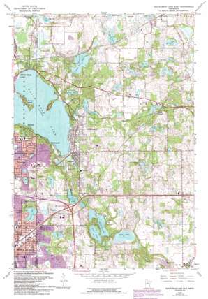
White Bear Lake East Topo Map Minnesota
To zoom in, hover over the map of White Bear Lake East
USGS Topo Quad 45092a8 - 1:24,000 scale
| Topo Map Name: | White Bear Lake East |
| USGS Topo Quad ID: | 45092a8 |
| Print Size: | ca. 21 1/4" wide x 27" high |
| Southeast Coordinates: | 45° N latitude / 92.875° W longitude |
| Map Center Coordinates: | 45.0625° N latitude / 92.9375° W longitude |
| U.S. State: | MN |
| Filename: | o45092a8.jpg |
| Download Map JPG Image: | White Bear Lake East topo map 1:24,000 scale |
| Map Type: | Topographic |
| Topo Series: | 7.5´ |
| Map Scale: | 1:24,000 |
| Source of Map Images: | United States Geological Survey (USGS) |
| Alternate Map Versions: |
White Bear Lake East MN 1951, updated 1952 Download PDF Buy paper map White Bear Lake East MN 1951, updated 1958 Download PDF Buy paper map White Bear Lake East MN 1967, updated 1969 Download PDF Buy paper map White Bear Lake East MN 1967, updated 1973 Download PDF Buy paper map White Bear Lake East MN 1967, updated 1981 Download PDF Buy paper map White Bear Lake East MN 1967, updated 1989 Download PDF Buy paper map White Bear Lake East MN 1967, updated 1993 Download PDF Buy paper map White Bear Lake East MN 2010 Download PDF Buy paper map White Bear Lake East MN 2013 Download PDF Buy paper map White Bear Lake East MN 2016 Download PDF Buy paper map |
1:24,000 Topo Quads surrounding White Bear Lake East
> Back to 45092a1 at 1:100,000 scale
> Back to 45092a1 at 1:250,000 scale
> Back to U.S. Topo Maps home
White Bear Lake East topo map: Gazetteer
White Bear Lake East: Airports
Benson Airport elevation 284m 931′Northport Airport elevation 308m 1010′
White Bear Lake Seaplane Base elevation 281m 921′
White Bear Lake East: Crossings
Interchange 52A and 52B elevation 295m 967′White Bear Lake East: Islands
Manitou Island elevation 290m 951′White Bear Lake East: Lakes
Benz Lake elevation 291m 954′Clear Lake elevation 284m 931′
Echo Lake elevation 287m 941′
Echo Lake elevation 302m 990′
Fish Lake elevation 281m 921′
Lake De Montreville elevation 281m 921′
Lake Jane elevation 278m 912′
Lake Masterman elevation 291m 954′
Lake Olson elevation 281m 921′
Lake Washington elevation 281m 921′
Long Lake elevation 289m 948′
Long Lake elevation 284m 931′
Lost Lake elevation 281m 921′
Mann Lake elevation 291m 954′
Mud Lake elevation 303m 994′
Pat Lake elevation 287m 941′
Pine Tree Lake elevation 287m 941′
Silver Lake elevation 299m 980′
Sunfish Lake elevation 269m 882′
Sunnybrook Lake elevation 296m 971′
Veronica Pond elevation 272m 892′
Weber Pond elevation 297m 974′
White Bear Lake elevation 281m 921′
Woodpile Lake elevation 291m 954′
White Bear Lake East: Parks
Bloomquist Field elevation 293m 961′Bossard Park elevation 298m 977′
Central Park elevation 291m 954′
Dorothy Park elevation 303m 994′
Eberle Park elevation 313m 1026′
Garden Boulevard Park elevation 314m 1030′
Goodwin Park elevation 311m 1020′
Hause Park elevation 302m 990′
Hidden Hollow Park elevation 288m 944′
Joy Park elevation 304m 997′
Katherine Abbott Park elevation 289m 948′
Matoska Park elevation 284m 931′
Northdale Park elevation 299m 980′
Northwood Park elevation 309m 1013′
Oakdale Park elevation 305m 1000′
Oakwood Lustre Park elevation 315m 1033′
Silver Lake Park elevation 303m 994′
Southwood Park elevation 304m 997′
Tighe - Schmitz Park elevation 282m 925′
Tower Park elevation 295m 967′
Wedgewood Park elevation 304m 997′
West Park elevation 283m 928′
White Bear Beach Park elevation 283m 928′
Wildwood Park elevation 286m 938′
White Bear Lake East: Populated Places
Bellaire elevation 287m 941′Birchwood elevation 295m 967′
Dellwood elevation 287m 941′
Duluth Junction elevation 302m 990′
Grant elevation 308m 1010′
Mahtomedi elevation 303m 994′
North Saint Paul elevation 297m 974′
Pine Springs elevation 298m 977′
White Bear Beach elevation 287m 941′
Willernie elevation 294m 964′
Withrow elevation 299m 980′
White Bear Lake East: Post Offices
Mahtomedi Post Office (historical) elevation 302m 990′Withrow Post Office (historical) elevation 299m 980′
White Bear Lake East digital topo map on disk
Buy this White Bear Lake East topo map showing relief, roads, GPS coordinates and other geographical features, as a high-resolution digital map file on DVD:


