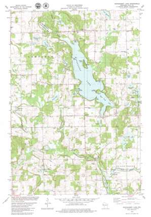
Wapogasset Lake Topo Map Wisconsin
To zoom in, hover over the map of Wapogasset Lake
USGS Topo Quad 45092c4 - 1:24,000 scale
| Topo Map Name: | Wapogasset Lake |
| USGS Topo Quad ID: | 45092c4 |
| Print Size: | ca. 21 1/4" wide x 27" high |
| Southeast Coordinates: | 45.25° N latitude / 92.375° W longitude |
| Map Center Coordinates: | 45.3125° N latitude / 92.4375° W longitude |
| U.S. State: | WI |
| Filename: | o45092c4.jpg |
| Download Map JPG Image: | Wapogasset Lake topo map 1:24,000 scale |
| Map Type: | Topographic |
| Topo Series: | 7.5´ |
| Map Scale: | 1:24,000 |
| Source of Map Images: | United States Geological Survey (USGS) |
| Alternate Map Versions: |
Balsam Lake SW WI 1974, updated 1976 Download PDF Buy paper map Wapogasset Lake WI 2010 Download PDF Buy paper map Wapogasset Lake WI 2013 Download PDF Buy paper map Wapogasset Lake WI 2015 Download PDF Buy paper map |
1:24,000 Topo Quads surrounding Wapogasset Lake
> Back to 45092a1 at 1:100,000 scale
> Back to 45092a1 at 1:250,000 scale
> Back to U.S. Topo Maps home
Wapogasset Lake topo map: Gazetteer
Wapogasset Lake: Airports
Amery Airport (historical) elevation 338m 1108′Amery Municipal Airport elevation 330m 1082′
Youngs Landing Strip elevation 326m 1069′
Wapogasset Lake: Capes
Hickory Point elevation 311m 1020′Wapogasset Lake: Dams
Black Brook WP-66 Dam elevation 317m 1040′Wapogasset Lake: Islands
Wallace Island elevation 319m 1046′Wapogasset Lake: Lakes
Basswood Lake elevation 320m 1049′Bear Trap Lake elevation 311m 1020′
Big Horseshoe Lake elevation 317m 1040′
Goose Lake elevation 311m 1020′
Joe Lake elevation 314m 1030′
King Lake elevation 321m 1053′
Kinney Lake elevation 314m 1030′
Lake Kenabee elevation 326m 1069′
Mud Lake elevation 311m 1020′
Ox Lake elevation 320m 1049′
Park Lake elevation 326m 1069′
Pine Lake elevation 320m 1049′
Smith Lake elevation 297m 974′
Summerfield Lake elevation 317m 1040′
Trident Lake elevation 323m 1059′
Wapogasset Lake: Parks
Balsam Branch State Wildlife Area elevation 316m 1036′Black Brook County Park elevation 310m 1017′
Parker Creek State Public Fishing Area elevation 310m 1017′
Wapogasset Lake: Populated Places
Deronda elevation 326m 1069′Little Falls elevation 310m 1017′
Wanderoos elevation 316m 1036′
Wapogasset Lake: Reservoirs
Black Brook Flowage elevation 317m 1040′Wapogasset Lake elevation 311m 1020′
Wapogasset Lake: Streams
Balsam Branch elevation 311m 1020′Friday Creek elevation 312m 1023′
Parker Creek elevation 309m 1013′
Peabody Creek elevation 291m 954′
Wapogasset Branch elevation 293m 961′
Wapogasset Lake digital topo map on disk
Buy this Wapogasset Lake topo map showing relief, roads, GPS coordinates and other geographical features, as a high-resolution digital map file on DVD:


