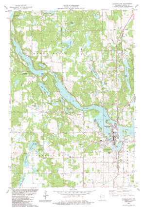
Cumberland Topo Map Wisconsin
To zoom in, hover over the map of Cumberland
USGS Topo Quad 45092e1 - 1:24,000 scale
| Topo Map Name: | Cumberland |
| USGS Topo Quad ID: | 45092e1 |
| Print Size: | ca. 21 1/4" wide x 27" high |
| Southeast Coordinates: | 45.5° N latitude / 92° W longitude |
| Map Center Coordinates: | 45.5625° N latitude / 92.0625° W longitude |
| U.S. State: | WI |
| Filename: | o45092e1.jpg |
| Download Map JPG Image: | Cumberland topo map 1:24,000 scale |
| Map Type: | Topographic |
| Topo Series: | 7.5´ |
| Map Scale: | 1:24,000 |
| Source of Map Images: | United States Geological Survey (USGS) |
| Alternate Map Versions: |
Cumberland WI 1982, updated 1983 Download PDF Buy paper map Cumberland WI 2010 Download PDF Buy paper map Cumberland WI 2013 Download PDF Buy paper map Cumberland WI 2015 Download PDF Buy paper map |
1:24,000 Topo Quads surrounding Cumberland
> Back to 45092e1 at 1:100,000 scale
> Back to 45092a1 at 1:250,000 scale
> Back to U.S. Topo Maps home
Cumberland topo map: Gazetteer
Cumberland: Dams
Beaver Dam Lake 2WP563 elevation 382m 1253′Little Sand Lake 1 2WP504 Dam elevation 382m 1253′
Little Sand Lake 4 2WP504 Dam elevation 381m 1250′
Cumberland: Lakes
Beauty Lake elevation 412m 1351′Beaver Dam Lake elevation 376m 1233′
Bullhead Lake elevation 394m 1292′
Collingwood Lake elevation 376m 1233′
Cranberry Lake elevation 382m 1253′
Granite Lake elevation 376m 1233′
Kidney Lake elevation 376m 1233′
Kirby Lake elevation 400m 1312′
Library Lake elevation 376m 1233′
Little Bass Lake elevation 373m 1223′
Little Sand Lake elevation 379m 1243′
Long Lake elevation 388m 1272′
Lower Spirit Lake elevation 376m 1233′
Lower Waterman Lake elevation 371m 1217′
Mud Lake elevation 388m 1272′
North Lake elevation 391m 1282′
Sand Lake elevation 373m 1223′
Scott Lake elevation 388m 1272′
Spring Lake elevation 391m 1282′
Upper Spirit Lake elevation 379m 1243′
Wickerts Lake elevation 391m 1282′
Wildcat Lake elevation 394m 1292′
Cumberland: Parks
Eagle Point Park elevation 378m 1240′Cumberland: Populated Places
Cumberland elevation 379m 1243′Cumberland: Post Offices
Cumberland Post Office elevation 381m 1250′Cumberland: Reservoirs
Beaver Dam Lake 12 elevation 382m 1253′Little Sand Lake 2 elevation 382m 1253′
Maple Plain Rearing Pond 1 elevation 381m 1250′
Cumberland digital topo map on disk
Buy this Cumberland topo map showing relief, roads, GPS coordinates and other geographical features, as a high-resolution digital map file on DVD:


