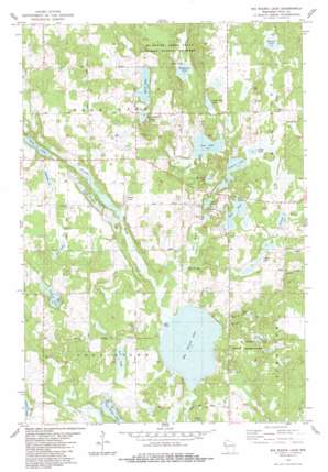
Big Round Lake Topo Map Wisconsin
To zoom in, hover over the map of Big Round Lake
USGS Topo Quad 45092e3 - 1:24,000 scale
| Topo Map Name: | Big Round Lake |
| USGS Topo Quad ID: | 45092e3 |
| Print Size: | ca. 21 1/4" wide x 27" high |
| Southeast Coordinates: | 45.5° N latitude / 92.25° W longitude |
| Map Center Coordinates: | 45.5625° N latitude / 92.3125° W longitude |
| U.S. State: | WI |
| Filename: | o45092e3.jpg |
| Download Map JPG Image: | Big Round Lake topo map 1:24,000 scale |
| Map Type: | Topographic |
| Topo Series: | 7.5´ |
| Map Scale: | 1:24,000 |
| Source of Map Images: | United States Geological Survey (USGS) |
| Alternate Map Versions: |
Frederic SE WI 1974, updated 1976 Download PDF Buy paper map Big Round Lake WI 1983, updated 1983 Download PDF Buy paper map Big Round Lake WI 2010 Download PDF Buy paper map Big Round Lake WI 2013 Download PDF Buy paper map Big Round Lake WI 2015 Download PDF Buy paper map |
1:24,000 Topo Quads surrounding Big Round Lake
> Back to 45092e1 at 1:100,000 scale
> Back to 45092a1 at 1:250,000 scale
> Back to U.S. Topo Maps home
Big Round Lake topo map: Gazetteer
Big Round Lake: Dams
Cragwood Corporation Number 2 H810 Dam elevation 405m 1328′Big Round Lake: Lakes
Andrus Lake elevation 360m 1181′Bass Lake elevation 357m 1171′
Big Lake elevation 372m 1220′
Big Round Lake elevation 351m 1151′
Dahl Lake elevation 370m 1213′
Depot Lake elevation 366m 1200′
Footes Lake elevation 360m 1181′
Hay Lake elevation 359m 1177′
Johnson Lake elevation 373m 1223′
Lake Evelyn elevation 355m 1164′
Lamont Lake elevation 357m 1171′
Little Pine Lake elevation 348m 1141′
Little Ward Lake elevation 360m 1181′
Long Lake elevation 376m 1233′
Loon Lake elevation 365m 1197′
Lost Lake elevation 354m 1161′
Mackie Lake elevation 351m 1151′
McKenzie Lake elevation 339m 1112′
Mullins Lake elevation 357m 1171′
Pickerel Lake elevation 357m 1171′
Pine Lake elevation 354m 1161′
Rhinstad Lake elevation 357m 1171′
Sedge Lake elevation 357m 1171′
Vincent Lake elevation 365m 1197′
Ward Lake elevation 360m 1181′
Big Round Lake: Reservoirs
Lake 18-1 1 elevation 405m 1328′Big Round Lake: Streams
Straight River elevation 351m 1151′Sucker Creek elevation 361m 1184′
Big Round Lake: Swamps
Devils Marsh elevation 358m 1174′Big Round Lake digital topo map on disk
Buy this Big Round Lake topo map showing relief, roads, GPS coordinates and other geographical features, as a high-resolution digital map file on DVD:


