Poquettes Lake Topo Map Wisconsin
To zoom in, hover over the map of Poquettes Lake
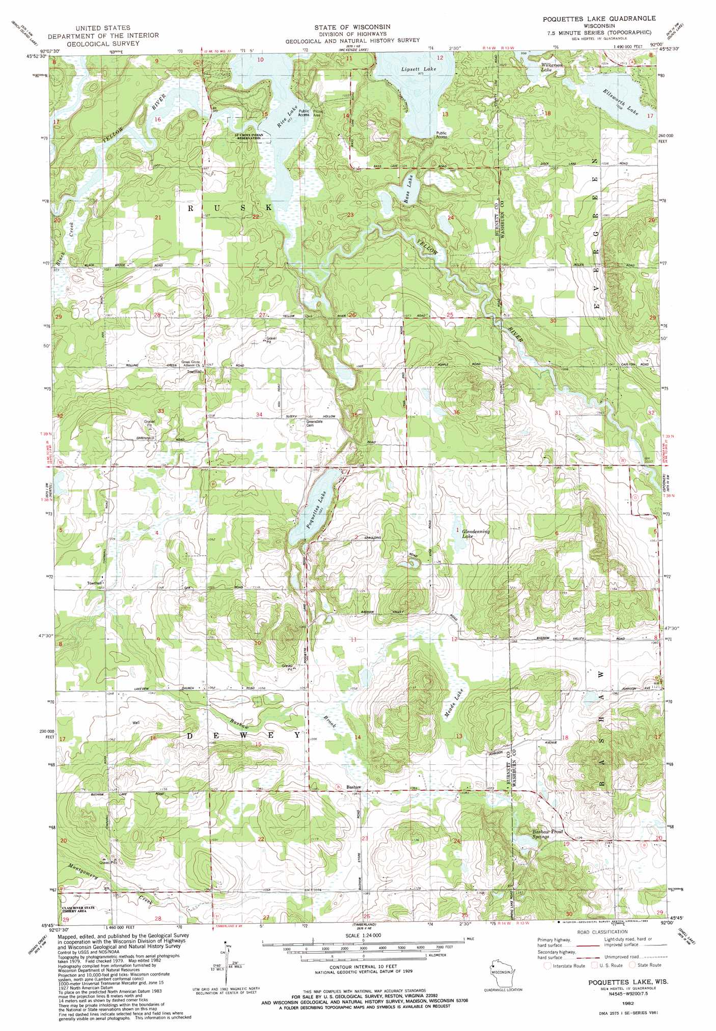
USGS Topo Quad 45092g1 - 1:24,000 scale
| Topo Map Name: | Poquettes Lake |
| USGS Topo Quad ID: | 45092g1 |
| Print Size: | ca. 21 1/4" wide x 27" high |
| Southeast Coordinates: | 45.75° N latitude / 92° W longitude |
| Map Center Coordinates: | 45.8125° N latitude / 92.0625° W longitude |
| U.S. State: | WI |
| Filename: | o45092g1.jpg |
| Download Map JPG Image: | Poquettes Lake topo map 1:24,000 scale |
| Map Type: | Topographic |
| Topo Series: | 7.5´ |
| Map Scale: | 1:24,000 |
| Source of Map Images: | United States Geological Survey (USGS) |
| Alternate Map Versions: |
Poquettes Lake WI 1982, updated 1983 Download PDF Buy paper map Poquettes Lake WI 2010 Download PDF Buy paper map Poquettes Lake WI 2013 Download PDF Buy paper map Poquettes Lake WI 2015 Download PDF Buy paper map |
1:24,000 Topo Quads surrounding Poquettes Lake
Danbury East |
Webb Lake |
Frog Lake |
Horseshoe Lake |
Minong |
Webster |
Birch Island Lake |
Mckenzie Lake |
Dunn Lake |
Trego |
Siren East |
Hertel |
Poquettes Lake |
Spooner |
Spooner Lake |
Clam Falls |
Indian Creek |
Timberland |
Shell Lake |
Sarona |
Big Round Lake |
Mckinley |
Cumberland |
Lower Vermillion Lake |
Haugen |
> Back to 45092e1 at 1:100,000 scale
> Back to 45092a1 at 1:250,000 scale
> Back to U.S. Topo Maps home
Poquettes Lake topo map: Gazetteer
Poquettes Lake: Lakes
Bass Lake elevation 300m 984′Ellsworth Lake elevation 307m 1007′
Glendenning Lake elevation 331m 1085′
Lipsett Lake elevation 297m 974′
Meads Lake elevation 324m 1062′
Poquettes Lake elevation 312m 1023′
Rice Lake elevation 297m 974′
Poquettes Lake: Populated Places
Bashaw elevation 323m 1059′Poquettes Lake: Springs
Bashaw Trout Springs elevation 326m 1069′Poquettes Lake: Streams
Black Creek elevation 296m 971′Poquettes Lake digital topo map on disk
Buy this Poquettes Lake topo map showing relief, roads, GPS coordinates and other geographical features, as a high-resolution digital map file on DVD: