Falun Topo Map Wisconsin
To zoom in, hover over the map of Falun
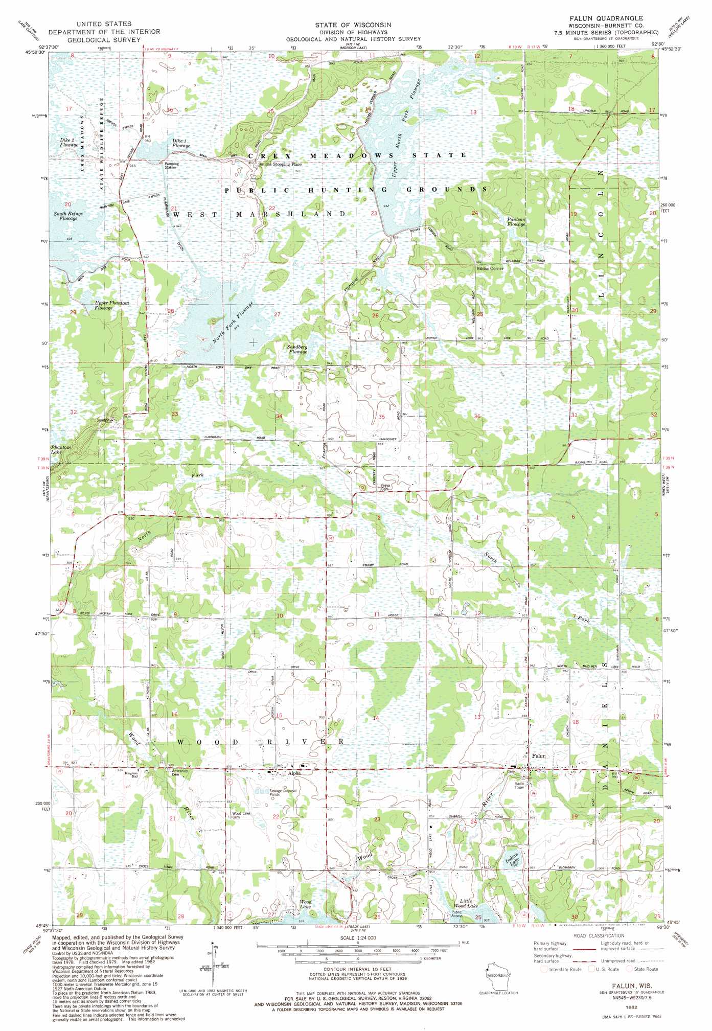
USGS Topo Quad 45092g5 - 1:24,000 scale
| Topo Map Name: | Falun |
| USGS Topo Quad ID: | 45092g5 |
| Print Size: | ca. 21 1/4" wide x 27" high |
| Southeast Coordinates: | 45.75° N latitude / 92.5° W longitude |
| Map Center Coordinates: | 45.8125° N latitude / 92.5625° W longitude |
| U.S. State: | WI |
| Filename: | o45092g5.jpg |
| Download Map JPG Image: | Falun topo map 1:24,000 scale |
| Map Type: | Topographic |
| Topo Series: | 7.5´ |
| Map Scale: | 1:24,000 |
| Source of Map Images: | United States Geological Survey (USGS) |
| Alternate Map Versions: |
Falun WI 1982, updated 1983 Download PDF Buy paper map Falun WI 2010 Download PDF Buy paper map Falun WI 2013 Download PDF Buy paper map Falun WI 2015 Download PDF Buy paper map |
1:24,000 Topo Quads surrounding Falun
Sandstone South |
Cloverdale |
Wilbur Lake |
Danbury West |
Danbury East |
Cedar Lake |
Lake Clayton |
Saint Johns Landing |
Yellow Lake |
Webster |
Bass Creek |
Grantsburg |
Falun |
Siren West |
Siren East |
Randall |
Trade River |
Trade Lake |
Frederic |
Clam Falls |
Sunrise |
Cushing |
Milltown |
Luck |
Big Round Lake |
> Back to 45092e1 at 1:100,000 scale
> Back to 45092a1 at 1:250,000 scale
> Back to U.S. Topo Maps home
Falun topo map: Gazetteer
Falun: Canals
Phantom Lake Bypass elevation 287m 941′Pumphouse Ditch elevation 286m 938′
Refuge Bypass elevation 287m 941′
Falun: Dams
Crex Meadows Dam elevation 288m 944′Crex Meadows North Fork Dike D12.393 Dam elevation 286m 938′
Falun: Lakes
Indian Lake elevation 287m 941′Falun: Parks
Crex Meadows State Public Hunting Grounds elevation 287m 941′Crex Meadows State Wildlife Refuge elevation 285m 935′
Falun: Populated Places
Alpha elevation 285m 935′Falun elevation 293m 961′
Falun: Reservoirs
22 Reservoir elevation 286m 938′Dike 1 Flowage elevation 287m 941′
North Fork Flowage elevation 285m 935′
Paulson Flowage elevation 291m 954′
Reed Lake elevation 288m 944′
Sandberg Flowage elevation 287m 941′
Upper North Fork Flowage elevation 290m 951′
Upper Phantom Flowage elevation 285m 935′
Falun: Streams
Wood Creek elevation 276m 905′Falun digital topo map on disk
Buy this Falun topo map showing relief, roads, GPS coordinates and other geographical features, as a high-resolution digital map file on DVD: