Lake Clayton Topo Map Minnesota
To zoom in, hover over the map of Lake Clayton
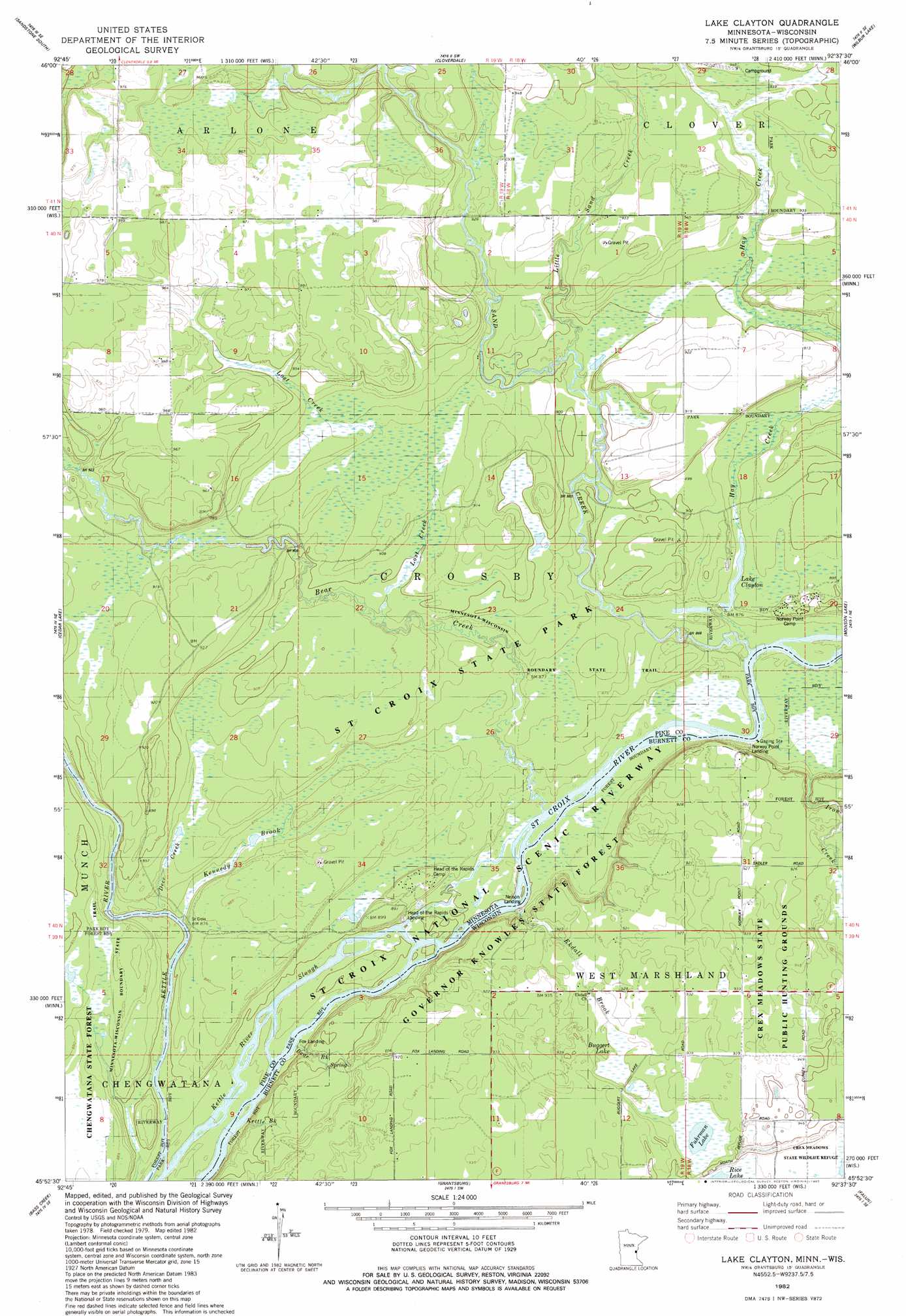
USGS Topo Quad 45092h6 - 1:24,000 scale
| Topo Map Name: | Lake Clayton |
| USGS Topo Quad ID: | 45092h6 |
| Print Size: | ca. 21 1/4" wide x 27" high |
| Southeast Coordinates: | 45.875° N latitude / 92.625° W longitude |
| Map Center Coordinates: | 45.9375° N latitude / 92.6875° W longitude |
| U.S. States: | MN, WI |
| Filename: | o45092h6.jpg |
| Download Map JPG Image: | Lake Clayton topo map 1:24,000 scale |
| Map Type: | Topographic |
| Topo Series: | 7.5´ |
| Map Scale: | 1:24,000 |
| Source of Map Images: | United States Geological Survey (USGS) |
| Alternate Map Versions: |
Lake Clayton MN 1982, updated 1983 Download PDF Buy paper map Lake Clayton MN 2010 Download PDF Buy paper map Lake Clayton MN 2013 Download PDF Buy paper map Lake Clayton MN 2016 Download PDF Buy paper map |
1:24,000 Topo Quads surrounding Lake Clayton
Finlayson |
Sandstone North |
Askov Lookout Tower |
Duxbury |
Ox Creek |
Hinckley |
Sandstone South |
Cloverdale |
Wilbur Lake |
Danbury West |
Beroun |
Cedar Lake |
Lake Clayton |
Saint Johns Landing |
Yellow Lake |
Pine City |
Bass Creek |
Grantsburg |
Falun |
Siren West |
Rush City |
Randall |
Trade River |
Trade Lake |
Frederic |
> Back to 45092e1 at 1:100,000 scale
> Back to 45092a1 at 1:250,000 scale
> Back to U.S. Topo Maps home
Lake Clayton topo map: Gazetteer
Lake Clayton: Guts
Kettle River Slough elevation 255m 836′Lake Clayton: Lakes
Buggert Lake elevation 284m 931′Fuhrman Lake elevation 286m 938′
Lake Clayton elevation 269m 882′
Lake Clayton: Parks
Crex Sand Prairie State Natural Area elevation 289m 948′Ekdall Wetlands State Natural Area elevation 260m 853′
Norway Point Bottomlands State Natural Area elevation 261m 856′
Lake Clayton: Streams
Bear Brook elevation 255m 836′Bear Creek elevation 260m 853′
Bear Paw Creek elevation 259m 849′
Deer Creek elevation 259m 849′
Ekdall Brook elevation 258m 846′
Hay Creek elevation 261m 856′
Iron Creek elevation 261m 856′
Kennedy Brook elevation 265m 869′
Kettle Brook elevation 254m 833′
Little Sand Creek elevation 270m 885′
Lost Creek elevation 269m 882′
Sand Creek elevation 261m 856′
Lake Clayton digital topo map on disk
Buy this Lake Clayton topo map showing relief, roads, GPS coordinates and other geographical features, as a high-resolution digital map file on DVD: