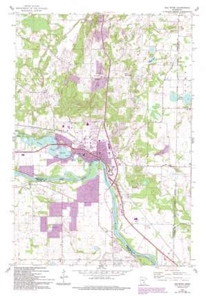
Elk River Topo Map Minnesota
To zoom in, hover over the map of Elk River
USGS Topo Quad 45093c5 - 1:24,000 scale
| Topo Map Name: | Elk River |
| USGS Topo Quad ID: | 45093c5 |
| Print Size: | ca. 21 1/4" wide x 27" high |
| Southeast Coordinates: | 45.25° N latitude / 93.5° W longitude |
| Map Center Coordinates: | 45.3125° N latitude / 93.5625° W longitude |
| U.S. State: | MN |
| Filename: | o45093c5.jpg |
| Download Map JPG Image: | Elk River topo map 1:24,000 scale |
| Map Type: | Topographic |
| Topo Series: | 7.5´ |
| Map Scale: | 1:24,000 |
| Source of Map Images: | United States Geological Survey (USGS) |
| Alternate Map Versions: |
Elk River MN 1961, updated 1963 Download PDF Buy paper map Elk River MN 1961, updated 1980 Download PDF Buy paper map Elk River MN 1961, updated 1993 Download PDF Buy paper map Elk River MN 2010 Download PDF Buy paper map Elk River MN 2013 Download PDF Buy paper map Elk River MN 2016 Download PDF Buy paper map |
1:24,000 Topo Quads surrounding Elk River
> Back to 45093a1 at 1:100,000 scale
> Back to 45092a1 at 1:250,000 scale
> Back to U.S. Topo Maps home
Elk River topo map: Gazetteer
Elk River: Airports
Meadowvale Airport elevation 289m 948′Elk River: Dams
Elk River Dam elevation 266m 872′Elk River: Lakes
Eagle Lake elevation 285m 935′Twin Lakes elevation 284m 931′
Elk River: Parks
Babcock Memorial Park elevation 262m 859′Baldwin Park elevation 280m 918′
Barrington Park elevation 283m 928′
Big Tooth Ridge Park elevation 288m 944′
City Hall Park elevation 269m 882′
Deerfield Hill Park elevation 303m 994′
Elk Hills Green Space elevation 285m 935′
Fresno Park elevation 269m 882′
Geology of the Elk River Region Historical Marker elevation 262m 859′
Grange Shrine - Oliver Hudson Kelley Home Historical Marker elevation 265m 869′
Highland East Park elevation 300m 984′
Hillside City Park elevation 301m 987′
Joplin Park elevation 273m 895′
Kelley Farm Historical Marker elevation 265m 869′
Lions Park elevation 274m 898′
Lucy Earle Kelley Historical Marker elevation 265m 869′
Meadow Park elevation 271m 889′
Meadowvale Heights Park elevation 276m 905′
Mississippi Oaks Park elevation 267m 875′
North Terrace Park elevation 279m 915′
Oak Knoll Athletic Complex elevation 277m 908′
Oak Savannah Park elevation 269m 882′
Oliver H Kelley Homestead Historical Marker elevation 265m 869′
Orono Park elevation 268m 879′
Otswego County Park elevation 263m 862′
Ridgewood East Park elevation 288m 944′
Rivers Edge Commons elevation 273m 895′
Sedge Meadow Park elevation 292m 958′
Top of the World Park elevation 302m 990′
Trott Brook Park elevation 287m 941′
Woodland Trails Park elevation 290m 951′
Youth Athletic Complex elevation 268m 879′
Elk River: Populated Places
Elk River elevation 273m 895′Lake Orono Estates elevation 269m 882′
Otsego elevation 268m 879′
Riverbend Mobile Home Park elevation 275m 902′
Elk River: Post Offices
Elk River Post Office elevation 271m 889′Otsego Post Office (historical) elevation 268m 879′
Elk River: Reservoirs
Orono Lake elevation 266m 872′Elk River: Streams
Elk River elevation 260m 853′Elk River: Swamps
Little Twin Lake elevation 294m 964′Elk River digital topo map on disk
Buy this Elk River topo map showing relief, roads, GPS coordinates and other geographical features, as a high-resolution digital map file on DVD:


