Becker Topo Map Minnesota
To zoom in, hover over the map of Becker
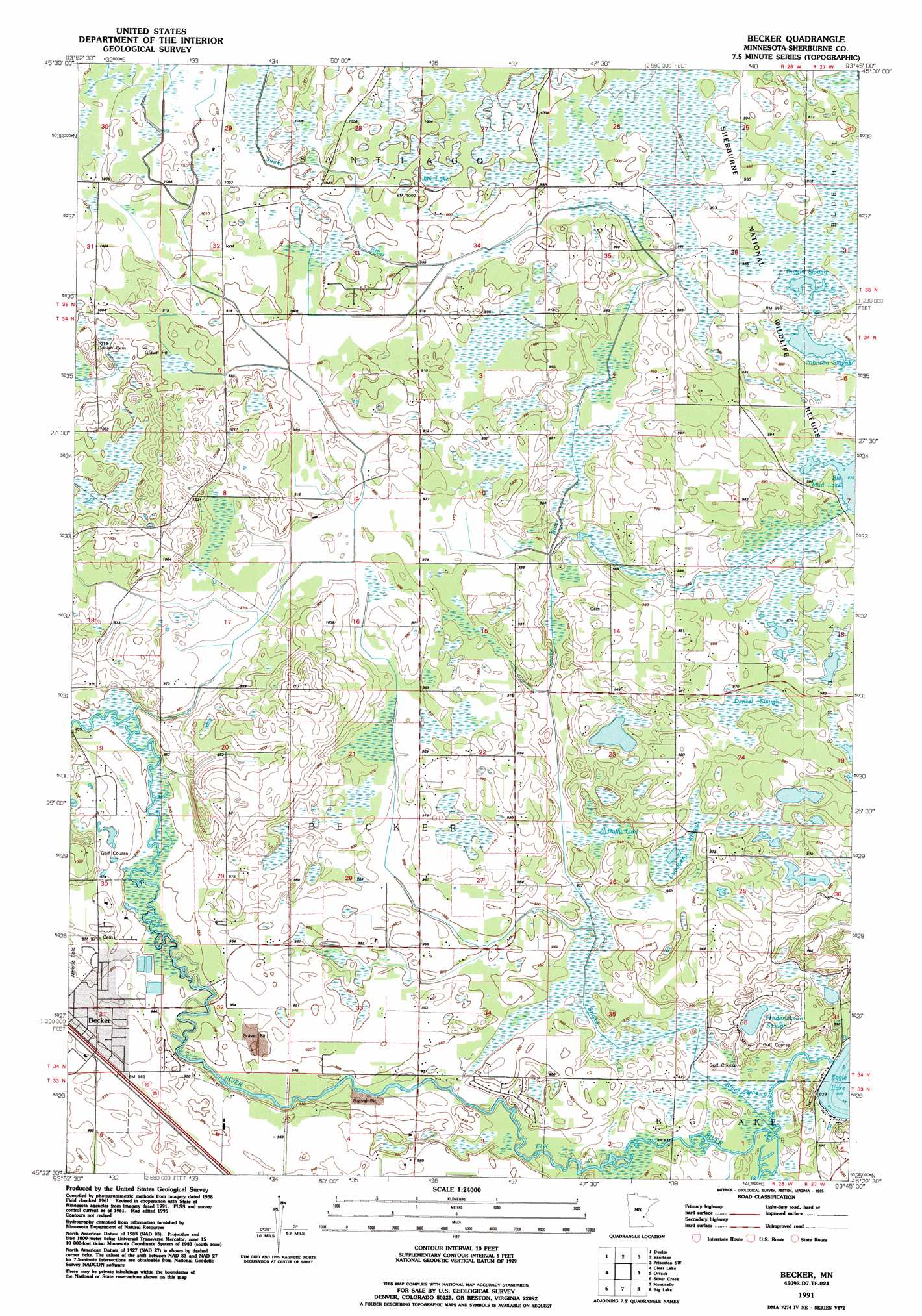
USGS Topo Quad 45093d7 - 1:24,000 scale
| Topo Map Name: | Becker |
| USGS Topo Quad ID: | 45093d7 |
| Print Size: | ca. 21 1/4" wide x 27" high |
| Southeast Coordinates: | 45.375° N latitude / 93.75° W longitude |
| Map Center Coordinates: | 45.4375° N latitude / 93.8125° W longitude |
| U.S. State: | MN |
| Filename: | o45093d7.jpg |
| Download Map JPG Image: | Becker topo map 1:24,000 scale |
| Map Type: | Topographic |
| Topo Series: | 7.5´ |
| Map Scale: | 1:24,000 |
| Source of Map Images: | United States Geological Survey (USGS) |
| Alternate Map Versions: |
Becker MN 1961, updated 1963 Download PDF Buy paper map Becker MN 1991, updated 1995 Download PDF Buy paper map Becker MN 2010 Download PDF Buy paper map Becker MN 2013 Download PDF Buy paper map Becker MN 2016 Download PDF Buy paper map |
1:24,000 Topo Quads surrounding Becker
Mayhew |
Foley |
Ronneby |
Foreston |
Princeton Ne |
Cable |
Duelm |
Santiago |
Princeton Sw |
Princeton |
Clearwater |
Clear Lake |
Becker |
Orrock |
Lake Fremont |
Annandale |
Silver Creek |
Monticello |
Big Lake |
Elk River |
Albion Center |
Buffalo West |
Buffalo East |
Saint Michael |
Rogers |
> Back to 45093a1 at 1:100,000 scale
> Back to 45092a1 at 1:250,000 scale
> Back to U.S. Topo Maps home
Becker topo map: Gazetteer
Becker: Airports
Schroeder Airport elevation 297m 974′Becker: Dams
Eagle Lake Dam elevation 281m 921′Sherburne National Wildlife Refuge Dike 6A elevation 301m 987′
Becker: Guts
Danzel Slough elevation 299m 980′Durgin Slough elevation 298m 977′
Johnson Slough elevation 298m 977′
Lundberg Slough elevation 289m 948′
Becker: Lakes
Duffy Lake elevation 285m 935′Frederickson Slough elevation 285m 935′
Becker: Parks
Lions Park elevation 284m 931′Becker: Populated Places
Pine Ridge Court elevation 296m 971′Becker: Post Offices
Becker Post Office elevation 296m 971′Becker: Reservoirs
Eagle Lake elevation 281m 921′Pool 6 elevation 301m 987′
Becker: Streams
Snake River elevation 283m 928′Becker: Swamps
Jim Lake elevation 305m 1000′Becker digital topo map on disk
Buy this Becker topo map showing relief, roads, GPS coordinates and other geographical features, as a high-resolution digital map file on DVD: