Stark Topo Map Minnesota
To zoom in, hover over the map of Stark
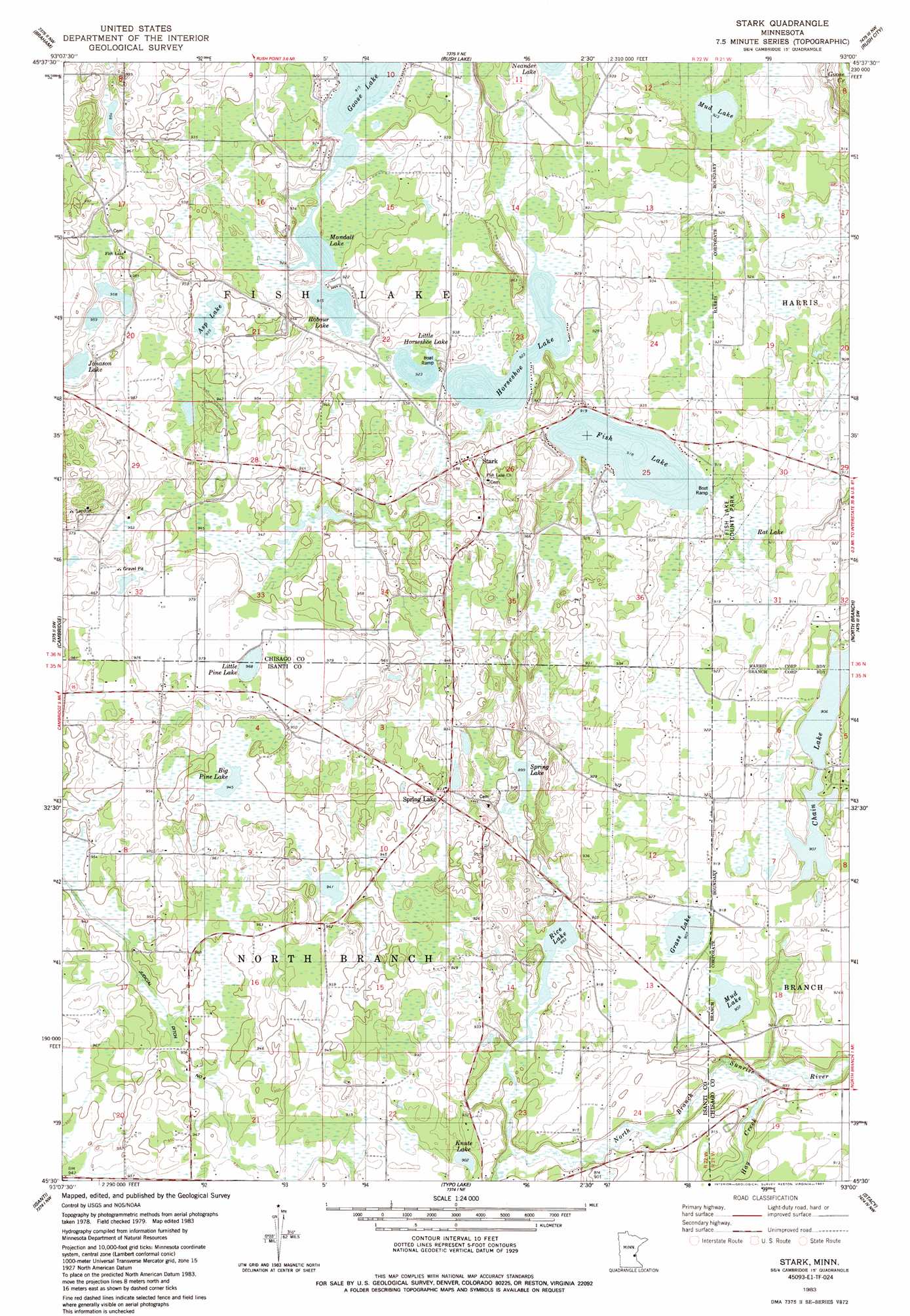
USGS Topo Quad 45093e1 - 1:24,000 scale
| Topo Map Name: | Stark |
| USGS Topo Quad ID: | 45093e1 |
| Print Size: | ca. 21 1/4" wide x 27" high |
| Southeast Coordinates: | 45.5° N latitude / 93° W longitude |
| Map Center Coordinates: | 45.5625° N latitude / 93.0625° W longitude |
| U.S. State: | MN |
| Filename: | o45093e1.jpg |
| Download Map JPG Image: | Stark topo map 1:24,000 scale |
| Map Type: | Topographic |
| Topo Series: | 7.5´ |
| Map Scale: | 1:24,000 |
| Source of Map Images: | United States Geological Survey (USGS) |
| Alternate Map Versions: |
Stark MN 1983, updated 1984 Download PDF Buy paper map Stark MN 1983, updated 1987 Download PDF Buy paper map Stark MN 2010 Download PDF Buy paper map Stark MN 2013 Download PDF Buy paper map Stark MN 2016 Download PDF Buy paper map |
1:24,000 Topo Quads surrounding Stark
Mora South |
Grasston |
Henriette |
Pine City |
Bass Creek |
Springvale |
Braham |
Rush Lake |
Rush City |
Randall |
Bradford |
Cambridge |
Stark |
North Branch |
Sunrise |
Saint Francis |
Isanti |
Typo Lake |
Stacy |
Lindstrom |
Cedar |
Coon Lake Beach |
Linwood |
Forest Lake |
Scandia |
> Back to 45093e1 at 1:100,000 scale
> Back to 45092a1 at 1:250,000 scale
> Back to U.S. Topo Maps home
Stark topo map: Gazetteer
Stark: Canals
Judicial Ditch Number Four elevation 284m 931′Stark: Dams
Trulson Wildlife Pond Dam elevation 283m 928′Stark: Lakes
Asp Lake elevation 284m 931′Big Pine Lake elevation 288m 944′
Chain Lake elevation 275m 902′
Fish Lake elevation 278m 912′
Grass Lake elevation 275m 902′
Horseshoe Lake elevation 281m 921′
Jonason Lake elevation 290m 951′
Knute Lake elevation 275m 902′
Little Horseshoe Lake elevation 281m 921′
Little Pine Lake elevation 293m 961′
Mandall Lake elevation 278m 912′
Mud Lake elevation 281m 921′
Mud Lake elevation 275m 902′
Rat Lake elevation 279m 915′
Rice Lake elevation 272m 892′
Robour Lake elevation 278m 912′
Spring Lake elevation 272m 892′
Stark: Parks
Fish Lake County Park elevation 280m 918′Stark: Populated Places
Spring Lake elevation 289m 948′Stark elevation 295m 967′
Stark: Post Offices
Spring Lake Post Office (historical) elevation 289m 948′Stark Post Office (historical) elevation 294m 964′
Stark digital topo map on disk
Buy this Stark topo map showing relief, roads, GPS coordinates and other geographical features, as a high-resolution digital map file on DVD: