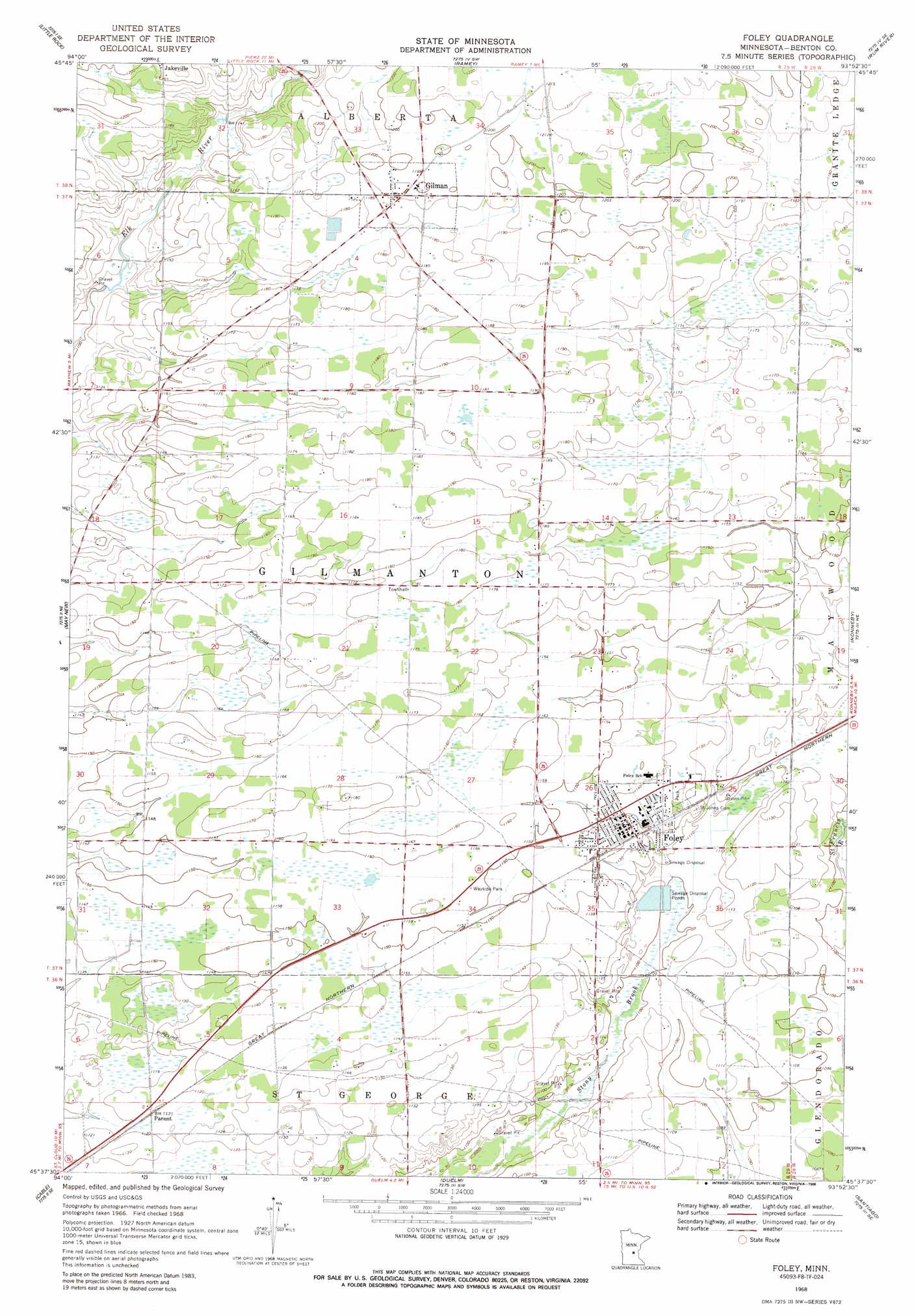
Foley Topo Map Minnesota
To zoom in, hover over the map of Foley
USGS Topo Quad 45093f8 - 1:24,000 scale
| Topo Map Name: | Foley |
| USGS Topo Quad ID: | 45093f8 |
| Print Size: | ca. 21 1/4" wide x 27" high |
| Southeast Coordinates: | 45.625° N latitude / 93.875° W longitude |
| Map Center Coordinates: | 45.6875° N latitude / 93.9375° W longitude |
| U.S. State: | MN |
| Filename: | o45093f8.jpg |
| Download Map JPG Image: | Foley topo map 1:24,000 scale |
| Map Type: | Topographic |
| Topo Series: | 7.5´ |
| Map Scale: | 1:24,000 |
| Source of Map Images: | United States Geological Survey (USGS) |
| Alternate Map Versions: |
Foley MN 1968, updated 1970 Download PDF Buy paper map Foley MN 1968, updated 1988 Download PDF Buy paper map Foley MN 2010 Download PDF Buy paper map Foley MN 2013 Download PDF Buy paper map Foley MN 2016 Download PDF Buy paper map |
1:24,000 Topo Quads surrounding Foley
Pierz Lake |
Pierz |
Ramey Nw |
Ramey Ne |
Page |
Rice |
Little Rock |
Ramey |
Rum River |
Milaca |
Little Rock Lake |
Mayhew |
Foley |
Ronneby |
Foreston |
Saint Cloud |
Cable |
Duelm |
Santiago |
Princeton Sw |
Saint Augusta |
Clearwater |
Clear Lake |
Becker |
Orrock |
> Back to 45093e1 at 1:100,000 scale
> Back to 45092a1 at 1:250,000 scale
> Back to U.S. Topo Maps home
Foley topo map: Gazetteer
Foley: Parks
Benton County Takes Shape Historical Marker elevation 345m 1131′Foley: Populated Places
Foley elevation 347m 1138′Foley Mobile Home Park elevation 346m 1135′
Foley Mobile Home Park South elevation 343m 1125′
Gilman elevation 363m 1190′
Glen Oaks Mobile Home Park elevation 349m 1145′
Parent elevation 342m 1122′
Foley: Post Offices
Foley Post Office elevation 347m 1138′Gilman Post Office (historical) elevation 363m 1190′
Parent Post Office (historical) elevation 342m 1122′
Foley digital topo map on disk
Buy this Foley topo map showing relief, roads, GPS coordinates and other geographical features, as a high-resolution digital map file on DVD: