Brook Park Topo Map Minnesota
To zoom in, hover over the map of Brook Park
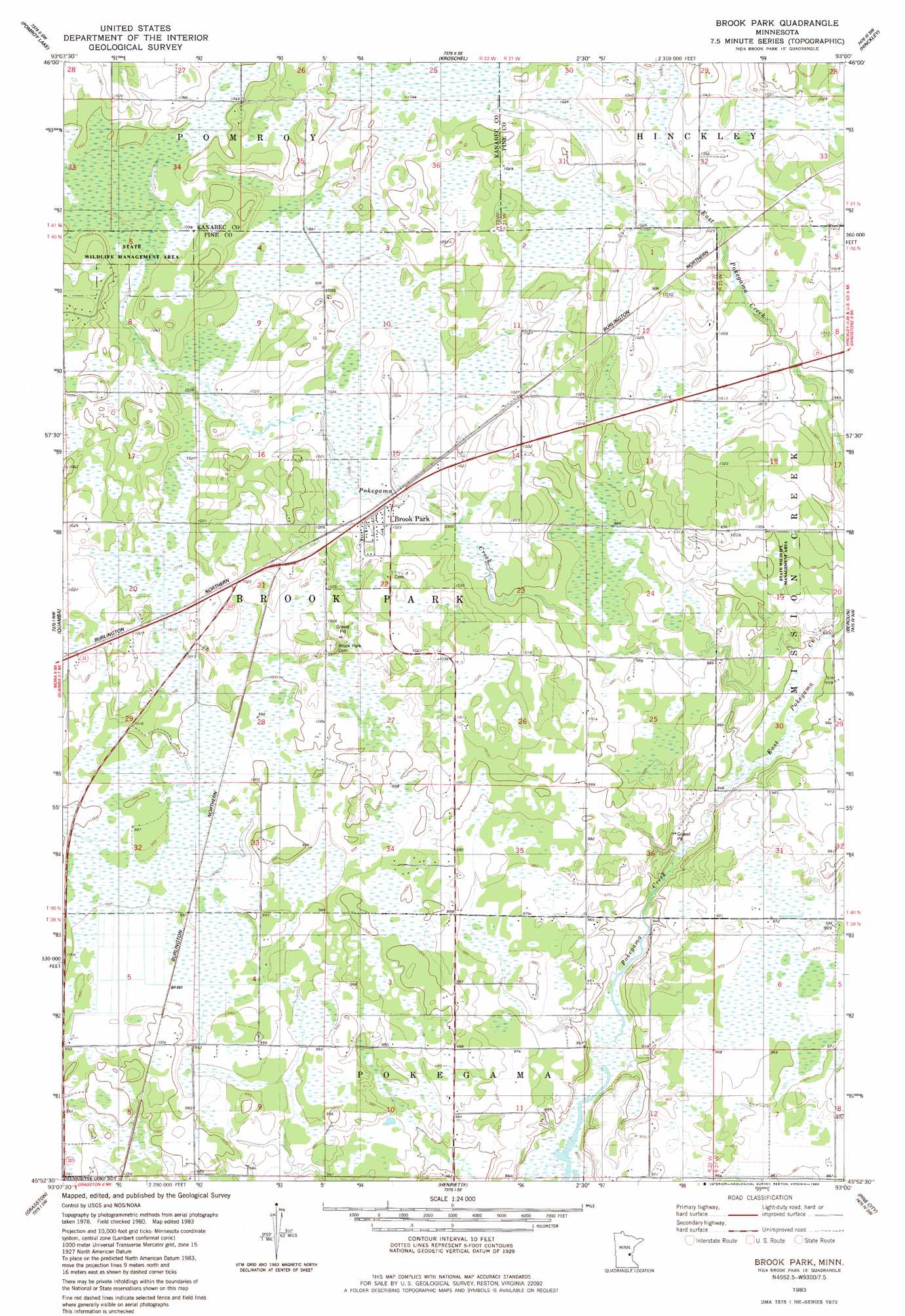
USGS Topo Quad 45093h1 - 1:24,000 scale
| Topo Map Name: | Brook Park |
| USGS Topo Quad ID: | 45093h1 |
| Print Size: | ca. 21 1/4" wide x 27" high |
| Southeast Coordinates: | 45.875° N latitude / 93° W longitude |
| Map Center Coordinates: | 45.9375° N latitude / 93.0625° W longitude |
| U.S. State: | MN |
| Filename: | o45093h1.jpg |
| Download Map JPG Image: | Brook Park topo map 1:24,000 scale |
| Map Type: | Topographic |
| Topo Series: | 7.5´ |
| Map Scale: | 1:24,000 |
| Source of Map Images: | United States Geological Survey (USGS) |
| Alternate Map Versions: |
Brook Park MN 1983, updated 1984 Download PDF Buy paper map Brook Park MN 2010 Download PDF Buy paper map Brook Park MN 2013 Download PDF Buy paper map Brook Park MN 2016 Download PDF Buy paper map |
1:24,000 Topo Quads surrounding Brook Park
Mcgrath |
Kroschel Nw |
Giese |
Finlayson |
Sandstone North |
Warman |
Pomroy Lake |
Kroschel |
Hinckley |
Sandstone South |
Mora North |
Quamba |
Brook Park |
Beroun |
Cedar Lake |
Mora South |
Grasston |
Henriette |
Pine City |
Bass Creek |
Springvale |
Braham |
Rush Lake |
Rush City |
Randall |
> Back to 45093e1 at 1:100,000 scale
> Back to 45092a1 at 1:250,000 scale
> Back to U.S. Topo Maps home
Brook Park topo map: Gazetteer
Brook Park: Parks
Brook Park Fire State Monument elevation 316m 1036′Brook Park: Populated Places
Brook Park elevation 313m 1026′Brook Park: Streams
East Pokegama Creek elevation 305m 1000′Brook Park digital topo map on disk
Buy this Brook Park topo map showing relief, roads, GPS coordinates and other geographical features, as a high-resolution digital map file on DVD: