Mora North Topo Map Minnesota
To zoom in, hover over the map of Mora North
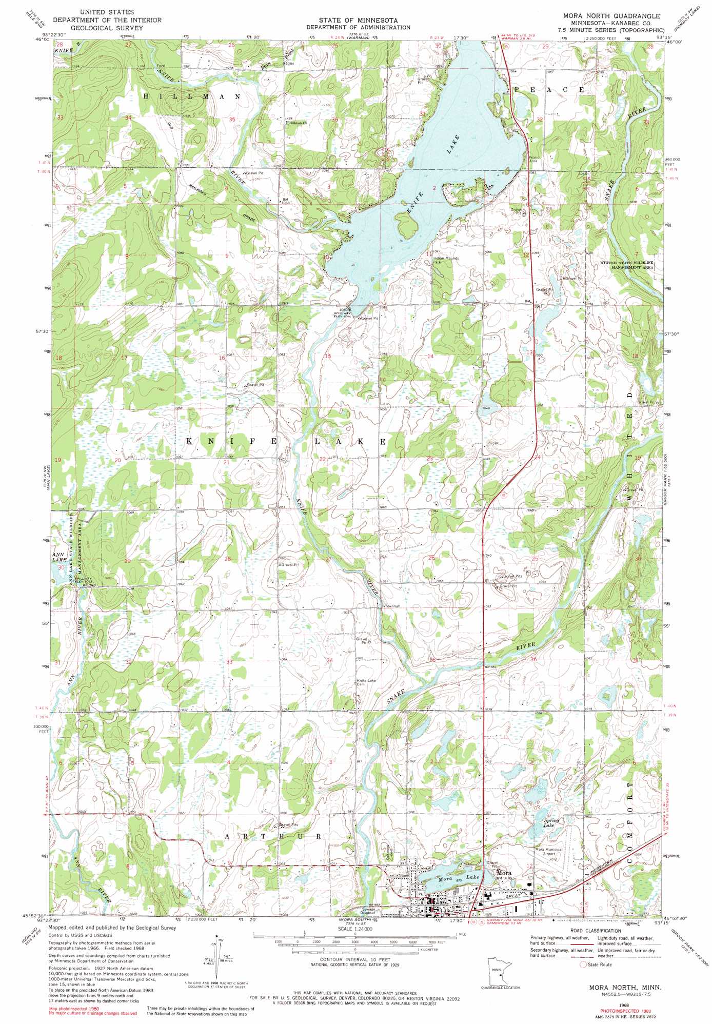
USGS Topo Quad 45093h3 - 1:24,000 scale
| Topo Map Name: | Mora North |
| USGS Topo Quad ID: | 45093h3 |
| Print Size: | ca. 21 1/4" wide x 27" high |
| Southeast Coordinates: | 45.875° N latitude / 93.25° W longitude |
| Map Center Coordinates: | 45.9375° N latitude / 93.3125° W longitude |
| U.S. State: | MN |
| Filename: | o45093h3.jpg |
| Download Map JPG Image: | Mora North topo map 1:24,000 scale |
| Map Type: | Topographic |
| Topo Series: | 7.5´ |
| Map Scale: | 1:24,000 |
| Source of Map Images: | United States Geological Survey (USGS) |
| Alternate Map Versions: |
Mora North MN 1968, updated 1970 Download PDF Buy paper map Mora North MN 1968, updated 1982 Download PDF Buy paper map Mora North MN 2010 Download PDF Buy paper map Mora North MN 2013 Download PDF Buy paper map Mora North MN 2016 Download PDF Buy paper map |
1:24,000 Topo Quads surrounding Mora North
Wahkon North |
Isle |
Mcgrath |
Kroschel Nw |
Giese |
Wahkon South |
Isle Sw |
Warman |
Pomroy Lake |
Kroschel |
Milaca Ne |
Ann Lake |
Mora North |
Quamba |
Brook Park |
Bock |
Ogilvie |
Mora South |
Grasston |
Henriette |
Princeton Ne |
Dalbo |
Springvale |
Braham |
Rush Lake |
> Back to 45093e1 at 1:100,000 scale
> Back to 45092a1 at 1:250,000 scale
> Back to U.S. Topo Maps home
Mora North topo map: Gazetteer
Mora North: Airports
Mora Municipal Airport elevation 306m 1003′Mora North: Dams
Carda Impoundment Dam elevation 327m 1072′Knife Lake Dam elevation 318m 1043′
William Peal Junior Memorial Dam elevation 318m 1043′
Mora North: Lakes
Mora Lake elevation 298m 977′Spring Lake elevation 301m 987′
Mora North: Parks
Indian Mounds Park elevation 322m 1056′Whited State Wildlife Management Area elevation 315m 1033′
Mora North: Populated Places
Mora elevation 308m 1010′Mora North: Reservoirs
Ann Lake elevation 318m 1043′Carda Impoundment Reservoir elevation 327m 1072′
Knife Lake elevation 318m 1043′
Mora North: Streams
Bean Brook elevation 325m 1066′Knife River elevation 295m 967′
Mora North digital topo map on disk
Buy this Mora North topo map showing relief, roads, GPS coordinates and other geographical features, as a high-resolution digital map file on DVD: