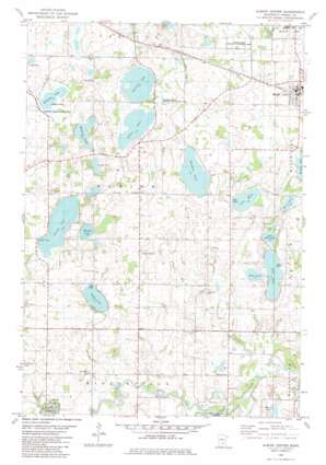
Albion Center Topo Map Minnesota
To zoom in, hover over the map of Albion Center
USGS Topo Quad 45094b1 - 1:24,000 scale
| Topo Map Name: | Albion Center |
| USGS Topo Quad ID: | 45094b1 |
| Print Size: | ca. 21 1/4" wide x 27" high |
| Southeast Coordinates: | 45.125° N latitude / 94° W longitude |
| Map Center Coordinates: | 45.1875° N latitude / 94.0625° W longitude |
| U.S. State: | MN |
| Filename: | o45094b1.jpg |
| Download Map JPG Image: | Albion Center topo map 1:24,000 scale |
| Map Type: | Topographic |
| Topo Series: | 7.5´ |
| Map Scale: | 1:24,000 |
| Source of Map Images: | United States Geological Survey (USGS) |
| Alternate Map Versions: |
Albion Center MN 1982, updated 1982 Download PDF Buy paper map Albion Center MN 2010 Download PDF Buy paper map Albion Center MN 2013 Download PDF Buy paper map Albion Center MN 2016 Download PDF Buy paper map |
1:24,000 Topo Quads surrounding Albion Center
> Back to 45094a1 at 1:100,000 scale
> Back to 45094a1 at 1:250,000 scale
> Back to U.S. Topo Maps home
Albion Center topo map: Gazetteer
Albion Center: Airports
Centerville Lake Seaplane Base elevation 317m 1040′Albion Center: Dams
Swart Watts Lake Dam elevation 311m 1020′Albion Center: Lakes
Albion Lake elevation 310m 1017′Camp Lake elevation 317m 1040′
Edwards Lake elevation 320m 1049′
Granite Lake elevation 312m 1023′
Henshaw Lake elevation 316m 1036′
Lake White elevation 312m 1023′
Little Rock Lake elevation 298m 977′
Mains Lake elevation 285m 935′
Mary Lake elevation 307m 1007′
Maxim Lake elevation 315m 1033′
Mud Lake elevation 296m 971′
Rock Lake elevation 297m 974′
Slough Lake elevation 319m 1046′
Swartout Lake elevation 309m 1013′
Albion Center: Parks
Albion State Wildlife Management Area elevation 315m 1033′Corinna State Wildlife Management Area elevation 311m 1020′
Swartout State Wildlife Management Area elevation 309m 1013′
Albion Center: Populated Places
Albion Center elevation 330m 1082′Albright elevation 312m 1023′
Maple Lake elevation 322m 1056′
Maple Lake Mobile Home Park elevation 317m 1040′
Albion Center: Post Offices
Albion Post Office (historical) elevation 330m 1082′Granite Lake Post Office (historical) elevation 320m 1049′
Maple Lake Post Office elevation 323m 1059′
Albion Center: Reservoirs
Swart Watts Lake elevation 311m 1020′Albion Center: Swamps
Willima Lake elevation 315m 1033′Wolfe Lake elevation 291m 954′
Albion Center digital topo map on disk
Buy this Albion Center topo map showing relief, roads, GPS coordinates and other geographical features, as a high-resolution digital map file on DVD:


