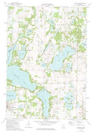
Annandale Topo Map Minnesota
To zoom in, hover over the map of Annandale
USGS Topo Quad 45094c1 - 1:24,000 scale
| Topo Map Name: | Annandale |
| USGS Topo Quad ID: | 45094c1 |
| Print Size: | ca. 21 1/4" wide x 27" high |
| Southeast Coordinates: | 45.25° N latitude / 94° W longitude |
| Map Center Coordinates: | 45.3125° N latitude / 94.0625° W longitude |
| U.S. State: | MN |
| Filename: | o45094c1.jpg |
| Download Map JPG Image: | Annandale topo map 1:24,000 scale |
| Map Type: | Topographic |
| Topo Series: | 7.5´ |
| Map Scale: | 1:24,000 |
| Source of Map Images: | United States Geological Survey (USGS) |
| Alternate Map Versions: |
Annandale MN 1974, updated 1976 Download PDF Buy paper map Annandale MN 2010 Download PDF Buy paper map Annandale MN 2013 Download PDF Buy paper map Annandale MN 2016 Download PDF Buy paper map |
1:24,000 Topo Quads surrounding Annandale
> Back to 45094a1 at 1:100,000 scale
> Back to 45094a1 at 1:250,000 scale
> Back to U.S. Topo Maps home
Annandale topo map: Gazetteer
Annandale: Airports
Mavencamp Airport elevation 317m 1040′Annandale: Canals
County Ditch Number Thirtyone elevation 307m 1007′County Ditch Number Twenty elevation 311m 1020′
Annandale: Dams
Cedar Lake Dam elevation 304m 997′Annandale: Lakes
Bass Lake elevation 303m 994′Cedar Lake elevation 305m 1000′
Clearwater Lake elevation 302m 990′
Cornell Lake elevation 303m 994′
Grass Lake elevation 302m 990′
Indian Lake elevation 308m 1010′
Mink Lake elevation 312m 1023′
Nixon Lake elevation 304m 997′
Quinn Lake elevation 300m 984′
Sandy Lake elevation 302m 990′
Shelden Lake elevation 292m 958′
Somers Lake elevation 312m 1023′
Sugar Lake elevation 301m 987′
Weigand Lake elevation 302m 990′
Annandale: Parks
Hoglund State Wildlife Management Area elevation 305m 1000′Robert E Ney Memorial Park elevation 316m 1036′
Schroeder Park elevation 306m 1003′
Suconnix State Wildlife Management Area elevation 303m 994′
Annandale: Populated Places
Annandale elevation 326m 1069′Eastview Mobile Home Park elevation 325m 1066′
Elm Grove Mobile Home Park elevation 326m 1069′
Annandale: Post Offices
Annandale Post Office elevation 325m 1066′Annandale: Reservoirs
Cedar Lake elevation 304m 997′Annandale digital topo map on disk
Buy this Annandale topo map showing relief, roads, GPS coordinates and other geographical features, as a high-resolution digital map file on DVD:


