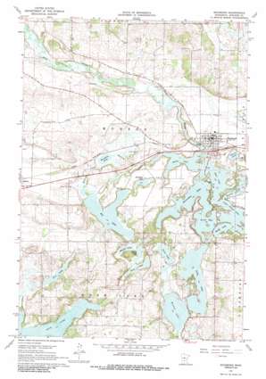
Richmond Topo Map Minnesota
To zoom in, hover over the map of Richmond
USGS Topo Quad 45094d5 - 1:24,000 scale
| Topo Map Name: | Richmond |
| USGS Topo Quad ID: | 45094d5 |
| Print Size: | ca. 21 1/4" wide x 27" high |
| Southeast Coordinates: | 45.375° N latitude / 94.5° W longitude |
| Map Center Coordinates: | 45.4375° N latitude / 94.5625° W longitude |
| U.S. State: | MN |
| Filename: | o45094d5.jpg |
| Download Map JPG Image: | Richmond topo map 1:24,000 scale |
| Map Type: | Topographic |
| Topo Series: | 7.5´ |
| Map Scale: | 1:24,000 |
| Source of Map Images: | United States Geological Survey (USGS) |
| Alternate Map Versions: |
Richmond MN 1967, updated 1968 Download PDF Buy paper map Richmond MN 2010 Download PDF Buy paper map Richmond MN 2013 Download PDF Buy paper map Richmond MN 2016 Download PDF Buy paper map |
1:24,000 Topo Quads surrounding Richmond
> Back to 45094a1 at 1:100,000 scale
> Back to 45094a1 at 1:250,000 scale
> Back to U.S. Topo Maps home
Richmond topo map: Gazetteer
Richmond: Bays
Krons Bay elevation 330m 1082′Richmond: Lakes
Becker Lake elevation 330m 1082′Big Lake elevation 333m 1092′
Browns Lake elevation 330m 1082′
Cedar Island Lake elevation 330m 1082′
Deep Lake elevation 336m 1102′
East Lake elevation 330m 1082′
Flint Lake elevation 330m 1082′
Ganzer Lake elevation 336m 1102′
Horseshoe Lake elevation 330m 1082′
Koetter Lake elevation 330m 1082′
Long Lake elevation 330m 1082′
Meyers Lake elevation 336m 1102′
Mud Lake elevation 330m 1082′
Pirz Lake elevation 342m 1122′
Roschien Lake elevation 330m 1082′
Schroeder Lake elevation 333m 1092′
Thein Lake elevation 330m 1082′
Richmond: Parks
Richmond Community Park elevation 340m 1115′Richmond: Populated Places
Richmond elevation 342m 1122′Richmond: Post Offices
Richmond Post Office elevation 342m 1122′Richmond: Streams
Kolling Creek elevation 330m 1082′Richmond digital topo map on disk
Buy this Richmond topo map showing relief, roads, GPS coordinates and other geographical features, as a high-resolution digital map file on DVD:


