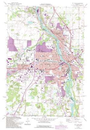
Saint Cloud Topo Map Minnesota
To zoom in, hover over the map of Saint Cloud
USGS Topo Quad 45094e2 - 1:24,000 scale
| Topo Map Name: | Saint Cloud |
| USGS Topo Quad ID: | 45094e2 |
| Print Size: | ca. 21 1/4" wide x 27" high |
| Southeast Coordinates: | 45.5° N latitude / 94.125° W longitude |
| Map Center Coordinates: | 45.5625° N latitude / 94.1875° W longitude |
| U.S. State: | MN |
| Filename: | o45094e2.jpg |
| Download Map JPG Image: | Saint Cloud topo map 1:24,000 scale |
| Map Type: | Topographic |
| Topo Series: | 7.5´ |
| Map Scale: | 1:24,000 |
| Source of Map Images: | United States Geological Survey (USGS) |
| Alternate Map Versions: |
St. Cloud MN 1974, updated 1976 Download PDF Buy paper map St Cloud MN 1974, updated 1993 Download PDF Buy paper map Saint Cloud MN 2010 Download PDF Buy paper map Saint Cloud MN 2013 Download PDF Buy paper map Saint Cloud MN 2016 Download PDF Buy paper map |
1:24,000 Topo Quads surrounding Saint Cloud
> Back to 45094e1 at 1:100,000 scale
> Back to 45094a1 at 1:250,000 scale
> Back to U.S. Topo Maps home
Saint Cloud topo map: Gazetteer
Saint Cloud: Airports
Guggenberger Airport elevation 319m 1046′Thens Airstrip elevation 318m 1043′
Saint Cloud: Bridges
Bridge of Hope elevation 305m 1000′Desota Bridge elevation 297m 974′
Saint Cloud: Canals
County Ditch Number Fourteen elevation 331m 1085′County Ditch Number Sixteen elevation 320m 1049′
Saint Cloud: Dams
Mississippi River Dam elevation 305m 1000′Saint Cloud Dam elevation 298m 977′
Sauk River Dam elevation 311m 1020′
Saint Cloud: Islands
Beaver Islands elevation 293m 961′Saint Cloud: Lakes
Davenport Lake elevation 317m 1040′Lake George elevation 310m 1017′
Saint Cloud: Mines
Saint Cloud Quarry elevation 327m 1072′Saint Cloud: Parks
Barden Park elevation 316m 1036′Bartz Park elevation 326m 1069′
BBC Park elevation 320m 1049′
Beaver Islands Park elevation 297m 974′
Benedict Acres Park elevation 337m 1105′
Bob Cross Nature Preserve elevation 328m 1076′
Bob Cross Park elevation 330m 1082′
Brookside Park elevation 313m 1026′
Calvary Hill Park elevation 324m 1062′
Carlin Playground elevation 323m 1059′
Case's River Park elevation 314m 1030′
Centennial Park elevation 316m 1036′
Central Park elevation 318m 1043′
Chantry Park elevation 317m 1040′
Clarks Field elevation 314m 1030′
Clemens Gardens elevation 315m 1033′
Community Park elevation 323m 1059′
Eastman Park elevation 312m 1023′
Felicity Park elevation 310m 1017′
Fountain Park elevation 318m 1043′
Heritage Park elevation 324m 1062′
Hester Park elevation 307m 1007′
Island View Park elevation 308m 1010′
Jaycee Park elevation 317m 1040′
Jiagello Park elevation 323m 1059′
Kiawanis Park elevation 324m 1062′
Lions Park elevation 305m 1000′
Lion's Park elevation 326m 1069′
Madison Park elevation 316m 1036′
McKinley Park elevation 319m 1046′
Moose Park elevation 320m 1049′
Munsinger Gardens elevation 306m 1003′
Northway Park elevation 315m 1033′
Oak Wood Park elevation 323m 1059′
Oaklane Park elevation 324m 1062′
Oakridge Park elevation 321m 1053′
Pantown Park elevation 317m 1040′
Pine View Park elevation 319m 1046′
Pleasant View Park elevation 326m 1069′
Plum Creek Park elevation 308m 1010′
Prairie Lane Park elevation 328m 1076′
Prairie Rose Park elevation 320m 1049′
Quarry Park and Nature Preserve elevation 339m 1112′
Raymond Park elevation 312m 1023′
Renaissance Fountain with Cranes elevation 315m 1033′
Ridgewood Park elevation 324m 1062′
River Park elevation 317m 1040′
Rivers Edge Park elevation 320m 1049′
Riverside Park elevation 305m 1000′
Riverside Park elevation 315m 1033′
Rose Richter Park elevation 322m 1056′
Rotary Park elevation 325m 1066′
Saint Cloud Municipal Park elevation 323m 1059′
Saint Cloud Park elevation 311m 1020′
Sauk Rapids Municipal Park elevation 308m 1010′
Scenic View Park elevation 327m 1072′
Schmidt Park elevation 316m 1036′
Seberger Park elevation 317m 1040′
Selke Field elevation 313m 1026′
Serenity One and Two Park elevation 313m 1026′
South Side Park elevation 305m 1000′
Southview Ninety Park elevation 323m 1059′
Sterling Heights Park elevation 333m 1092′
Sunset Park elevation 323m 1059′
Talahi Park elevation 313m 1026′
Triangle Park elevation 314m 1030′
Val Smith Park elevation 323m 1059′
Watab Creek Park elevation 309m 1013′
West River Meadows Park elevation 320m 1049′
Whitney Park elevation 314m 1030′
Willow Creek Park elevation 326m 1069′
Wilson Park elevation 301m 987′
Saint Cloud: Populated Places
Blue Skies Mobile Park elevation 311m 1020′Cloverleaf Mobile Home Community elevation 313m 1026′
Evergreen Village elevation 326m 1069′
Evergreen Village elevation 315m 1033′
Fischers Garden Mobile Park elevation 309m 1013′
Hi-Vue Park elevation 318m 1043′
Riverview Park elevation 319m 1046′
Saint Cloud elevation 314m 1030′
Sartell elevation 316m 1036′
Sauk Rapids elevation 313m 1026′
Shady Oak Mobile Park elevation 317m 1040′
Sherwood Manor elevation 317m 1040′
Waite Park elevation 326m 1069′
Willie's Mobile Home Park elevation 321m 1053′
Saint Cloud: Post Offices
Saint Cloud Post Office elevation 315m 1033′Sartell Post Office elevation 315m 1033′
Waite Park Post Office (historical) elevation 326m 1069′
Saint Cloud: Reservoirs
Little Rock Lake elevation 305m 1000′Millpond elevation 311m 1020′
Mississippi River Reservoir elevation 298m 977′
Saint Cloud: Streams
Sauk River elevation 300m 984′Watab River elevation 305m 1000′
Saint Cloud digital topo map on disk
Buy this Saint Cloud topo map showing relief, roads, GPS coordinates and other geographical features, as a high-resolution digital map file on DVD:


