Rice Topo Map Minnesota
To zoom in, hover over the map of Rice
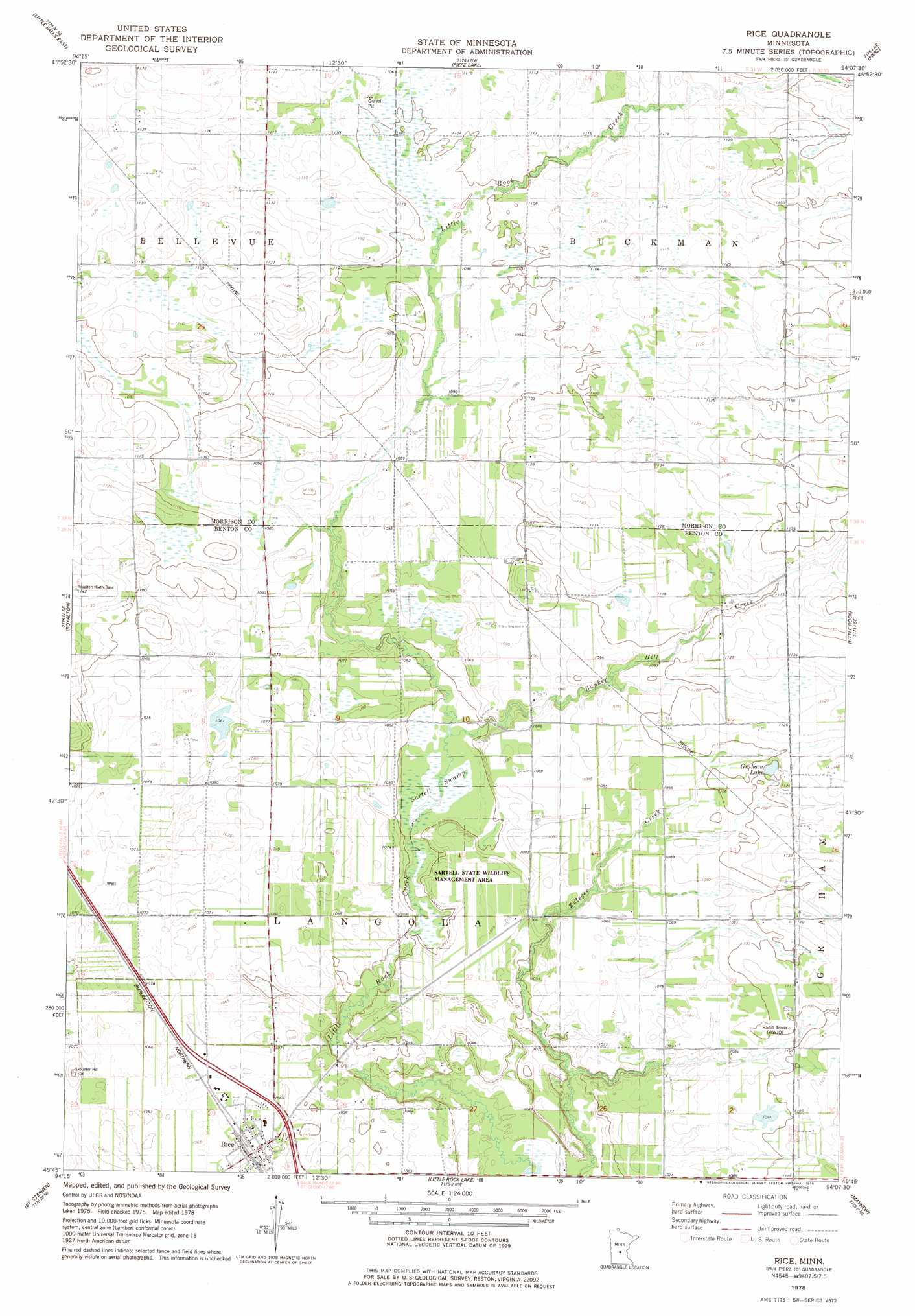
USGS Topo Quad 45094g2 - 1:24,000 scale
| Topo Map Name: | Rice |
| USGS Topo Quad ID: | 45094g2 |
| Print Size: | ca. 21 1/4" wide x 27" high |
| Southeast Coordinates: | 45.75° N latitude / 94.125° W longitude |
| Map Center Coordinates: | 45.8125° N latitude / 94.1875° W longitude |
| U.S. State: | MN |
| Filename: | o45094g2.jpg |
| Download Map JPG Image: | Rice topo map 1:24,000 scale |
| Map Type: | Topographic |
| Topo Series: | 7.5´ |
| Map Scale: | 1:24,000 |
| Source of Map Images: | United States Geological Survey (USGS) |
| Alternate Map Versions: |
Rice MN 1978, updated 1978 Download PDF Buy paper map Rice MN 2010 Download PDF Buy paper map Rice MN 2013 Download PDF Buy paper map Rice MN 2016 Download PDF Buy paper map |
1:24,000 Topo Quads surrounding Rice
Randall |
Belle Prairie |
Freedhem |
Lastrup |
Hillman |
Little Falls West |
Little Falls East |
Pierz Lake |
Pierz |
Ramey Nw |
Bowlus |
Royalton |
Rice |
Little Rock |
Ramey |
Holdingford |
Saint Stephen |
Little Rock Lake |
Mayhew |
Foley |
Avon |
Saint Joseph |
Saint Cloud |
Cable |
Duelm |
> Back to 45094e1 at 1:100,000 scale
> Back to 45094a1 at 1:250,000 scale
> Back to U.S. Topo Maps home
Rice topo map: Gazetteer
Rice: Dams
Little Rock Creek Impoundment Structure Dam elevation 329m 1079′Rice: Lakes
Graham Lake elevation 334m 1095′Rice: Parks
Sartell State Wildlife Management Area elevation 328m 1076′Rice: Populated Places
Rice elevation 323m 1059′Rice: Post Offices
Rice Post Office elevation 323m 1059′Rice: Reservoirs
Little Rock Creek elevation 329m 1079′Rice: Streams
Bunker Hill Creek elevation 318m 1043′Rice: Swamps
Sartell Swamp elevation 317m 1040′Rice digital topo map on disk
Buy this Rice topo map showing relief, roads, GPS coordinates and other geographical features, as a high-resolution digital map file on DVD: