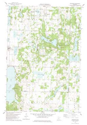
Burtrum Topo Map Minnesota
To zoom in, hover over the map of Burtrum
USGS Topo Quad 45094g6 - 1:24,000 scale
| Topo Map Name: | Burtrum |
| USGS Topo Quad ID: | 45094g6 |
| Print Size: | ca. 21 1/4" wide x 27" high |
| Southeast Coordinates: | 45.75° N latitude / 94.625° W longitude |
| Map Center Coordinates: | 45.8125° N latitude / 94.6875° W longitude |
| U.S. State: | MN |
| Filename: | o45094g6.jpg |
| Download Map JPG Image: | Burtrum topo map 1:24,000 scale |
| Map Type: | Topographic |
| Topo Series: | 7.5´ |
| Map Scale: | 1:24,000 |
| Source of Map Images: | United States Geological Survey (USGS) |
| Alternate Map Versions: |
Burtrum MN 1978, updated 1978 Download PDF Buy paper map Burtrum MN 2010 Download PDF Buy paper map Burtrum MN 2013 Download PDF Buy paper map Burtrum MN 2016 Download PDF Buy paper map |
1:24,000 Topo Quads surrounding Burtrum
> Back to 45094e1 at 1:100,000 scale
> Back to 45094a1 at 1:250,000 scale
> Back to U.S. Topo Maps home
Burtrum topo map: Gazetteer
Burtrum: Dams
August Glockzin Pond Dam elevation 371m 1217′Burtrum: Lakes
Bass Lake elevation 370m 1213′Bony Dog Lake elevation 370m 1213′
Buck Lake elevation 373m 1223′
Buckhead Lake elevation 401m 1315′
Cedar Lake elevation 370m 1213′
Coon Lake elevation 395m 1295′
Goose Lake elevation 382m 1253′
Hill Lake elevation 422m 1384′
Horseshoe Lake elevation 364m 1194′
Jim Lake elevation 395m 1295′
Lady Lake elevation 363m 1190′
Little Mound Lake elevation 388m 1272′
Lovell Lake elevation 367m 1204′
Mary Lake elevation 370m 1213′
Molly Lake elevation 367m 1204′
Mound Lake elevation 391m 1282′
Mountain Lake elevation 364m 1194′
Nellies Lake elevation 370m 1213′
Pine Lake elevation 379m 1243′
Rock Lake elevation 380m 1246′
Schreiers Lake elevation 373m 1223′
Slough Lake elevation 397m 1302′
Stony Lake elevation 373m 1223′
Stump Lake elevation 391m 1282′
Twin Lakes elevation 367m 1204′
Burtrum: Parks
Buckhead Lake State Wildlife Management Area elevation 404m 1325′Cedar Lake Memorial Park elevation 384m 1259′
Ireland State Wildlife Management Area elevation 375m 1230′
Oak Ridge State Wildlife Management Area elevation 399m 1309′
Sponsa State Wildlife Management Area elevation 396m 1299′
Burtrum: Populated Places
Burtrum elevation 391m 1282′Grey Eagle elevation 373m 1223′
North Shore elevation 371m 1217′
Pleasant Beach elevation 377m 1236′
Burtrum: Post Offices
Burtrum Post Office elevation 391m 1282′Grey Eagle Post Office elevation 373m 1223′
Burtrum: Reservoirs
August Glockzin Reservoir elevation 371m 1217′Burtrum: Streams
Fish Creek elevation 361m 1184′Burtrum: Summits
Eagle Mountain elevation 445m 1459′The Mound elevation 431m 1414′
Burtrum digital topo map on disk
Buy this Burtrum topo map showing relief, roads, GPS coordinates and other geographical features, as a high-resolution digital map file on DVD:


