Milan Nw Topo Map Minnesota
To zoom in, hover over the map of Milan Nw
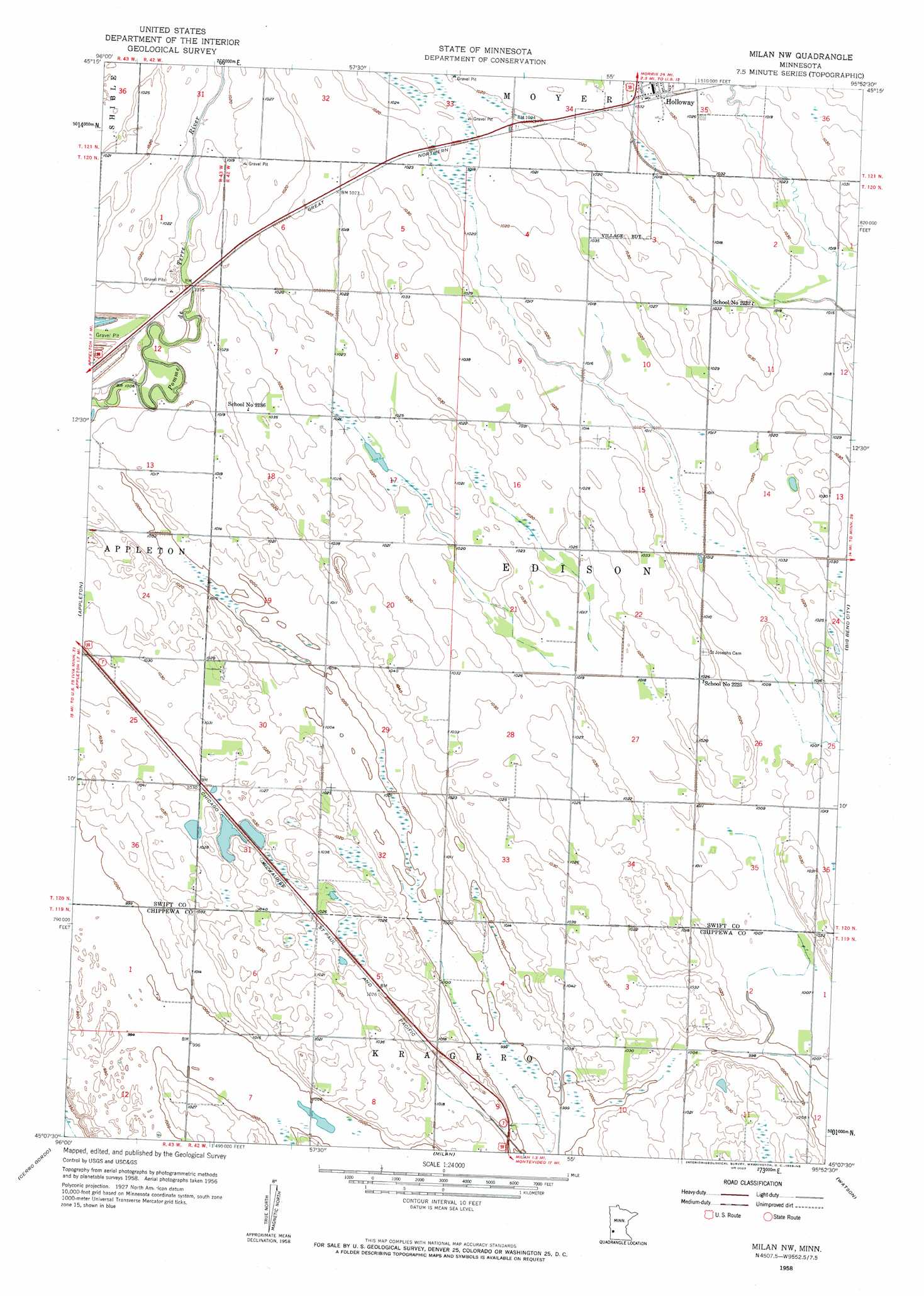
USGS Topo Quad 45095b8 - 1:24,000 scale
| Topo Map Name: | Milan Nw |
| USGS Topo Quad ID: | 45095b8 |
| Print Size: | ca. 21 1/4" wide x 27" high |
| Southeast Coordinates: | 45.125° N latitude / 95.875° W longitude |
| Map Center Coordinates: | 45.1875° N latitude / 95.9375° W longitude |
| U.S. State: | MN |
| Filename: | o45095b8.jpg |
| Download Map JPG Image: | Milan Nw topo map 1:24,000 scale |
| Map Type: | Topographic |
| Topo Series: | 7.5´ |
| Map Scale: | 1:24,000 |
| Source of Map Images: | United States Geological Survey (USGS) |
| Alternate Map Versions: |
Milan NW MN 1958, updated 1959 Download PDF Buy paper map Milan NW MN 2010 Download PDF Buy paper map Milan NW MN 2013 Download PDF Buy paper map Milan NW MN 2016 Download PDF Buy paper map |
1:24,000 Topo Quads surrounding Milan Nw
Artichoke Lake Nw |
Dry Wood Lake |
Hancock Nw |
Hancock |
Clontarf North |
Artichoke Lake |
Lake Oliver |
Hancock Sw |
Danvers |
Clontarf South |
Correll |
Appleton |
Milan Nw |
Big Bend City |
Gracelock Nw |
Madison |
Cerro Gordo |
Milan |
Watson |
Gracelock Sw |
Dawson Nw |
Dawson |
Tenmile Lake |
Clarkfield Ne |
Montevideo |
> Back to 45095a1 at 1:100,000 scale
> Back to 45094a1 at 1:250,000 scale
> Back to U.S. Topo Maps home
Milan Nw topo map: Gazetteer
Milan Nw: Airports
Home-Base Airport elevation 311m 1020′Milan Nw: Populated Places
Holloway elevation 315m 1033′Milan Nw: Post Offices
Holloway Post Office elevation 314m 1030′Holloway Post Office elevation 314m 1030′
Milan Nw digital topo map on disk
Buy this Milan Nw topo map showing relief, roads, GPS coordinates and other geographical features, as a high-resolution digital map file on DVD: