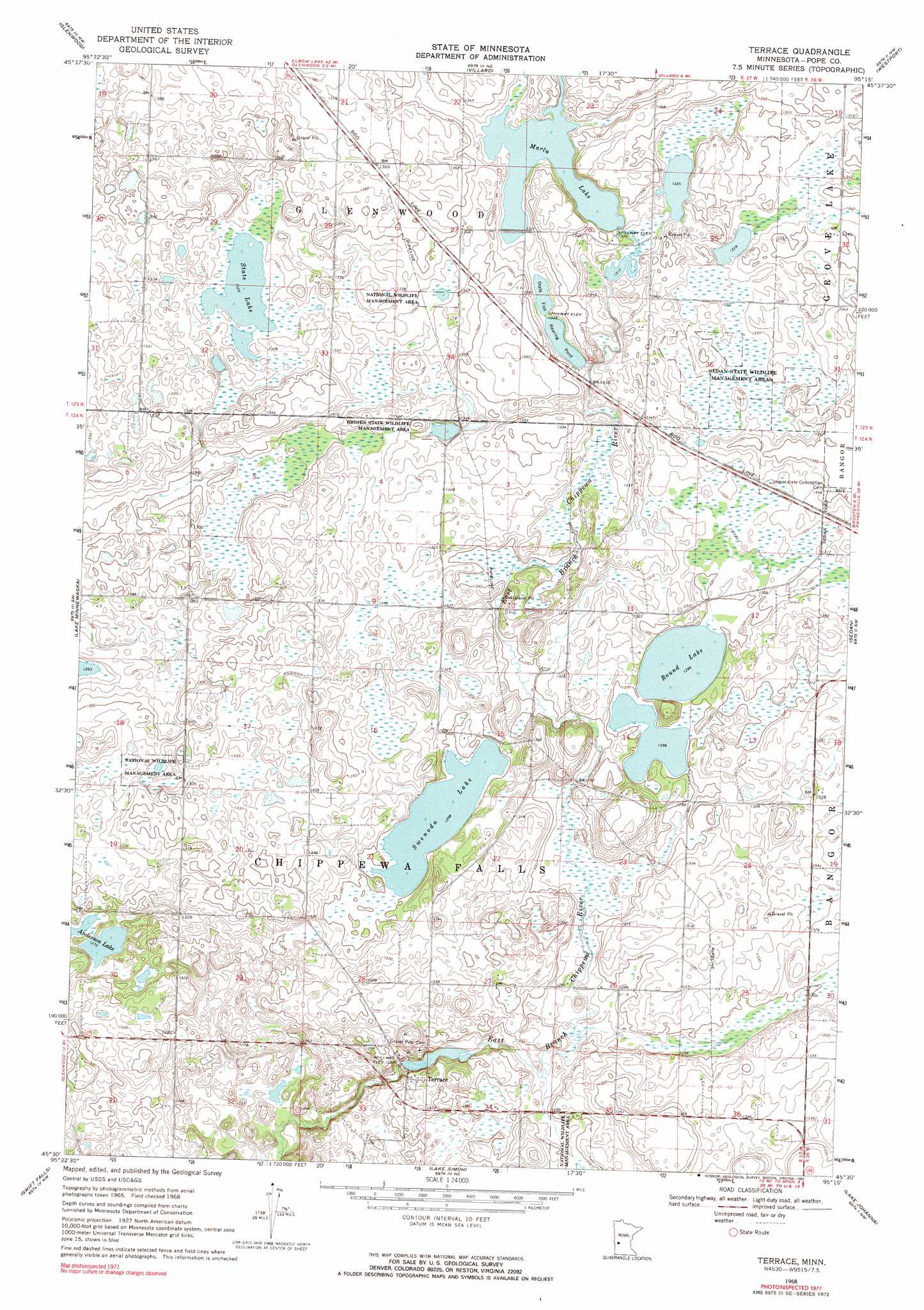
Terrace Topo Map Minnesota
To zoom in, hover over the map of Terrace
USGS Topo Quad 45095e3 - 1:24,000 scale
| Topo Map Name: | Terrace |
| USGS Topo Quad ID: | 45095e3 |
| Print Size: | ca. 21 1/4" wide x 27" high |
| Southeast Coordinates: | 45.5° N latitude / 95.25° W longitude |
| Map Center Coordinates: | 45.5625° N latitude / 95.3125° W longitude |
| U.S. State: | MN |
| Filename: | o45095e3.jpg |
| Download Map JPG Image: | Terrace topo map 1:24,000 scale |
| Map Type: | Topographic |
| Topo Series: | 7.5´ |
| Map Scale: | 1:24,000 |
| Source of Map Images: | United States Geological Survey (USGS) |
| Alternate Map Versions: |
Terrace MN 1968, updated 1970 Download PDF Buy paper map Terrace MN 1968, updated 1991 Download PDF Buy paper map Terrace MN 2010 Download PDF Buy paper map Terrace MN 2013 Download PDF Buy paper map Terrace MN 2016 Download PDF Buy paper map |
1:24,000 Topo Quads surrounding Terrace
Farwell |
Lake Mary |
Forada |
Osakis |
West Union |
Lowry |
Glenwood |
Villard |
Westport |
Raymond Lake |
Starbuck |
Lake Minnewaska |
Terrace |
Sedan |
Padua |
Lake Hassel |
Swift Falls |
Lake Simon |
Lake Johanna |
Belgrade |
Benson |
De Graff |
De Graff Se |
Sunburg |
Mount Tom |
> Back to 45095e1 at 1:100,000 scale
> Back to 45094a1 at 1:250,000 scale
> Back to U.S. Topo Maps home
Terrace topo map: Gazetteer
Terrace: Dams
Chippewa River Dam elevation 385m 1263′Lake Linka Structure Number 1 Dam elevation 383m 1256′
Marlu Lake Dam elevation 403m 1322′
Marlu Mill Pond Structure Dam elevation 402m 1318′
Terrace: Lakes
Anderson Lake elevation 389m 1276′Round Lake elevation 394m 1292′
State Lake elevation 403m 1322′
Swenoda Lake elevation 395m 1295′
Terrace: Parks
Heinks State Wildlife Management Area elevation 402m 1318′Sedan State Wildlife Management Areas elevation 405m 1328′
Terrace: Populated Places
Pine Hill Park elevation 419m 1374′Terrace elevation 399m 1309′
Terrace: Post Offices
Terrace Post Office (historical) elevation 401m 1315′Terrace: Reservoirs
Lake Linka Trail Erosion Control Reservoir elevation 383m 1256′Marlu Lake elevation 403m 1322′
Marlu Millpond elevation 402m 1318′
Terrace digital topo map on disk
Buy this Terrace topo map showing relief, roads, GPS coordinates and other geographical features, as a high-resolution digital map file on DVD: