Starbuck Topo Map Minnesota
To zoom in, hover over the map of Starbuck
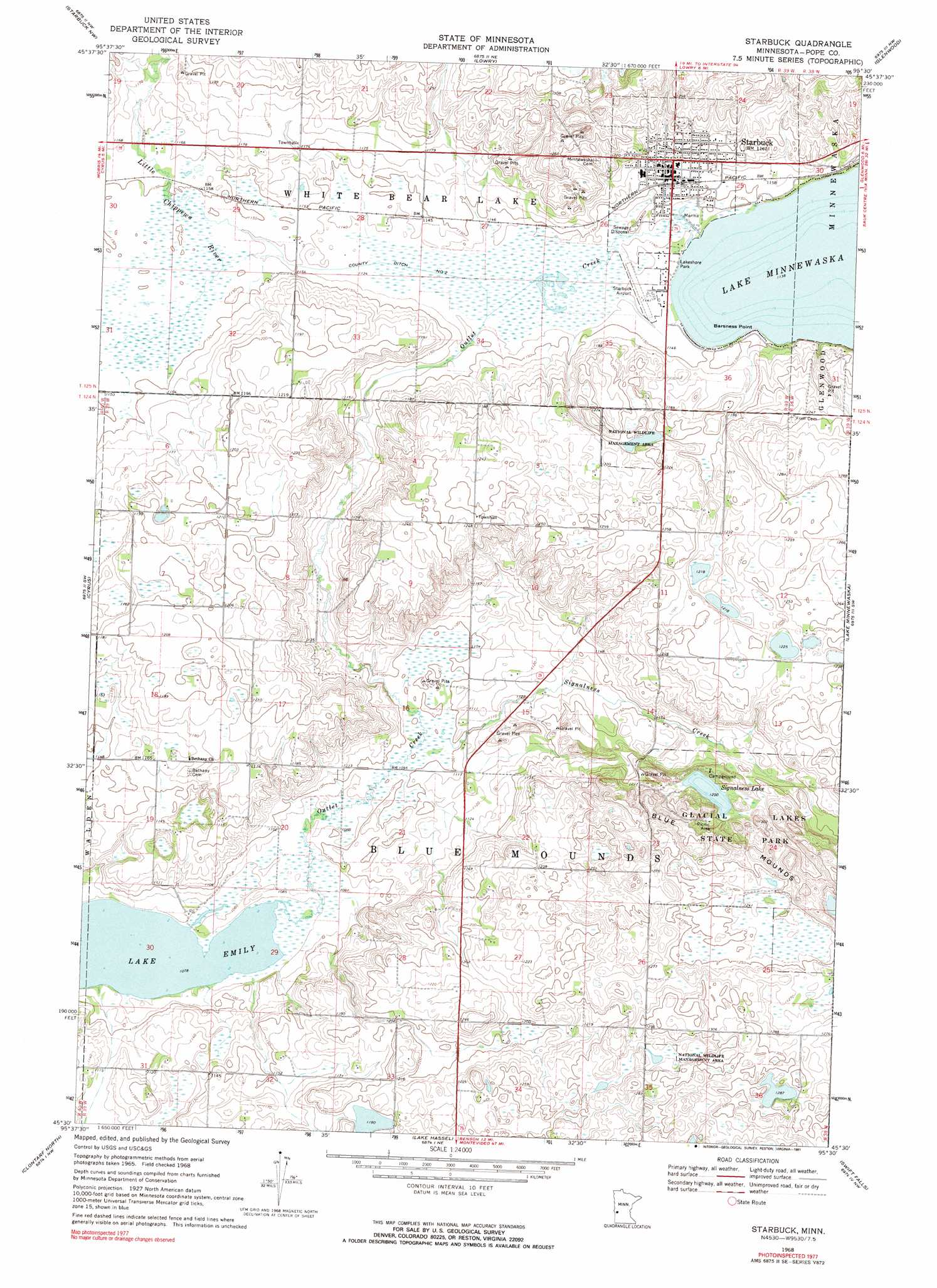
USGS Topo Quad 45095e5 - 1:24,000 scale
| Topo Map Name: | Starbuck |
| USGS Topo Quad ID: | 45095e5 |
| Print Size: | ca. 21 1/4" wide x 27" high |
| Southeast Coordinates: | 45.5° N latitude / 95.5° W longitude |
| Map Center Coordinates: | 45.5625° N latitude / 95.5625° W longitude |
| U.S. State: | MN |
| Filename: | o45095e5.jpg |
| Download Map JPG Image: | Starbuck topo map 1:24,000 scale |
| Map Type: | Topographic |
| Topo Series: | 7.5´ |
| Map Scale: | 1:24,000 |
| Source of Map Images: | United States Geological Survey (USGS) |
| Alternate Map Versions: |
Starbuck MN 1968, updated 1970 Download PDF Buy paper map Starbuck MN 1968, updated 1991 Download PDF Buy paper map Starbuck MN 2010 Download PDF Buy paper map Starbuck MN 2013 Download PDF Buy paper map Starbuck MN 2016 Download PDF Buy paper map |
1:24,000 Topo Quads surrounding Starbuck
Hoffman |
Kensington |
Farwell |
Lake Mary |
Forada |
Pomme De Terre Lakes |
Starbuck Nw |
Lowry |
Glenwood |
Villard |
Page Lake |
Cyrus |
Starbuck |
Lake Minnewaska |
Terrace |
Hancock |
Clontarf North |
Lake Hassel |
Swift Falls |
Lake Simon |
Danvers |
Clontarf South |
Benson |
De Graff |
De Graff Se |
> Back to 45095e1 at 1:100,000 scale
> Back to 45094a1 at 1:250,000 scale
> Back to U.S. Topo Maps home
Starbuck topo map: Gazetteer
Starbuck: Airports
Starbuck Municipal Airport elevation 348m 1141′Starbuck: Canals
County Ditch Number Two elevation 346m 1135′Starbuck: Capes
Barness Point elevation 348m 1141′Starbuck: Lakes
Signalness Lake elevation 366m 1200′Starbuck: Parks
Glacial Lakes State Park elevation 371m 1217′Hobo Park elevation 349m 1145′
Holly Skogen elevation 363m 1190′
Lakeshore Park elevation 348m 1141′
Starbuck: Populated Places
Starbuck elevation 357m 1171′Starbuck: Post Offices
Starbuck Post Office elevation 348m 1141′Starbuck: Streams
Outlet Creek elevation 329m 1079′Signalness Creek elevation 335m 1099′
Starbuck digital topo map on disk
Buy this Starbuck topo map showing relief, roads, GPS coordinates and other geographical features, as a high-resolution digital map file on DVD: