Glenwood Topo Map Minnesota
To zoom in, hover over the map of Glenwood
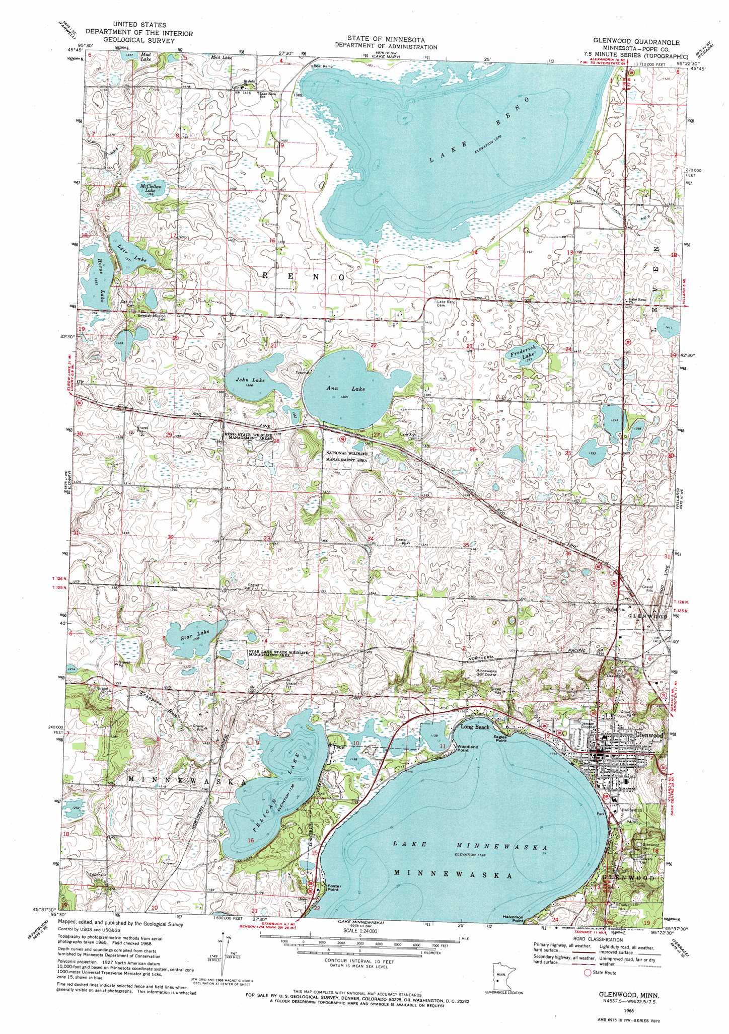
USGS Topo Quad 45095f4 - 1:24,000 scale
| Topo Map Name: | Glenwood |
| USGS Topo Quad ID: | 45095f4 |
| Print Size: | ca. 21 1/4" wide x 27" high |
| Southeast Coordinates: | 45.625° N latitude / 95.375° W longitude |
| Map Center Coordinates: | 45.6875° N latitude / 95.4375° W longitude |
| U.S. State: | MN |
| Filename: | o45095f4.jpg |
| Download Map JPG Image: | Glenwood topo map 1:24,000 scale |
| Map Type: | Topographic |
| Topo Series: | 7.5´ |
| Map Scale: | 1:24,000 |
| Source of Map Images: | United States Geological Survey (USGS) |
| Alternate Map Versions: |
Glenwood MN 1968, updated 1970 Download PDF Buy paper map Glenwood MN 2010 Download PDF Buy paper map Glenwood MN 2013 Download PDF Buy paper map Glenwood MN 2016 Download PDF Buy paper map |
1:24,000 Topo Quads surrounding Glenwood
Quam Lake |
Brandon |
Alexandria West |
Alexandria East |
Lake Osakis West |
Kensington |
Farwell |
Lake Mary |
Forada |
Osakis |
Starbuck Nw |
Lowry |
Glenwood |
Villard |
Westport |
Cyrus |
Starbuck |
Lake Minnewaska |
Terrace |
Sedan |
Clontarf North |
Lake Hassel |
Swift Falls |
Lake Simon |
Lake Johanna |
> Back to 45095e1 at 1:100,000 scale
> Back to 45094a1 at 1:250,000 scale
> Back to U.S. Topo Maps home
Glenwood topo map: Gazetteer
Glenwood: Canals
County Ditch Number Nine elevation 427m 1400′Glenwood: Capes
Eagles Point elevation 356m 1167′Foster Point elevation 349m 1145′
Halvorson Point elevation 348m 1141′
Woodland Point elevation 348m 1141′
Glenwood: Dams
Pelican Lake Inlet Dam elevation 351m 1151′Glenwood: Lakes
Ann Lake elevation 416m 1364′Frederick Lake elevation 425m 1394′
Horse Lake elevation 413m 1354′
John Lake elevation 417m 1368′
Lair Lake elevation 418m 1371′
Lake Reno elevation 420m 1377′
McClellan Lake elevation 417m 1368′
Pelican Lake elevation 347m 1138′
Star Lake elevation 368m 1207′
Glenwood: Parks
Barsness Park elevation 357m 1171′Glenwood City Park elevation 351m 1151′
Glenwood Region Historical Marker elevation 350m 1148′
Glenwood Wayside Park elevation 431m 1414′
Indian Mounds Park elevation 347m 1138′
Mount Lookout Park elevation 435m 1427′
Reno State Wildlife Management Area elevation 414m 1358′
Star Lake State Wildlife Management Area elevation 370m 1213′
Glenwood: Populated Places
Glenwood elevation 353m 1158′Long Beach elevation 348m 1141′
Glenwood: Post Offices
Glenwood Post Office elevation 355m 1164′Glenwood: Reservoirs
Pelican Lake elevation 351m 1151′Glenwood: Streams
Trappers Run elevation 347m 1138′Glenwood digital topo map on disk
Buy this Glenwood topo map showing relief, roads, GPS coordinates and other geographical features, as a high-resolution digital map file on DVD: