West Union Topo Map Minnesota
To zoom in, hover over the map of West Union
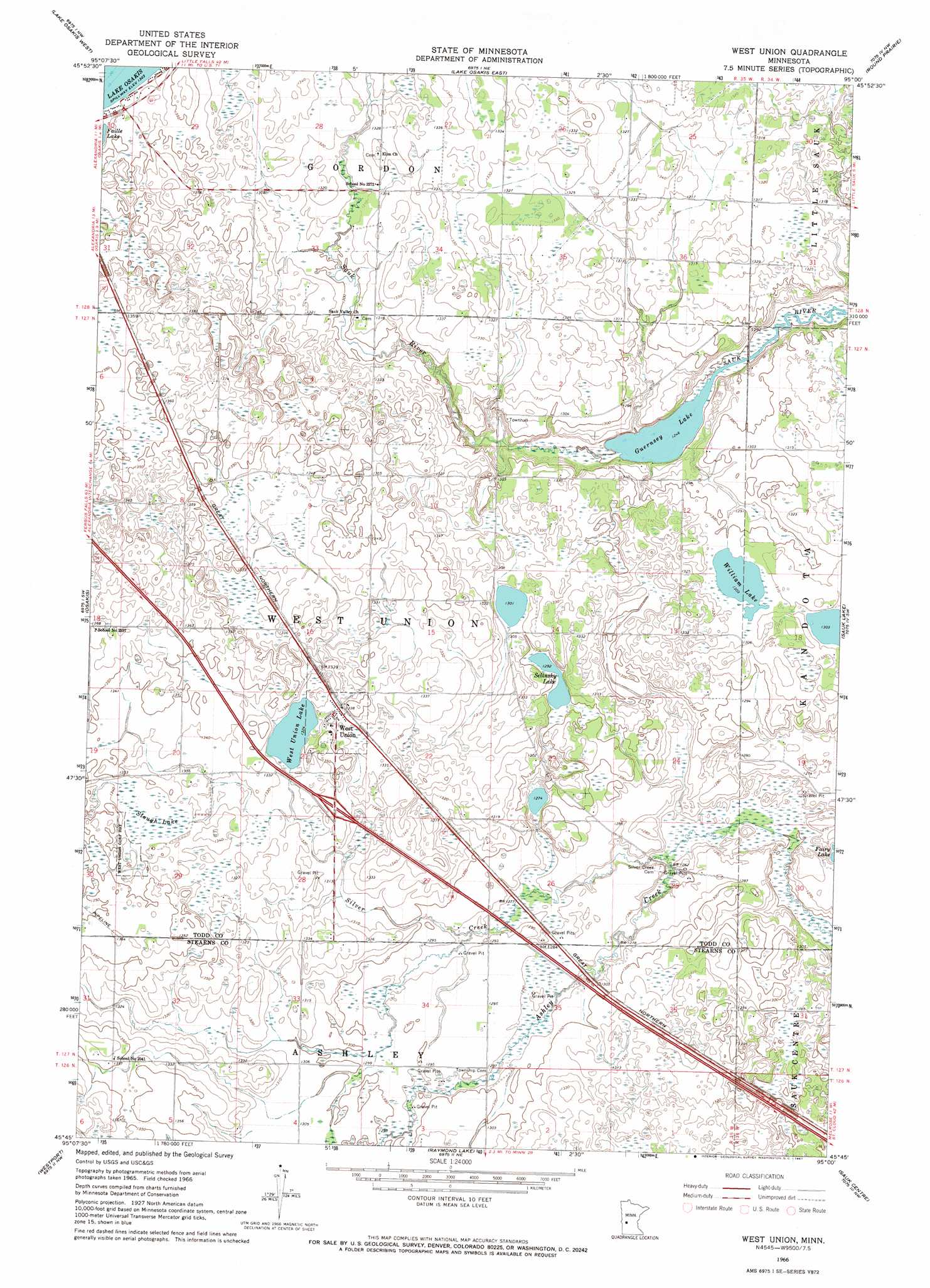
USGS Topo Quad 45095g1 - 1:24,000 scale
| Topo Map Name: | West Union |
| USGS Topo Quad ID: | 45095g1 |
| Print Size: | ca. 21 1/4" wide x 27" high |
| Southeast Coordinates: | 45.75° N latitude / 95° W longitude |
| Map Center Coordinates: | 45.8125° N latitude / 95.0625° W longitude |
| U.S. State: | MN |
| Filename: | o45095g1.jpg |
| Download Map JPG Image: | West Union topo map 1:24,000 scale |
| Map Type: | Topographic |
| Topo Series: | 7.5´ |
| Map Scale: | 1:24,000 |
| Source of Map Images: | United States Geological Survey (USGS) |
| Alternate Map Versions: |
West Union MN 1966, updated 1967 Download PDF Buy paper map West Union MN 2010 Download PDF Buy paper map West Union MN 2013 Download PDF Buy paper map West Union MN 2016 Download PDF Buy paper map |
1:24,000 Topo Quads surrounding West Union
Lake Miltona East |
Rose City |
Clotho |
Browerville Sw |
Browerville |
Alexandria East |
Lake Osakis West |
Lake Osakis East |
Round Prairie |
Long Prairie |
Forada |
Osakis |
West Union |
Sauk Lake |
Ward Springs |
Villard |
Westport |
Raymond Lake |
Sauk Centre |
Melrose |
Terrace |
Sedan |
Padua |
Elrosa |
Greenwald |
> Back to 45095e1 at 1:100,000 scale
> Back to 45094a1 at 1:250,000 scale
> Back to U.S. Topo Maps home
West Union topo map: Gazetteer
West Union: Lakes
Guernsey Lake elevation 379m 1243′Selinsky Lake elevation 394m 1292′
West Union Lake elevation 403m 1322′
William Lake elevation 397m 1302′
West Union: Populated Places
West Union elevation 408m 1338′West Union: Post Offices
West Union Post Office elevation 408m 1338′West Union: Streams
Silver Creek elevation 382m 1253′West Union: Swamps
Slough Lake elevation 407m 1335′West Union digital topo map on disk
Buy this West Union topo map showing relief, roads, GPS coordinates and other geographical features, as a high-resolution digital map file on DVD: