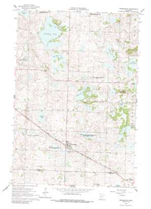
Kensington Topo Map Minnesota
To zoom in, hover over the map of Kensington
USGS Topo Quad 45095g6 - 1:24,000 scale
| Topo Map Name: | Kensington |
| USGS Topo Quad ID: | 45095g6 |
| Print Size: | ca. 21 1/4" wide x 27" high |
| Southeast Coordinates: | 45.75° N latitude / 95.625° W longitude |
| Map Center Coordinates: | 45.8125° N latitude / 95.6875° W longitude |
| U.S. State: | MN |
| Filename: | o45095g6.jpg |
| Download Map JPG Image: | Kensington topo map 1:24,000 scale |
| Map Type: | Topographic |
| Topo Series: | 7.5´ |
| Map Scale: | 1:24,000 |
| Source of Map Images: | United States Geological Survey (USGS) |
| Alternate Map Versions: |
Kensington MN 1966, updated 1967 Download PDF Buy paper map Kensington MN 1966, updated 1988 Download PDF Buy paper map Kensington MN 2010 Download PDF Buy paper map Kensington MN 2013 Download PDF Buy paper map Kensington MN 2016 Download PDF Buy paper map |
1:24,000 Topo Quads surrounding Kensington
> Back to 45095e1 at 1:100,000 scale
> Back to 45094a1 at 1:250,000 scale
> Back to U.S. Topo Maps home
Kensington topo map: Gazetteer
Kensington: Lakes
Eng Lake elevation 411m 1348′Jorgenson Lake elevation 385m 1263′
Long Lake elevation 414m 1358′
North Lake Oscar elevation 420m 1377′
Ostlund Lake elevation 393m 1289′
Red Rock Lake elevation 396m 1299′
Roland Lake elevation 385m 1263′
Solem Lake elevation 422m 1384′
Wally Lake elevation 417m 1368′
Kensington: Parks
Eng Lake State Wildlife Management Area elevation 408m 1338′Hegg Lake State Wildlife Management Area elevation 408m 1338′
Kensington State Wildlife Management Area elevation 392m 1286′
Runestone County Park elevation 421m 1381′
Schnepf State Wildlife Management Area elevation 411m 1348′
Kensington: Populated Places
Kensington elevation 399m 1309′Kensington: Post Offices
Kensington Post Office elevation 402m 1318′Kensington: Summits
Lookout Mountain elevation 465m 1525′Runestone Hill elevation 431m 1414′
Kensington digital topo map on disk
Buy this Kensington topo map showing relief, roads, GPS coordinates and other geographical features, as a high-resolution digital map file on DVD:


